MyTopo
Goshen Arkansas US Topo Map
Couldn't load pickup availability
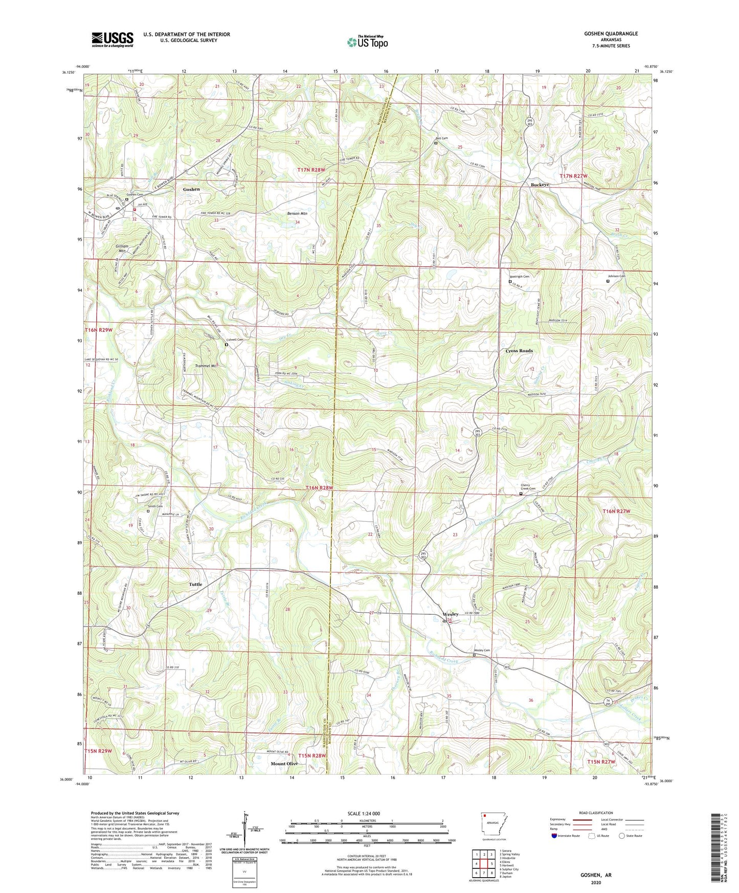
2024 topographic map quadrangle Goshen in the state of Arkansas. Scale: 1:24000. Based on the newly updated USGS 7.5' US Topo map series, this map is in the following counties: Madison, Washington. The map contains contour data, water features, and other items you are used to seeing on USGS maps, but also has updated roads and other features. This is the next generation of topographic maps. Printed on high-quality waterproof paper with UV fade-resistant inks.
Quads adjacent to this one:
West: Elkins
Northwest: Sonora
North: Spring Valley
Northeast: Hindsville
East: Hartwell
Southeast: Japton
South: Durham
Southwest: Sulphur City
This map covers the same area as the classic USGS quad with code o36093a8.
Contains the following named places: Bell Cemetery, Benson Lookout Tower, Benson Mountain, Boatrigth Cemetery, Buckeye, Cave Creek, Cherry Creek, Cherry Creek Cemetery, Cross Roads, Culwell Cemetery, Drakes Creek, Dry Creek, Gilliam Mountain, Goshen, Goshen Cemetery, Goshen City Marshall's Office, Goshen Fire Department Station 1, Goshen Post Office, Johnson Cemetery, Langley Church, Lollars Creek, Mount Olive, Mountain Springs Church, Pigeon Creek, Richland Tabernacle, Richland View Church, Sinking Creek, Smith Cemetery, Thorney Branch, Tisdale Ford, Township of Goshen, Township of Richland, Trammel Mountain, Tuttle, Tuttle Branch, Wesley, Wesley Cemetery, Wesley Census Designated Place, Wesley Fire Department, Wesley Post Office