MyTopo
Spring Valley Arkansas US Topo Map
Couldn't load pickup availability
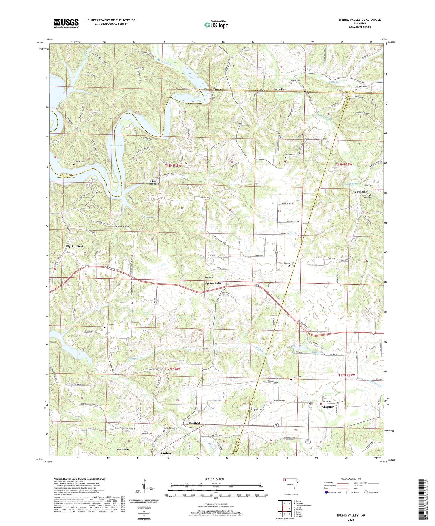
2024 topographic map quadrangle Spring Valley in the state of Arkansas. Scale: 1:24000. Based on the newly updated USGS 7.5' US Topo map series, this map is in the following counties: Washington, Madison, Benton. The map contains contour data, water features, and other items you are used to seeing on USGS maps, but also has updated roads and other features. This is the next generation of topographic maps. Printed on high-quality waterproof paper with UV fade-resistant inks.
Quads adjacent to this one:
West: Sonora
Northwest: Rogers
North: War Eagle
Northeast: Sandstone Mountain
East: Hindsville
Southeast: Hartwell
South: Goshen
Southwest: Elkins
This map covers the same area as the classic USGS quad with code o36093b8.
Contains the following named places: Austin Cemetery, Beaver Lake, Been Mountain, Black Jack School, Brush Creek, Burkshed Cemetery, Burkshed School, Clifty Creek, Cook Ford, Cottage Hill, Cottage Hill School, Denny Cemetery, Denny Ford, Elkins Hollow, Ellis Ford, Gar Hole Ford, Granny Hollow, Hickory Flat Hollow, Hickory Flat School, Hindsville Lake, Hindsville Lake Dam, Johnson Cemetery, Joyce Cemetery, KKIP-AM (Lowell), Macedonia Church, Martin Bluff, Mayfield, Mayfield Cemetery, Morriss Cemetery, New Hope Church, Nob Hill Fire Department Station 1, Nob Hill Fire Station 4, Old Best Cemetery, Pilgrims Rest, Pilgrims Rest School, Pine Creek, Pleasant Church, Sharp Ford, Spring Valley, Spring Valley Baptist Church, Township of Brush Creek, Vaughan Cemetery, Vaughan Mountain, Wade Cemetery, War Eagle Cove, War Eagle Creek, Whitener, Whitener Branch, ZIP Code: 72738