MyTopo
Hindsville Arkansas US Topo Map
Couldn't load pickup availability
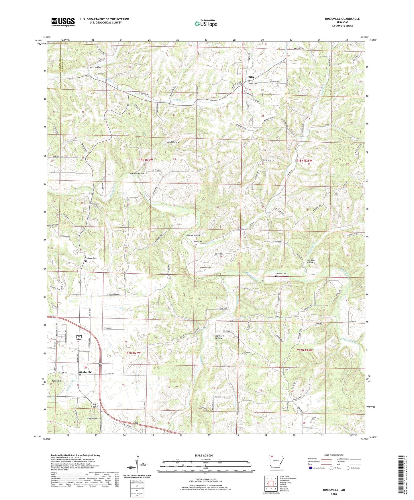
2024 topographic map quadrangle Hindsville in the state of Arkansas. Scale: 1:24000. Based on the newly updated USGS 7.5' US Topo map series, this map is in the following counties: Madison, Benton. The map contains contour data, water features, and other items you are used to seeing on USGS maps, but also has updated roads and other features. This is the next generation of topographic maps. Printed on high-quality waterproof paper with UV fade-resistant inks.
Quads adjacent to this one:
West: Spring Valley
Northwest: War Eagle
North: Sandstone Mountain
Northeast: Rockhouse
East: Forum
Southeast: Huntsville
South: Hartwell
Southwest: Goshen
This map covers the same area as the classic USGS quad with code o36093b7.
Contains the following named places: Bohannan Cemetery, Cannady Cemetery, Clear Creek, Clear Creek School, Clifty, Clifty Cemetery, Clifty Volunteer Fire Department, Colbaugh Cemetery, Colbaugh Church, Elizabeth Church, Glade Creek, Hartwell Creek, Hartwell Hollow, Hickory Grove Church, Hindsville, Hindsville Fire Department, Hindsville Post Office, Houston Creek, Houston Hollow, Lone Star Church, Lynch Hollow, Martin Cemetery, Parker Ford, Poyner Hollow, Rocky Ford, Scissom Cemetery, Smyrna Volunteer Fire Department, Tater Hill, Town of Hindsville, Township of Prairie, Walnut Hollow, Ward Hollow