MyTopo
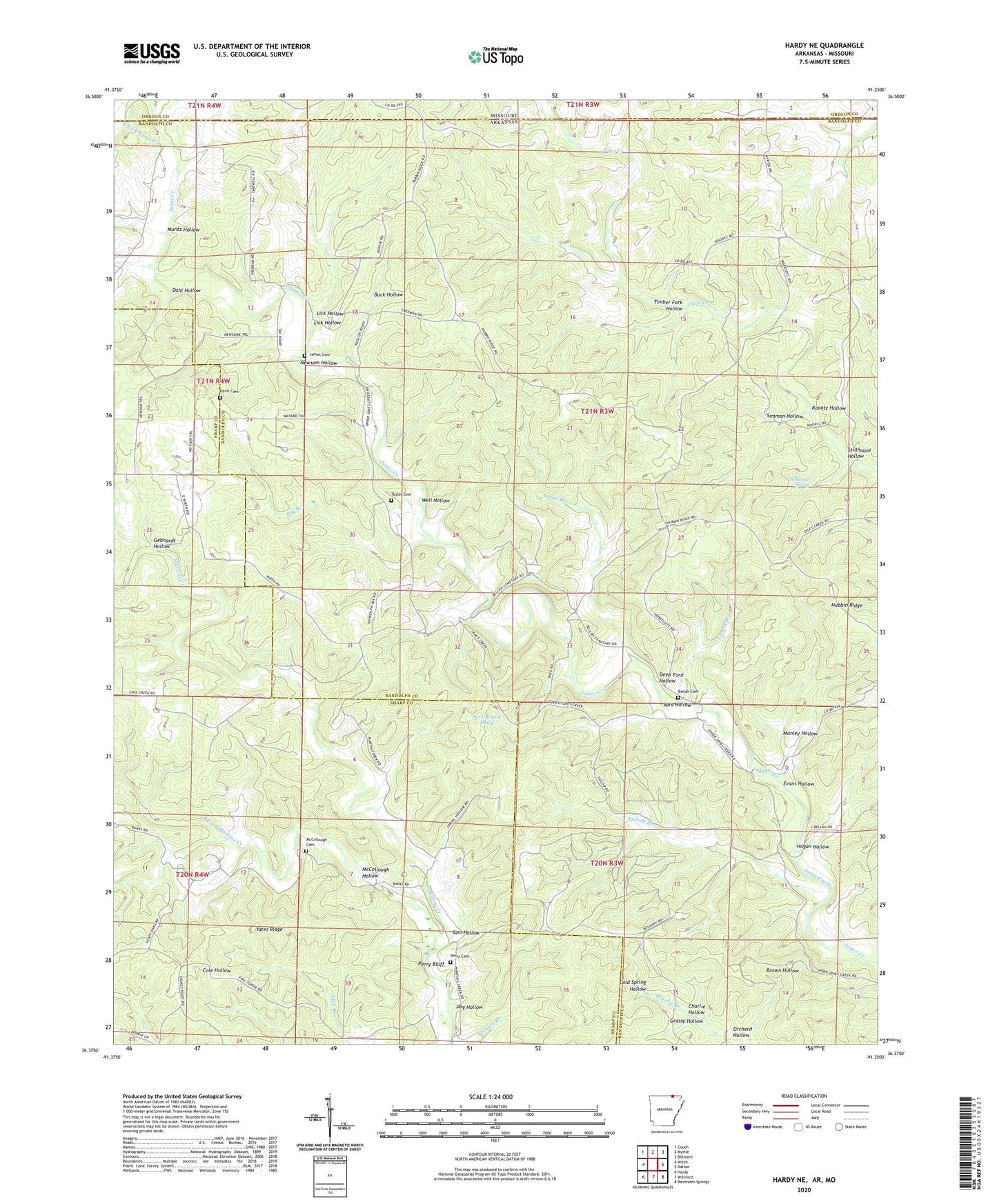
Hardy NE Arkansas US Topo Map
Couldn't load pickup availability
2024 topographic map quadrangle Hardy NE in the states of Arkansas, Missouri. Scale: 1:24000. Based on the newly updated USGS 7.5' US Topo map series, this map is in the following counties: Randolph, Sharp, Oregon. The map contains contour data, water features, and other items you are used to seeing on USGS maps, but also has updated roads and other features. This is the next generation of topographic maps. Printed on high-quality waterproof paper with UV fade-resistant inks.
Quads adjacent to this one:
West: Wirth
Northwest: Couch
North: Myrtle
Northeast: Billmore
East: Dalton
Southeast: Ravenden Springs
South: Williford
Southwest: Hardy
Contains the following named places: Athye Branch, Banks Church, Bellah Cemetery, Big Branch, Bishop Branch, Buck Hollow, Charlie Hollow, Cold Spring Hollow, Dahl Hollow, Davis Cemetery, Deep Ford Hollow, Diles Creek Church, Dog Hollow, English Bluff Church of Christ, Evans Hollow, Gebhardt Hollow, Grassy Hollow, Hogan Hollow, James Cemetery, Koontz Hollow, Lick Hollow, Manley Hollow, McCollough Cemetery, McCollough Hollow, Muntz Hollow, Newsom Hollow, Orchard Hollow, Perry Bluff, Perry Cemetery, Persimmon Pond, Ring Church of Christ, Ring School, Sam Hollow, Sara Hollow, Simmon Hollow, South Fork Janes Creek, South Fork Martins Creek, Stillhouse Hollow, Stillhouse Spring, Taylor Cemetery, Timber Fork Hollow, Township of Union, Well Hollow, Wenstead, Yates Ridge, Young Branch