MyTopo
Couch Missouri US Topo Map
Couldn't load pickup availability
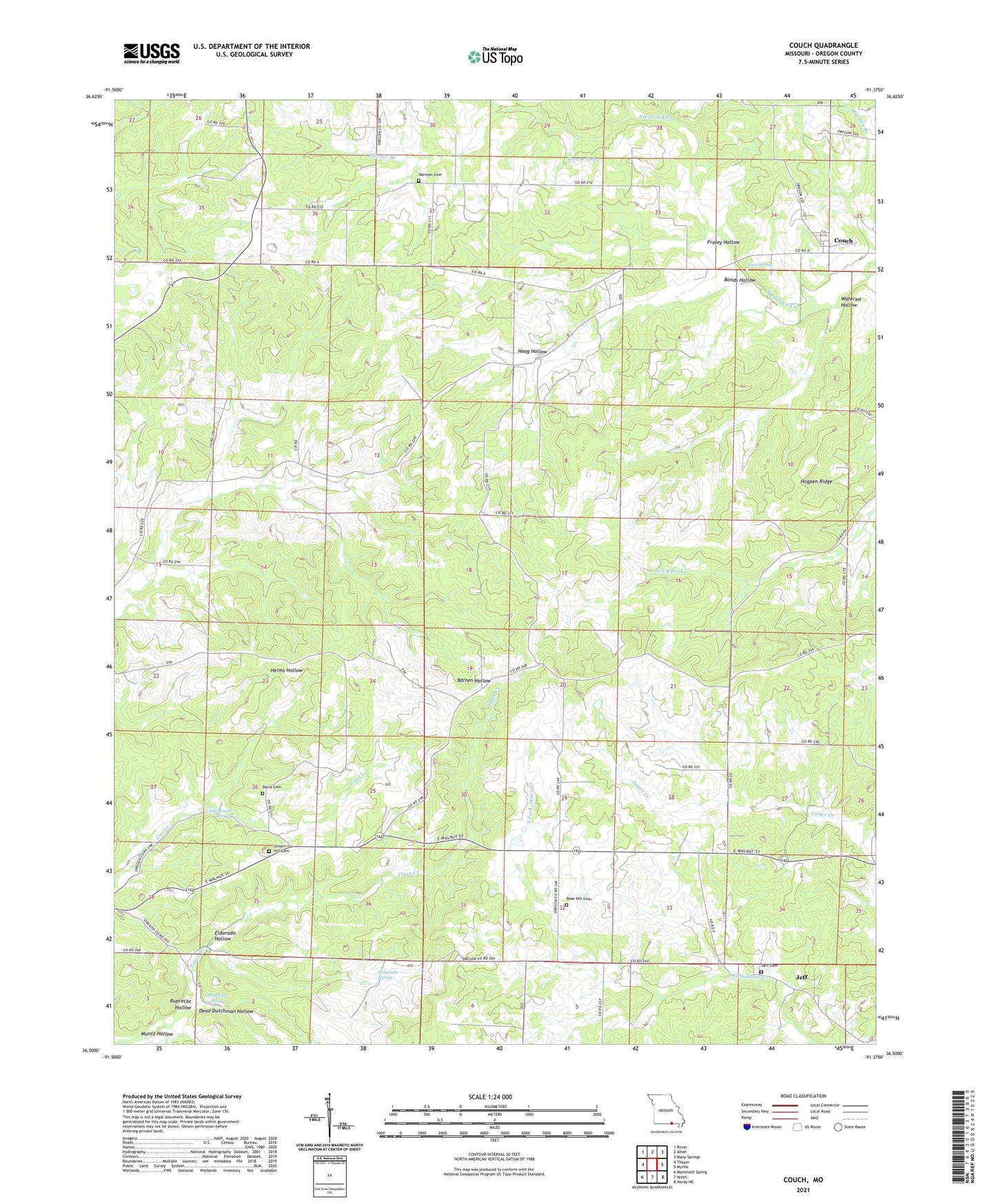
2021 topographic map quadrangle Couch in the state of Missouri. Scale: 1:24000. Based on the newly updated USGS 7.5' US Topo map series, this map is in the following counties: Oregon. The map contains contour data, water features, and other items you are used to seeing on USGS maps, but also has updated roads and other features. This is the next generation of topographic maps. Printed on high-quality waterproof paper with UV fade-resistant inks.
Quads adjacent to this one:
West: Thayer
Northwest: Rover
North: Alton
Northeast: Many Springs
East: Myrtle
Southeast: Hardy NE
South: Wirth
Southwest: Mammoth Spring
This map covers the same area as the classic USGS quad with code o36091e4.
Contains the following named places: Arytown Church, Barren Hollow School, Bonds Church, Bonds Hollow, Bonds School, Cane Hill School, Corona, Couch, Couch Church, Davis Church, Dead Dutchman Hollow, Duncan Spring, Eldorado Hollow, Eldorado Spring, Fraley Hollow, German Church, Harper Branch, Hart Spring, Hoag Hollow, Hogpen Ridge, Hy, Hy Post Office, Jeff, Jeff Church, Jeff School, Midway, Mooney Branch, Norman Cemetery, Norman Church, Norman School, Pleasant Hill School, Rose Hill Cemetery, Rose Hill Church, Rose Hill School, Ruprecht Hollow, Ruprecht Spring, Township of Couch, Township of Jeff, Underwood Spring, Watered Hollow, Wendt Lake Dam, ZIP Code: 65791