MyTopo
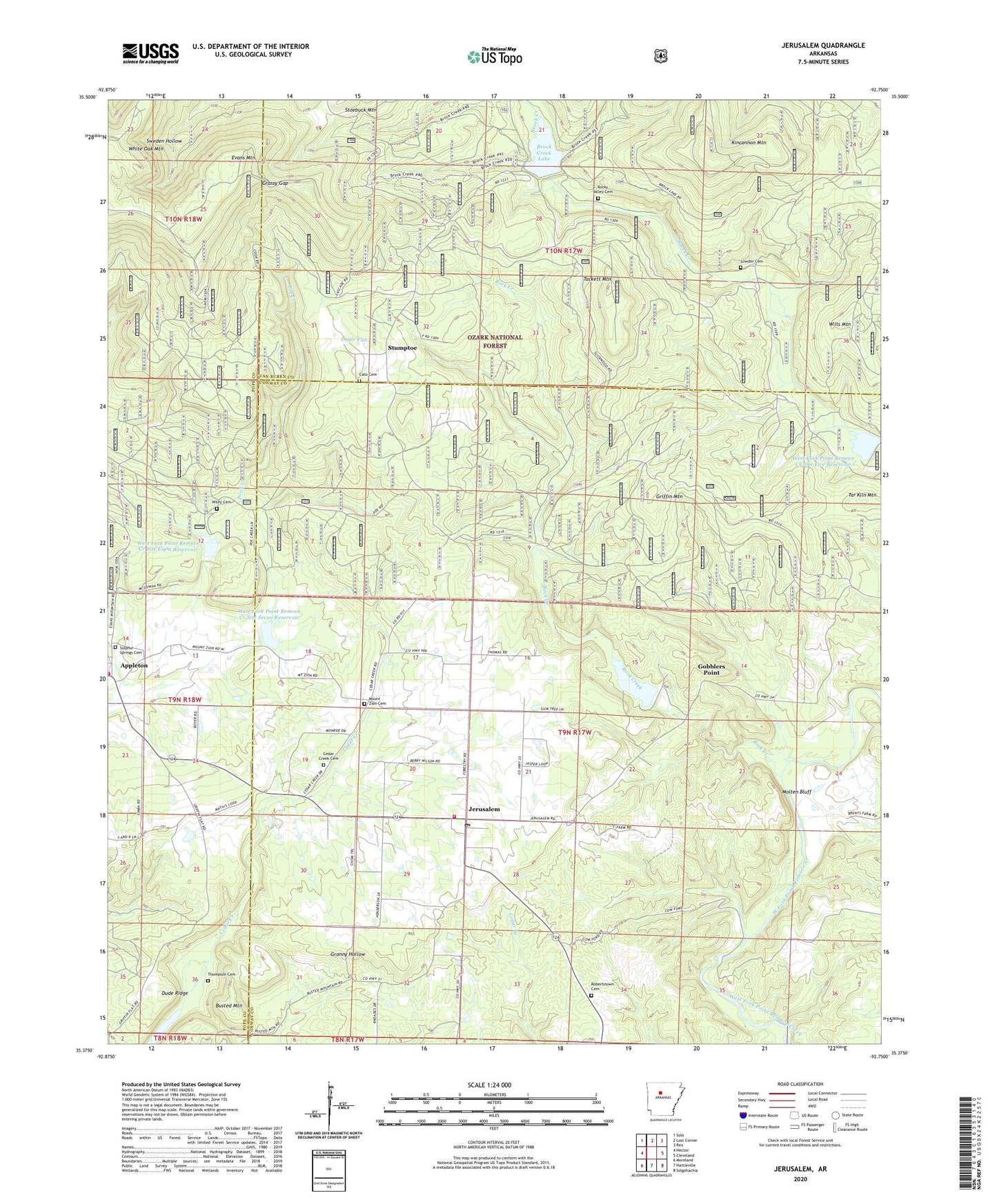
Jerusalem Arkansas US Topo Map
Couldn't load pickup availability
Also explore the Jerusalem Forest Service Topo of this same quad for updated USFS data
2024 topographic map quadrangle Jerusalem in the state of Arkansas. Scale: 1:24000. Based on the newly updated USGS 7.5' US Topo map series, this map is in the following counties: Conway, Van Buren, Pope. The map contains contour data, water features, and other items you are used to seeing on USGS maps, but also has updated roads and other features. This is the next generation of topographic maps. Printed on high-quality waterproof paper with UV fade-resistant inks.
Quads adjacent to this one:
West: Hector
Northwest: Solo
North: Lost Corner
Northeast: Rex
East: Cleveland
Southeast: Solgohachia
South: Hattieville
Southwest: Moreland
This map covers the same area as the classic USGS quad with code o35092d7.
Contains the following named places: Appleton, Appleton Census Designated Place, Appleton Cumberland Presbyterian Church, Appleton Fire Department, Appleton School, Brock Creek Lake, Busted Mountain, Cato Cemetery, Cedar Creek Cemetery, Cedar Grove Church, Doyle Flat, Dude Ridge, Dude Ridge School, Evans Mountain, Gobblers Point, Grassy Gap, Griffin Mountain, Jerusalem, Jerusalem Census Designated Place, Jerusalem Fire Station, Jerusalem Gas Field, Jerusalem Post Office, Lowder Cemetery, Molten Bluff, Mount Zion Cemetery, Mount Zion Church, Robertstown Cemetery, Rock Creek, Rocky Valley Cemetery, Stumptoe, Sulphur Springs Cemetery, Sulphur Springs School, Tackett Mountain, Tar Kiln Mountain, Thompson Cemetery, Thompson Chapel, Township of Griffin, Upper Brock Creeek Campground, West Fork Point Remove Creek Site 11 Dam, West Fork Point Remove Creek Site 11 Reservoir, West Fork Point Remove Creek Site Eight Dam, West Fork Point Remove Creek Site Eight Reservoir, West Fork Point Remove Creek Site Five Dam, West Fork Point Remove Creek Site Five Reservoir, West Fork Point Remove Creek Site Seven Dam, West Fork Point Remove Creek Site Seven Reservoir, West Fork Point Remove Creek Site Six Dam, West Fork Point Remove Creek Site Six Reservoir, West Fork Point Remove Creek Site Three Dam, Wiley Cemetery, Wills Mountain, ZIP Code: 72080