MyTopo
Jerome Arkansas US Topo Map
Couldn't load pickup availability
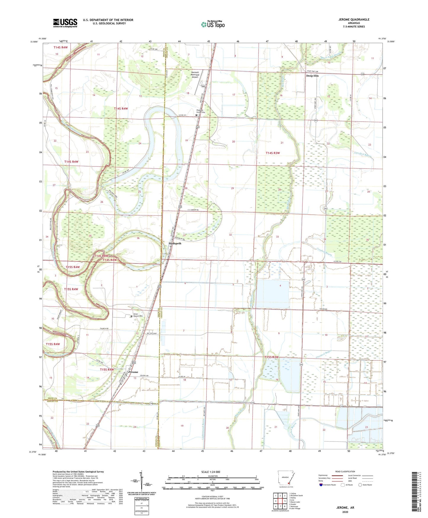
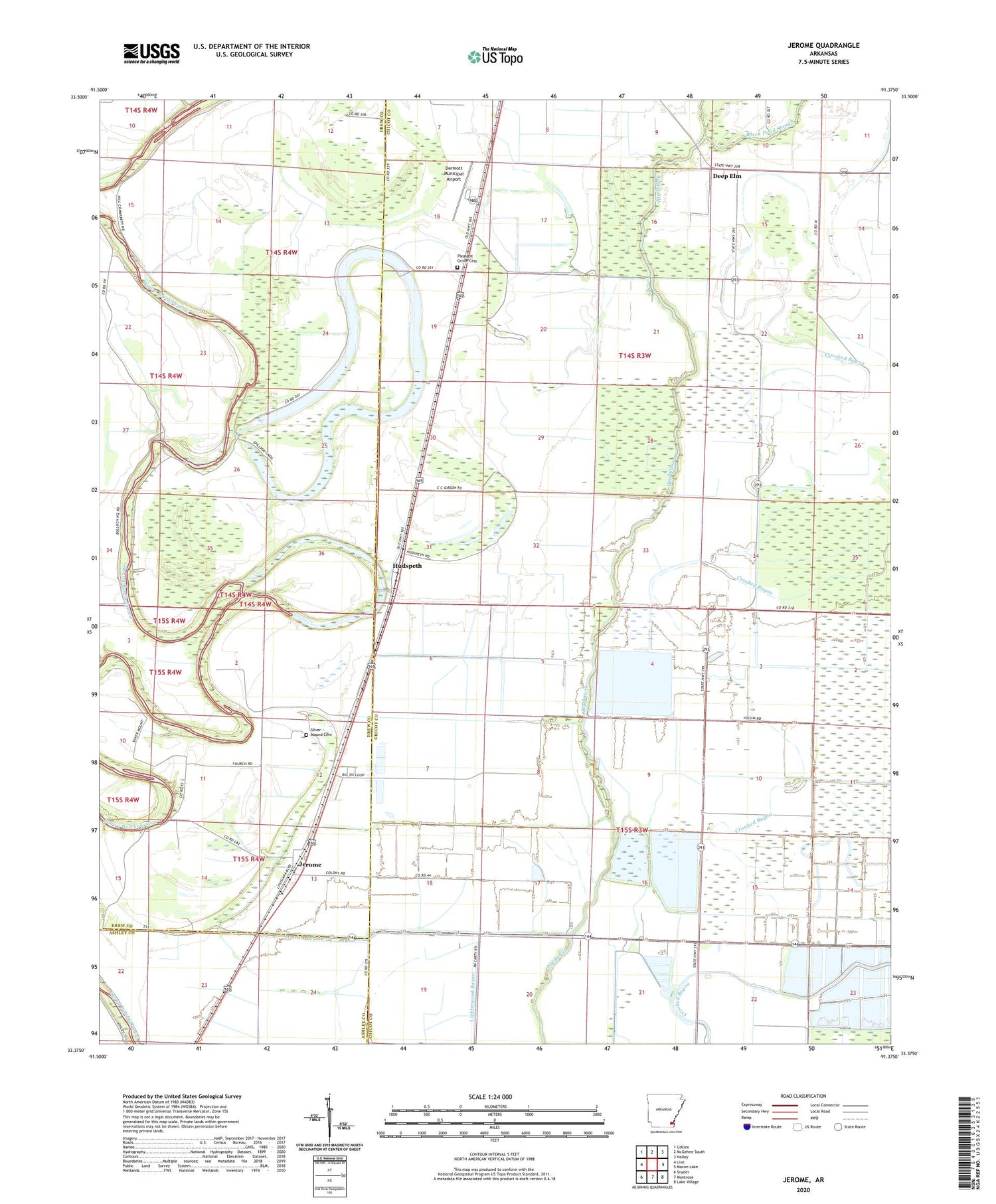
2024 topographic map quadrangle Jerome in the state of Arkansas. Scale: 1:24000. Based on the newly updated USGS 7.5' US Topo map series, this map is in the following counties: Chicot, Drew, Ashley. The map contains contour data, water features, and other items you are used to seeing on USGS maps, but also has updated roads and other features. This is the next generation of topographic maps. Printed on high-quality waterproof paper with UV fade-resistant inks.
Quads adjacent to this one:
West: Line
Northwest: Collins
North: McGehee South
Northeast: Halley
East: Macon Lake
Southeast: Lake Village
South: Montrose
Southwest: Snyder
This map covers the same area as the classic USGS quad with code o33091d4.
Contains the following named places: Bellaire Academy, Bethel Temple, Black Pond Slough, Decker, Deep Elm, Dermott Municipal Airport, Dickson Brake, Hudspeth, Jerome, Jerome Relocation Center, Lake Wallace, Lake Wallace Dam, Little Click Bayou, Morning Star Church, Oak Grove Church, Pleasant Grove Cemetery, Pleasant Grove Church, Silver Mound Cemetery, Silver Mound Church, Town of Jerome, Township of Bartholomew