MyTopo
McGehee South Arkansas US Topo Map
Couldn't load pickup availability
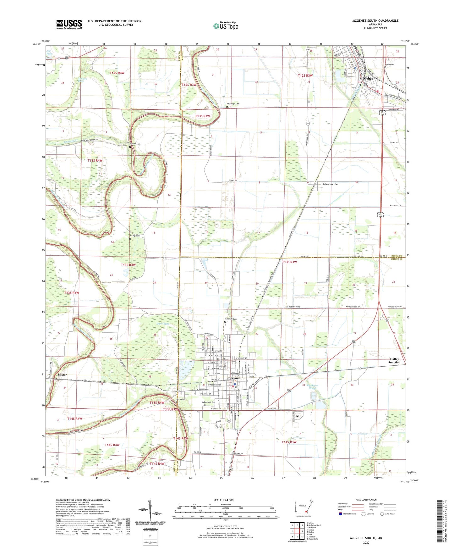
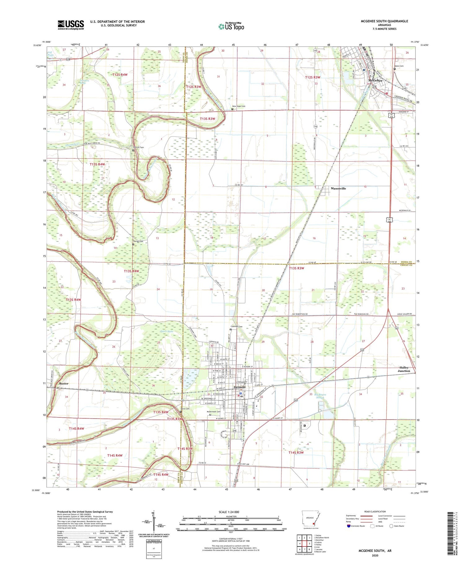
2024 topographic map quadrangle McGehee South in the state of Arkansas. Scale: 1:24000. Based on the newly updated USGS 7.5' US Topo map series, this map is in the following counties: Drew, Chicot, Desha. The map contains contour data, water features, and other items you are used to seeing on USGS maps, but also has updated roads and other features. This is the next generation of topographic maps. Printed on high-quality waterproof paper with UV fade-resistant inks.
Quads adjacent to this one:
West: Collins
Northwest: Selma
North: McGehee North
Northeast: McArthur
East: Halley
Southeast: Macon Lake
South: Jerome
Southwest: Line
This map covers the same area as the classic USGS quad with code o33091e4.
Contains the following named places: Antioch Church, Arkansas Department of Corrections Delta Regional Unit, Bates Cemetery, Baxter, Big Bayou Slough, Bold Pilgrim Baptist Church, Church of God, City of Dermott, Coleman Cemetery, Constance, Davis Cemetery, Dermott, Dermott City EMS - Advanced Life Support, Dermott City Hall, Dermott Elementary School, Dermott Fire Department, Dermott High School, Dermott Hospital Heliport, Dermott Middle School, Dermott Police Department, Dermott Post Office, Dermott Upper Elementary School, Duncan Cemetery, Fourmile Creek, Friendship Missionary Baptist Church, Grace Church, Halley Junction, KVSA-AM (McGehee), KXSA-AM (Dermott), KXSA-FM (Dermott), Leavits, Masonville, McDermott Cemetery, McGehee Desha County Hospital Heliport, Mcgehee Fire Department Station 2, Mcgehee Hospital, McGehee Primary School, Memorial Hospital, Morris-Booker Memorial College, Mount Carmel Church, New Hope Cemetery, New Hope Church, Rose Hill Church, Seven Star Church, Township of Bowie, True Vine Church, Tupelo Brake, Youngs Cemetery, Youngs Chapel, Youngs School, ZIP Code: 71638