MyTopo
Collins Arkansas US Topo Map
Couldn't load pickup availability
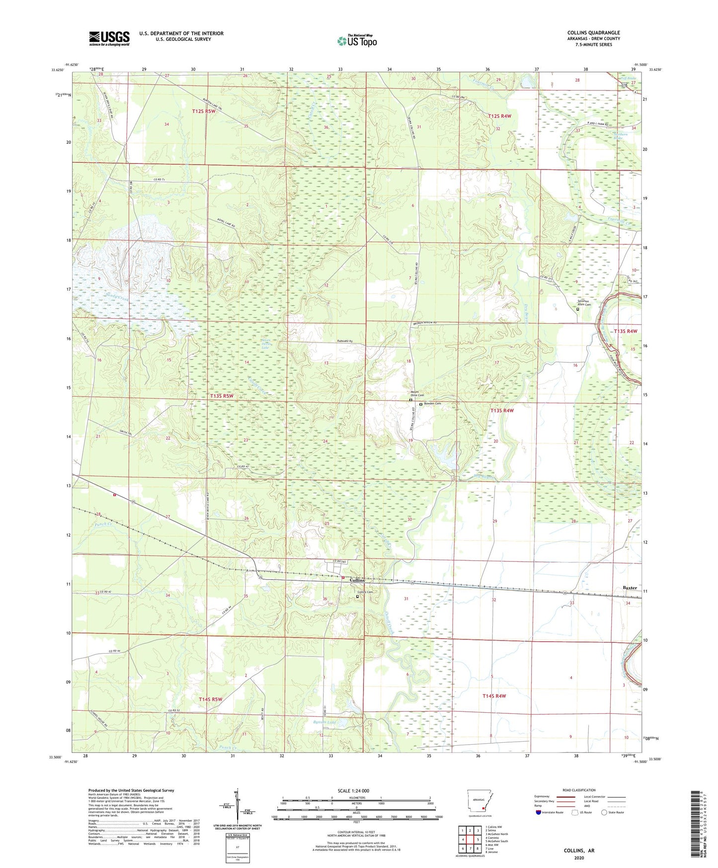
2024 topographic map quadrangle Collins in the state of Arkansas. Scale: 1:24000. Based on the newly updated USGS 7.5' US Topo map series, this map is in the following counties: Drew. The map contains contour data, water features, and other items you are used to seeing on USGS maps, but also has updated roads and other features. This is the next generation of topographic maps. Printed on high-quality waterproof paper with UV fade-resistant inks.
Quads adjacent to this one:
West: Cominto
Northwest: Collins NW
North: Selma
Northeast: McGehee North
East: McGehee South
Southeast: Jerome
South: Line
Southwest: Mist NW
This map covers the same area as the classic USGS quad with code o33091e5.
Contains the following named places: Big Lake, Bowden Cemetery, Bynum Lake, Bynum Lake Dam, Chinquapin Creek, Collins, Collins Cemetery, Collins Census Designated Place, Collins Cominto Fire Station 1, Collins Cominto Fire Station 2, Collins Missionary Baptist Church, Collins School, Dry Bayou, Gethsemane Church, KXSA-FM (Dermott), Little Cutoff Creek, Little Zion Church, Mills Creek, Mount Olive Cemetery, Northern Brake, Ruby School, Sandy Creek, Seven Devils Lake, Seven Devils Swamp Dam, Solomon Allen Cemetery