MyTopo
Kingsland Arkansas US Topo Map
Couldn't load pickup availability
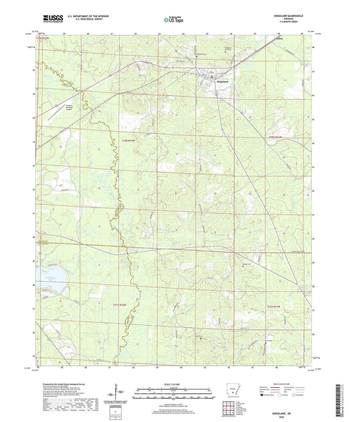
2024 topographic map quadrangle Kingsland in the state of Arkansas. Scale: 1:24000. Based on the newly updated USGS 7.5' US Topo map series, this map is in the following counties: Cleveland, Dallas, Calhoun. The map contains contour data, water features, and other items you are used to seeing on USGS maps, but also has updated roads and other features. This is the next generation of topographic maps. Printed on high-quality waterproof paper with UV fade-resistant inks.
Quads adjacent to this one:
West: Fordyce
Northwest: Ivan
North: Fordyce NE
Northeast: Rison
East: New Edinburg
Southeast: McKinney
South: Tinsman
Southwest: Chambersville
This map covers the same area as the classic USGS quad with code o33092g3.
Contains the following named places: Camp Creek, Caney Creek, City of Kingsland, Cooks Creek, Crain Cemetery, Draughon, Fordyce Municipal Airport, Jug Creek, Kingsland, Kingsland Cemetery, Kingsland Cemetery East, Kingsland Elementary School, Kingsland High School, Kingsland Police Department, Kingsland Post Office, Kingsland Volunteer Fire Department, Larson Lake, Marks Mill Battleground, McCoy Cemetery, Meek, Morgan Cemetery, Moro Lookout Tower, Mount Lebanon Church, Saline, Smith Church, Smith Creek, Tipton, Township of Dry Run, Tri-County Lake, Tri-County Lake Dam