MyTopo
Tinsman Arkansas US Topo Map
Couldn't load pickup availability
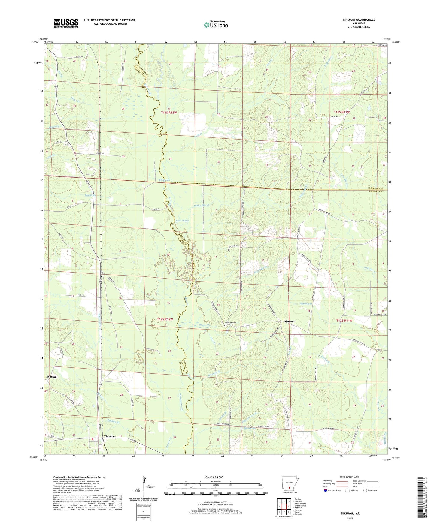
2024 topographic map quadrangle Tinsman in the state of Arkansas. Scale: 1:24000. Based on the newly updated USGS 7.5' US Topo map series, this map is in the following counties: Calhoun, Bradley, Cleveland. The map contains contour data, water features, and other items you are used to seeing on USGS maps, but also has updated roads and other features. This is the next generation of topographic maps. Printed on high-quality waterproof paper with UV fade-resistant inks.
Quads adjacent to this one:
West: Chambersville
Northwest: Fordyce
North: Kingsland
Northeast: New Edinburg
East: McKinney
Southeast: Farmville
South: Banks
Southwest: Hampton
This map covers the same area as the classic USGS quad with code o33092f3.
Contains the following named places: Anna Branch, Beech Creek, Berks Branch, Big Slough, Blue Springs, Blue Springs Branch, Blue Springs Church, Brown Branch, Brushy Branch, Clear Creek, Douglas Branch, Dry Creek, Ellisville, Ellisville Church, Fritz Creek, Hunter Branch, Lavender Branch, Levit, Lindale, Parr Branch, Rough Branch, Scott Water, Tinsman, Tinsman Fire Station, Town of Tinsman, Township of Moro, Wagnon, Wagnon Branch, Wagnon Methodist Church, Watson, White Oak Creek, Whitewater Creek, Williams Cemetery, Williford School