MyTopo
Chambersville Arkansas US Topo Map
Couldn't load pickup availability
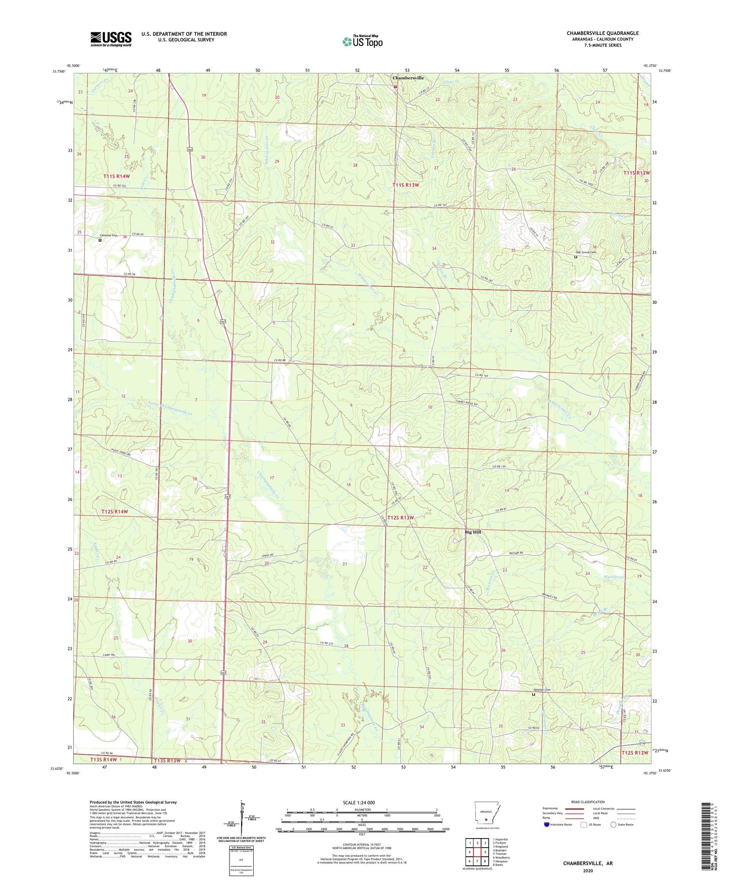
2024 topographic map quadrangle Chambersville in the state of Arkansas. Scale: 1:24000. Based on the newly updated USGS 7.5' US Topo map series, this map is in the following counties: Calhoun. The map contains contour data, water features, and other items you are used to seeing on USGS maps, but also has updated roads and other features. This is the next generation of topographic maps. Printed on high-quality waterproof paper with UV fade-resistant inks.
Quads adjacent to this one:
West: Bearden
Northwest: Hopeville
North: Fordyce
Northeast: Kingsland
East: Tinsman
Southeast: Banks
South: Hampton
Southwest: Woodberry
This map covers the same area as the classic USGS quad with code o33092f4.
Contains the following named places: Big Hill, Bluff Hill Church, Bud Hill Lookout Tower, Calaway Cemetery, Chambersville, Chambersville Fire Department, Church Number 10, Elberta, Garden Branch, Green Hall, Little Champagnolle Creek, Lost Creek, Mount Olive Church, Mount Pleasant Church, Newton Cemetery, Oak Grove Cemetery, Sulphur Springs Church, Township 2, Township 3, Township of Jefferson, Turners Creek