MyTopo
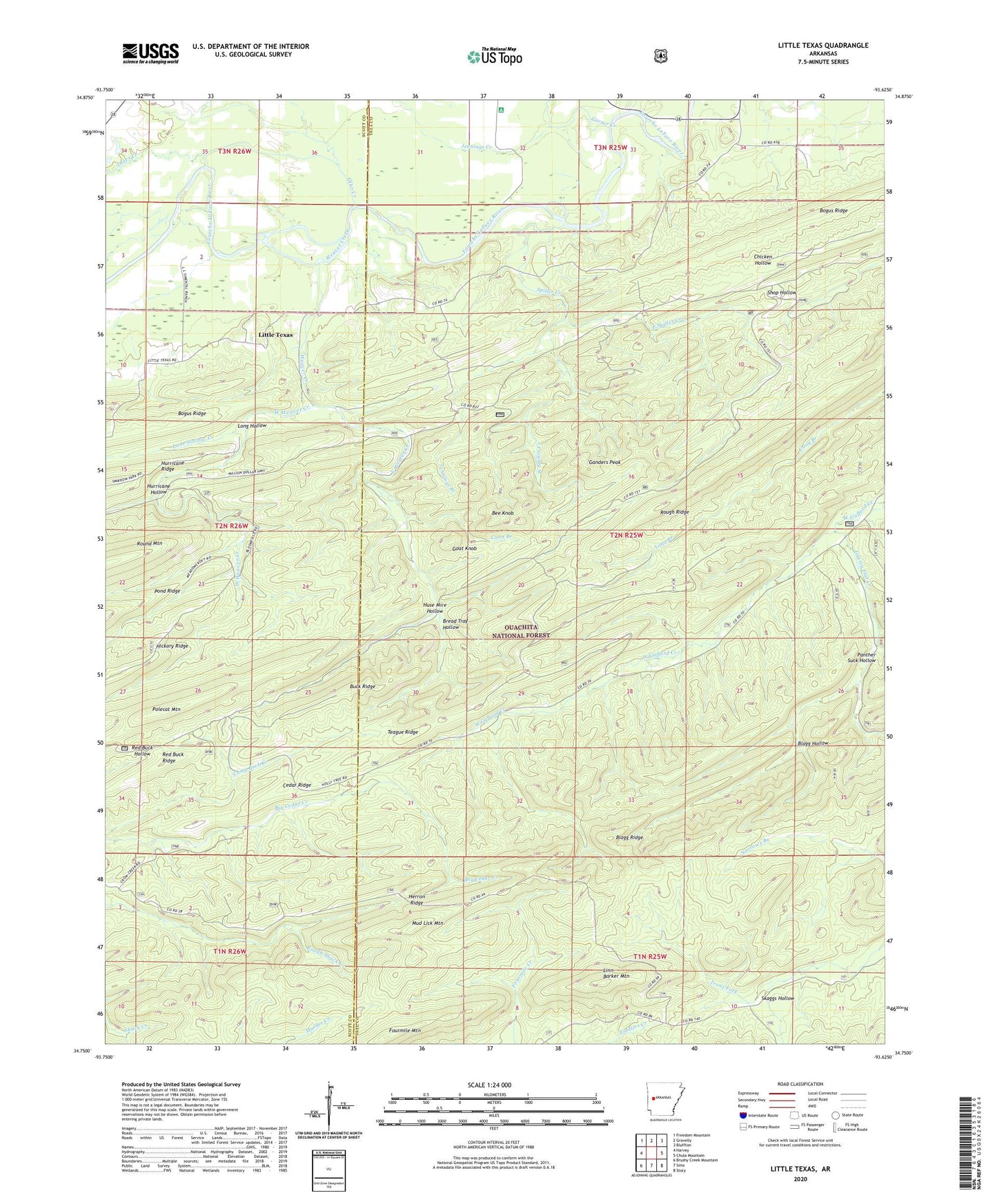
Little Texas Arkansas US Topo Map
Couldn't load pickup availability
Also explore the Little Texas Forest Service Topo of this same quad for updated USFS data
2024 topographic map quadrangle Little Texas in the state of Arkansas. Scale: 1:24000. Based on the newly updated USGS 7.5' US Topo map series, this map is in the following counties: Yell, Scott. The map contains contour data, water features, and other items you are used to seeing on USGS maps, but also has updated roads and other features. This is the next generation of topographic maps. Printed on high-quality waterproof paper with UV fade-resistant inks.
Quads adjacent to this one:
West: Harvey
Northwest: Freedom Mountain
North: Gravelly
Northeast: Bluffton
East: Chula Mountain
Southeast: Story
South: Sims
Southwest: Brushy Creek Mountain
This map covers the same area as the classic USGS quad with code o34093g6.
Contains the following named places: Bee Knob, Blagg Hollow, Blagg Ridge, Bogus Ridge, Bread Tray Hollow, Buck Ridge, Cedar Ridge, Coon Branch, East Spiller Creek, East Weaver Creek, Fourmile Mountain, Ganders Peak, Garner Creek, Goat Knob, Grassy Flat Creek, Herron Ridge, Hurricane Hollow, Huse Mire Hollow, Janes Creek, Jennings Branch, Jennings Creek, Linn Barker Mountain, Little Texas, Lone Hollow Creek, Lone Oak School, Long Hollow, Mud Lick Mountain, Oller Creek, Panther Suck Hollow, Piney Grove School, Polecat Mountain, Red Buck Ridge, Red Hill School, Rough Ridge, Skaggs Hollow, Spiller Creek, Teague Ridge, Township of Little Texas, Weaver Creek, West Spiller Creek, West Weaver Creek, ZIP Code: 72827