MyTopo
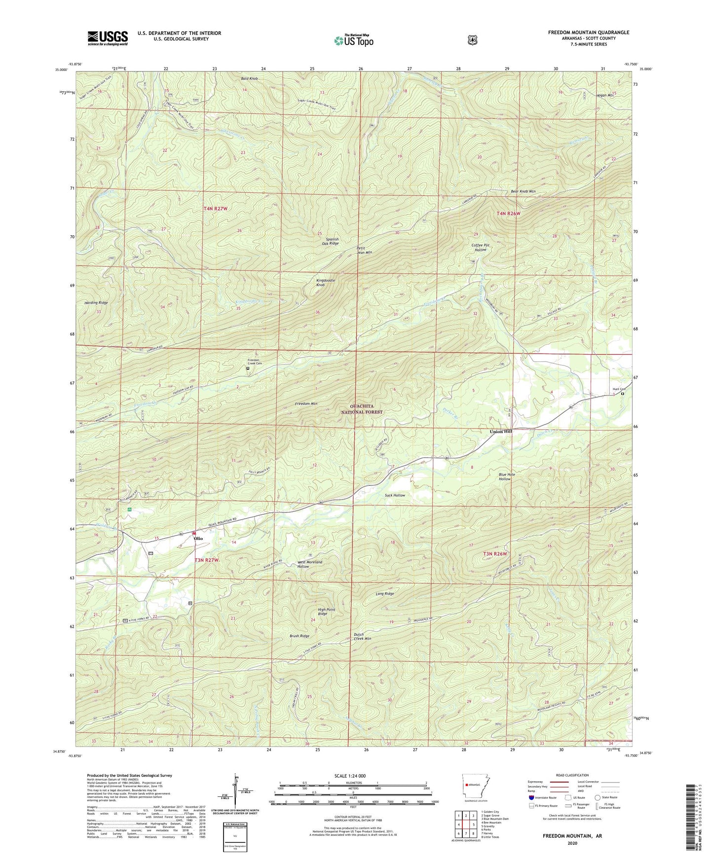
Freedom Mountain Arkansas US Topo Map
Couldn't load pickup availability
Also explore the Freedom Mountain Forest Service Topo of this same quad for updated USFS data
2024 topographic map quadrangle Freedom Mountain in the state of Arkansas. Scale: 1:24000. Based on the newly updated USGS 7.5' US Topo map series, this map is in the following counties: Scott. The map contains contour data, water features, and other items you are used to seeing on USGS maps, but also has updated roads and other features. This is the next generation of topographic maps. Printed on high-quality waterproof paper with UV fade-resistant inks.
Quads adjacent to this one:
West: Bee Mountain
Northwest: Golden City
North: Sugar Grove
Northeast: Blue Mountain Dam
East: Gravelly
Southeast: Little Texas
South: Harvey
Southwest: Parks
This map covers the same area as the classic USGS quad with code o34093h7.
Contains the following named places: Bear Knob Lookout Tower, Bear Knob Mountain, Blue Hole Hollow, Brush Ridge, Coffee Pot Hollow, Dutch Creek School, Freedom Creek, Freedom Creek Cemetery, Freedom Mountain, Haletown Volunteer Fire Department, High Point Ridge, Hogan Mountain, Hunt Cemetery, Kingdoodle Creek, Kingdoodle Knob, Long Ridge, Mount Moriah Church, Olio, Parker Branch, Pigeon Creek, Rock Quarry Branch, Rocky Branch, Spanish Oak Ridge, Suck Hollow, Township of Hunt, Township of James, Union Hill, Union Hill Church, Waldron Branch, West Moreland Hollow, Whetstone Creek