MyTopo
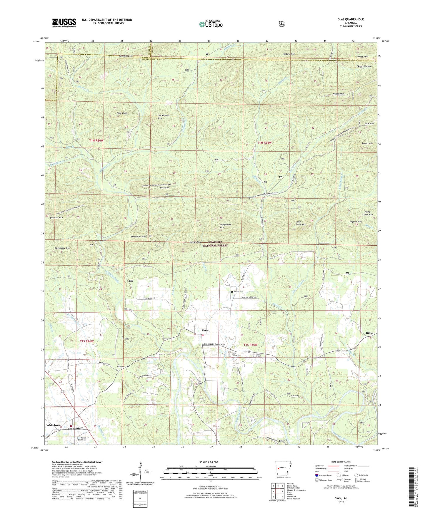
Sims Arkansas US Topo Map
Couldn't load pickup availability
Also explore the Sims Forest Service Topo of this same quad for updated USFS data
2024 topographic map quadrangle Sims in the state of Arkansas. Scale: 1:24000. Based on the newly updated USGS 7.5' US Topo map series, this map is in the following counties: Montgomery, Yell, Scott. The map contains contour data, water features, and other items you are used to seeing on USGS maps, but also has updated roads and other features. This is the next generation of topographic maps. Printed on high-quality waterproof paper with UV fade-resistant inks.
Quads adjacent to this one:
West: Brushy Creek Mountain
Northwest: Harvey
North: Little Texas
Northeast: Chula Mountain
East: Story
Southeast: Reed Mountain
South: Mount Ida
Southwest: Oden
This map covers the same area as the classic USGS quad with code o34093f6.
Contains the following named places: Barber Cemetery, Blowout Mountain, Central School, Chalybeate Mountain, Chasewood Landing, Craft Creek, Dragover Recreation Area, Fiddler Valley School, Fiddlers Creek, Fourmile Creek, Fulton Branch, Fulton Branch Recreation Area, Gibbs School, Hackberry Creek, Hackberry Mountain, Harris Creek, Hopper Mountain, John Burns Mountain, Little Rainy Creek, Lone Valley Cemetery, Lone Valley Church of God, Macedonia Cemetery, Muddy Mountain, Muddy Mountain Lookout Tower, Murder Creek, Oden Pencil Bluff Volunteer Fire Department Station 2, Old Mitchel Mountain, Oxbow Mountain, Pencil Bluff, Pencil Bluff Cemetery, Pencil Bluff Census Designated Place, Pencil Bluff First Baptist Church, Pencil Bluff Post Office, Pilot Branch, Pilot Knob, Pleasant Valley School, Rainy Creek, River Bluff Recreation Area, Rock Creek, Rock Row, Round Mountain, Sims, Sims Post Office, Sims School, Sims Volunteer Fire Department, Skaggs Mountain, Stevenson Mountain, Stovall Mountain, Township of Pencil Bluff, Township of Sims, West Fiddlers Creek, Whitetown, ZIP Codes: 71965, 71969