MyTopo
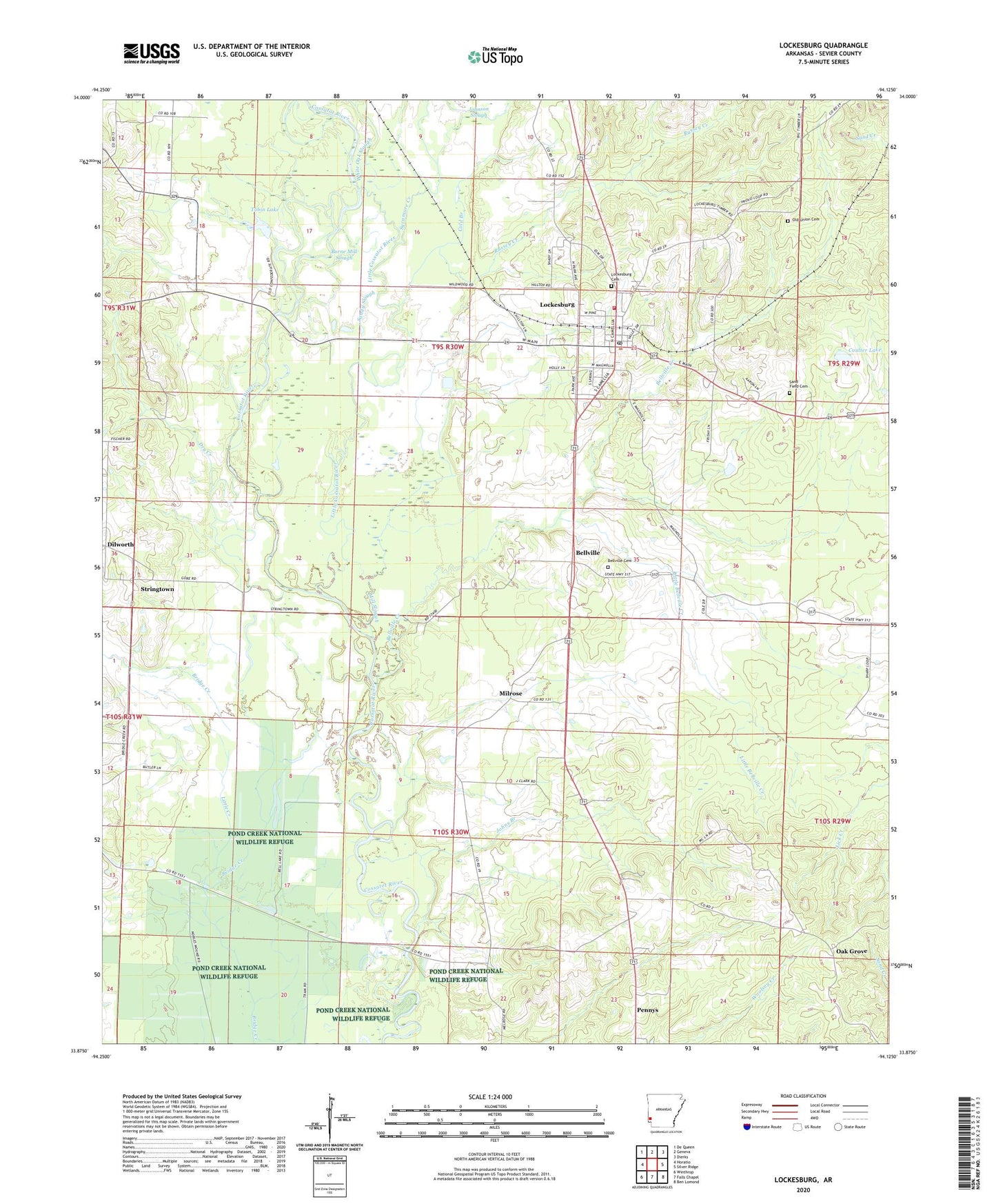
Lockesburg Arkansas US Topo Map
Couldn't load pickup availability
2024 topographic map quadrangle Lockesburg in the state of Arkansas. Scale: 1:24000. Based on the newly updated USGS 7.5' US Topo map series, this map is in the following counties: Sevier. The map contains contour data, water features, and other items you are used to seeing on USGS maps, but also has updated roads and other features. This is the next generation of topographic maps. Printed on high-quality waterproof paper with UV fade-resistant inks.
Quads adjacent to this one:
West: Horatio
Northwest: De Queen
North: Geneva
Northeast: Dierks
East: Silver Ridge
Southeast: Ben Lomond
South: Falls Chapel
Southwest: Winthrop
This map covers the same area as the classic USGS quad with code o33094h2.
Contains the following named places: Bellville, Bellville Cemetery, Bellville Creek, Borne Mill Slough, City of Lockesburg, Cold Branch, Coulter Lake, Coulter Lake Dam, Dilworth, Dry Creek, Fraser Pond, Fraser Pond Dam, Johns Branch, Johnson Slough, Little Bellville Creek, Little Cossatot River, Little Creek, Lockesburg, Lockesburg Cemetery, Lockesburg Elementary School, Lockesburg Fire Department, Lockesburg High School, Lockesburg Post Office, Lone Oak Church, Melrose School, Mill Slough, Milrose, Mount Carmel Church, Mount Ida Church, Oak Grove, Oak Grove School, Old Bellville Church, Old Union Cemetery, Old Union Church, Pennys, Rock Hill, Russey Creek, Russey Lake, Sand Field Cemetery, Sandy Slough, Sevier County, Southwest Transport Service (Basic Life Support), Stringtown, Sycamore Creek, Tobin Lake, Tobin Lake Dam, United States Fish and Wildlife Pond Creek National Wildlife Refuge Park Security, White Oak Slough, ZIP Code: 71846