MyTopo
Silver Ridge Arkansas US Topo Map
Couldn't load pickup availability
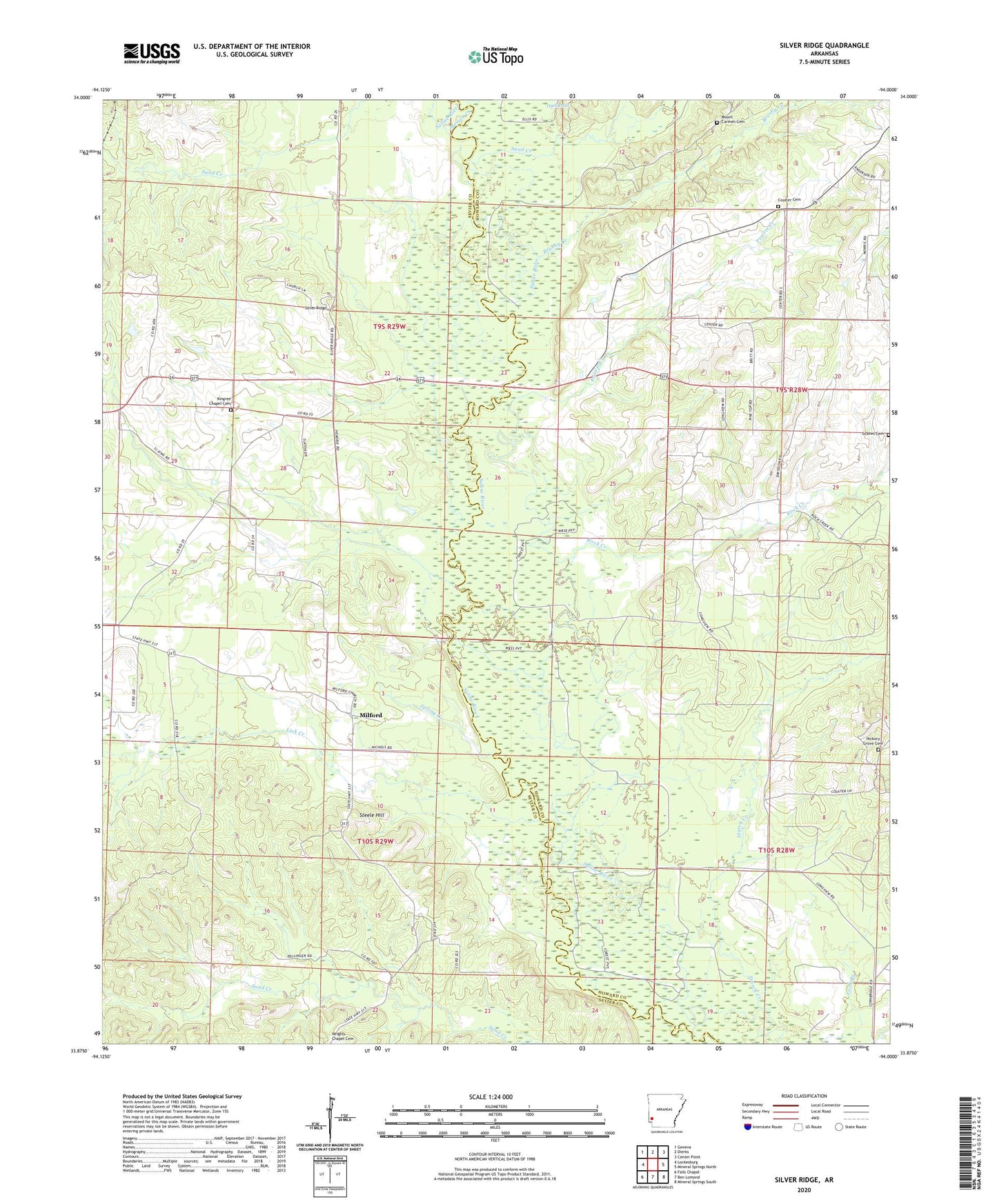
2024 topographic map quadrangle Silver Ridge in the state of Arkansas. Scale: 1:24000. Based on the newly updated USGS 7.5' US Topo map series, this map is in the following counties: Sevier, Howard. The map contains contour data, water features, and other items you are used to seeing on USGS maps, but also has updated roads and other features. This is the next generation of topographic maps. Printed on high-quality waterproof paper with UV fade-resistant inks.
Quads adjacent to this one:
West: Lockesburg
Northwest: Geneva
North: Dierks
Northeast: Center Point
East: Mineral Springs North
Southeast: Mineral Springs South
South: Ben Lomond
Southwest: Falls Chapel
This map covers the same area as the classic USGS quad with code o33094h1.
Contains the following named places: Brushy Creek, Center Methodist Church, Center School, Coulter Cemetery, Cypress Slough, Graves Cemetery, Gravity Point Church, Hickory Grove Cemetery, Hickory Grove Church, Holly Springs Church, Kennedys Store, Kingree Chapel, Kingree Chapel Cemetery, Lick Creek, Longview School, Lyons United Methodist Church, Messer Creek, Milford, Mount Carmen Cemetery, Murphy Ford, Nutt School, Prairie Creek, Rock Creek, Rosedale, Rosedale Baptist Church, Rosedale School, Saltworks Ford, Sanctified Church, Sand Creek, Silver Ridge, Spring Creek, Steele Hill, Sulphur Slough, Township of Blue Bayou, Township of Saline