MyTopo
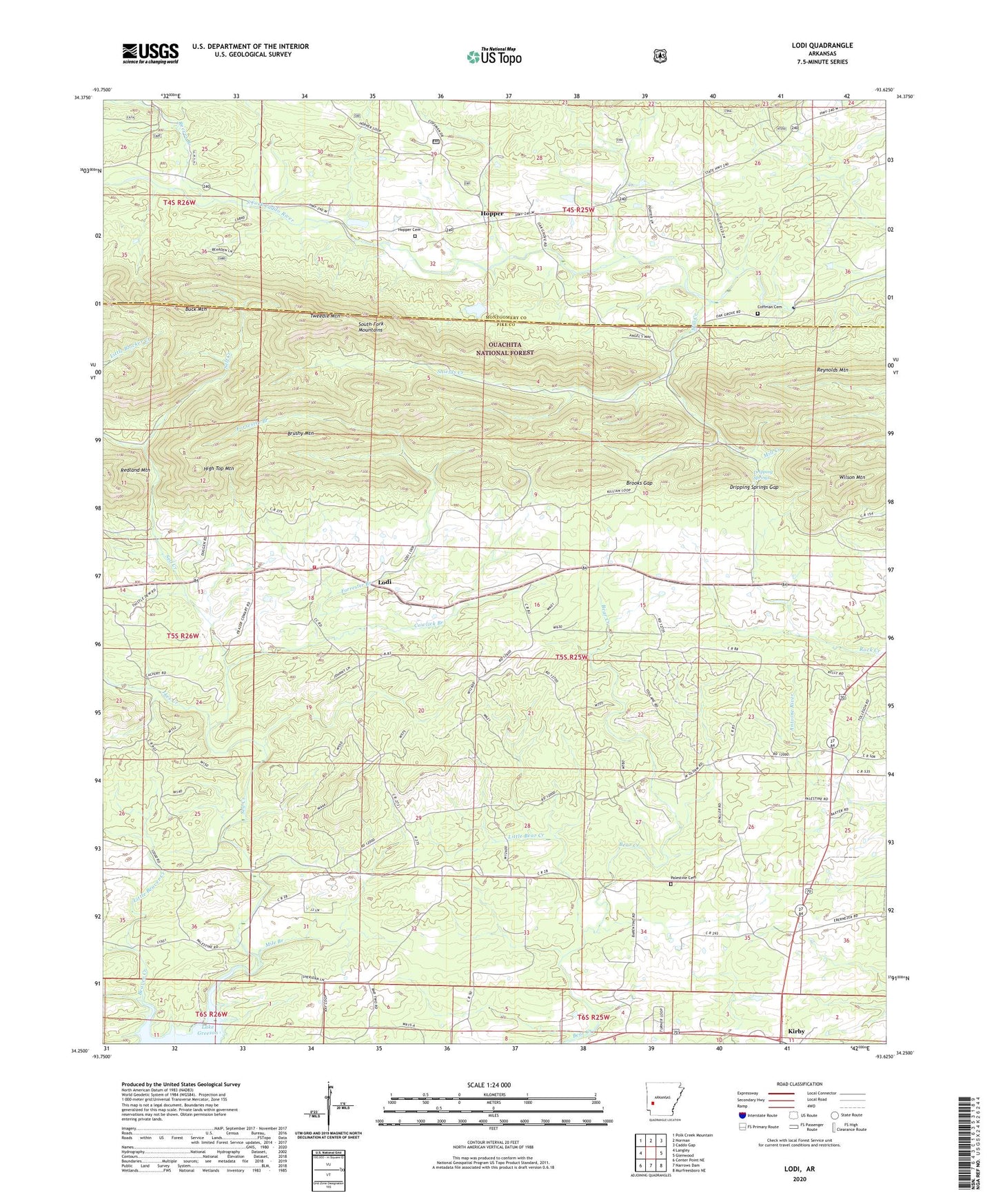
Lodi Arkansas US Topo Map
Couldn't load pickup availability
Also explore the Lodi Forest Service Topo of this same quad for updated USFS data
2024 topographic map quadrangle Lodi in the state of Arkansas. Scale: 1:24000. Based on the newly updated USGS 7.5' US Topo map series, this map is in the following counties: Pike, Montgomery. The map contains contour data, water features, and other items you are used to seeing on USGS maps, but also has updated roads and other features. This is the next generation of topographic maps. Printed on high-quality waterproof paper with UV fade-resistant inks.
Quads adjacent to this one:
West: Langley
Northwest: Polk Creek Mountain
North: Norman
Northeast: Caddo Gap
East: Glenwood
Southeast: Murfreesboro NE
South: Narrows Dam
Southwest: Center Point NE
This map covers the same area as the classic USGS quad with code o34093c6.
Contains the following named places: Beaver Creek, Brooks Gap, Brushy Mountain, Buck Mountain, Coffman Cemetery, Cooper, Cowlick Branch, Dripping Springs, Dripping Springs Gap, Dunlap, Forrester Branch, Free Will Baptist Church, High Top Mountain, Hopper, Hopper Cemetery, Hopper Church of Christ, Ikes Creek, Kirby, Kirby Census Designated Place, Little Bear Creek, Little Beaver Creek, Lodi, Lodi Missionary Baptist Church, Lodi School, Lodi Volunteer Fire Station, Mile Branch, Mill Creek, Palestine Cemetery, Palestine Church, Parks School, Reeves Branch, Self Creek, Shields Creek, South Fork Mountains, Township of Eagle, Tweedle Mountain, Wilson Mountain, Zebulon, ZIP Code: 71950