MyTopo
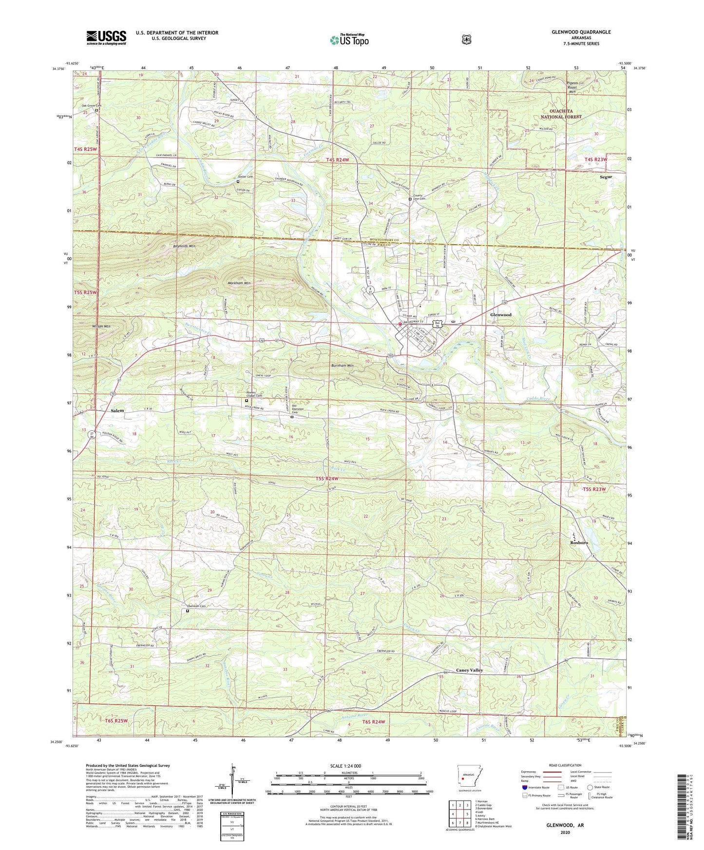
Glenwood Arkansas US Topo Map
Couldn't load pickup availability
Also explore the Glenwood Forest Service Topo of this same quad for updated USFS data
2024 topographic map quadrangle Glenwood in the state of Arkansas. Scale: 1:24000. Based on the newly updated USGS 7.5' US Topo map series, this map is in the following counties: Pike, Montgomery, Clark. The map contains contour data, water features, and other items you are used to seeing on USGS maps, but also has updated roads and other features. This is the next generation of topographic maps. Printed on high-quality waterproof paper with UV fade-resistant inks.
Quads adjacent to this one:
West: Lodi
Northwest: Norman
North: Caddo Gap
Northeast: Bonnerdale
East: Amity
Southeast: Chalybeate Mountain West
South: Murfreesboro NE
Southwest: Narrows Dam
This map covers the same area as the classic USGS quad with code o34093c5.
Contains the following named places: Assembly of God Church, Bethel Missionary Baptist Church, Bethel School, Bigsby Branch, Burnham Mountain, Caddo Ranger Station and Work Center, Caney Valley, Caney Valley Missionary Baptist Church, Centerpoint Elementary School, Centerpoint High School, Centerpoint Middle School, Church of Christ, Church of God, City of Glenwood, Community Bible Baptist Church, County Line Cemetery, County Line Methodist Church, County Line School, Ebenezer Cemetery, Emergency Medical Transport, Fields School, Five Mile School, Fivemile Creek, Forest Hill Church, Fox Branch, Glenwood, Glenwood Elementary School, Glenwood Fire Department, Glenwood High School, Glenwood Police Department, Glenwood Post Office, Hickory Station, Juneau Spur, Kingdom Hall, KWXE-FM (Glenwood), KWXI-AM (Glenwood), Little Antoine Creek, Logan School, Markham Mountain, Mill Pond, Mill Pond Dam, Mountain View School, Mud Lick Creek, Oak Grove Baptist Church, Oak Grove Cemetery, Old Ebenezer Cemetery, Pigeon Roost Mine, Powers Chapel, Powers Chapel Cemetery, Primitive Baptist Church, Reynolds Mountain, Rock Creek, Rosboro, Rosboro Missionary Baptist Church, Salem, Salem Baptist Church, Segur, South Fork Caddo River, Steller Cemetery, Sweetwater Creek, Tigue Lake, Tigue Lake Dam, Township of Clark, ZIP Code: 71943