MyTopo
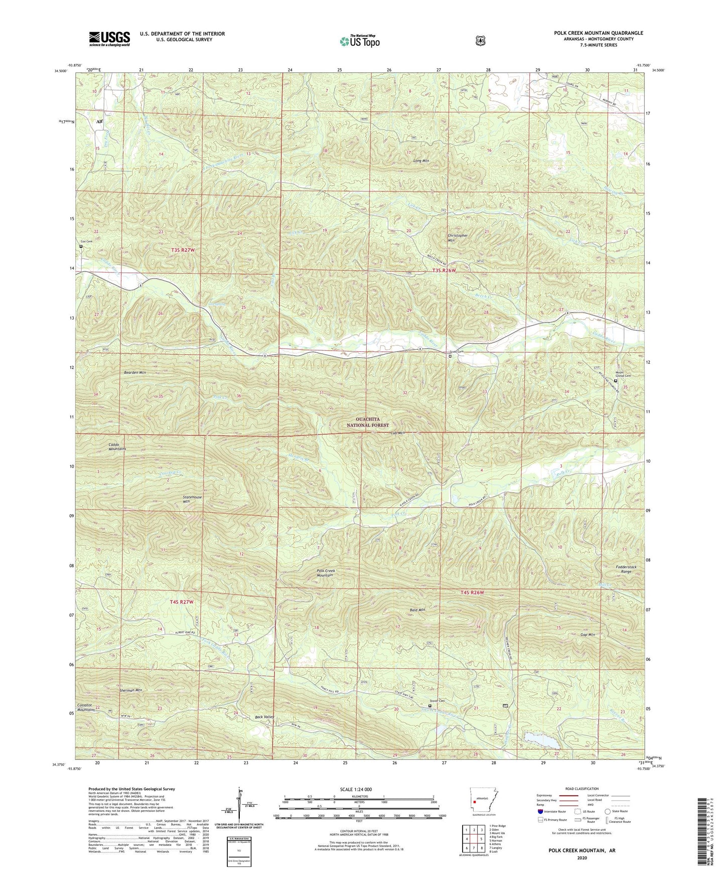
Polk Creek Mountain Arkansas US Topo Map
Couldn't load pickup availability
Also explore the Polk Creek Mountain Forest Service Topo of this same quad for updated USFS data
2024 topographic map quadrangle Polk Creek Mountain in the state of Arkansas. Scale: 1:24000. Based on the newly updated USGS 7.5' US Topo map series, this map is in the following counties: Montgomery. The map contains contour data, water features, and other items you are used to seeing on USGS maps, but also has updated roads and other features. This is the next generation of topographic maps. Printed on high-quality waterproof paper with UV fade-resistant inks.
Quads adjacent to this one:
West: Big Fork
Northwest: Pine Ridge
North: Oden
Northeast: Mount Ida
East: Norman
Southeast: Lodi
South: Langley
Southwest: Athens
This map covers the same area as the classic USGS quad with code o34093d7.
Contains the following named places: Alf, Bald Mountain, Barnett School, Bearden Mountain, Call Branch, CCC Camp, Christopher Mountain, Cox Cemetery, Cox Spring, Cub Mountain, Faith Valley Church, Faith Valley Landmark Missionary Baptist Church, Gap Mountain Trail, Hendrix Branch, Long Mountain, Mount Gilead Baptist Church, Mount Gilead Cemetery, Mount Gilend Church, Murphy Baptist Church, Perrin School, Polk Creek Mountain, Rocky Hollow School, Scott Cemetery, Scott School, Sherman Mountain, Slatington, Slatington School, Statehouse Mountain, Stover Cemetery, Township of Black Springs, Township of Caddo, Township of Hopper, Township of Missouri, Township of Parks, Township of Scott, Wagner Creek, ZIP Code: 71935