MyTopo
Louann Arkansas US Topo Map
Couldn't load pickup availability
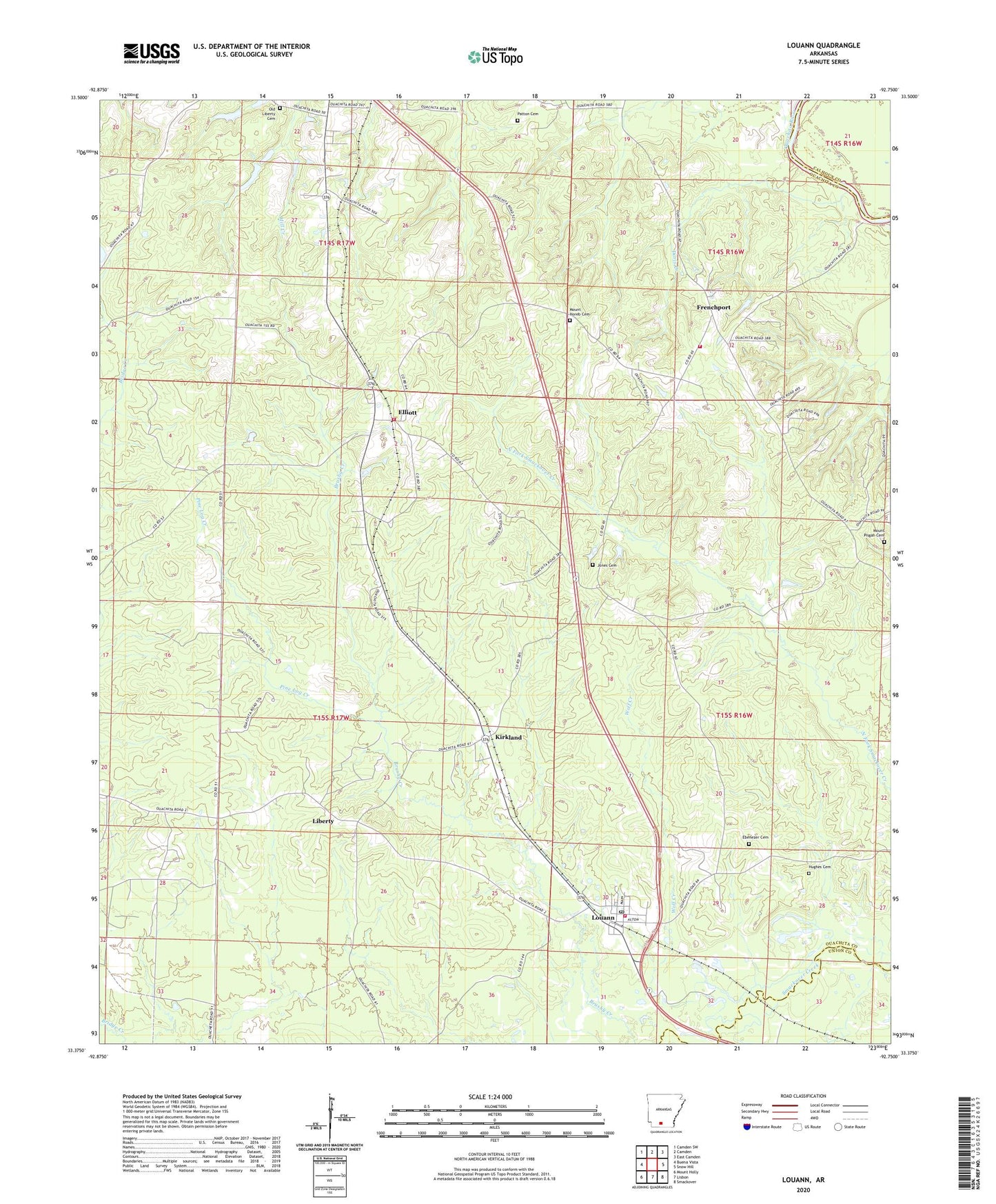
2024 topographic map quadrangle Louann in the state of Arkansas. Scale: 1:24000. Based on the newly updated USGS 7.5' US Topo map series, this map is in the following counties: Ouachita, Union, Calhoun. The map contains contour data, water features, and other items you are used to seeing on USGS maps, but also has updated roads and other features. This is the next generation of topographic maps. Printed on high-quality waterproof paper with UV fade-resistant inks.
Quads adjacent to this one:
West: Buena Vista
Northwest: Camden SW
North: Camden
Northeast: East Camden
East: Snow Hill
Southeast: Smackover
South: Lisbon
Southwest: Mount Holly
This map covers the same area as the classic USGS quad with code o33092d7.
Contains the following named places: Bethesda Cumberland Church, Calvary Church, Doris Creek, East Pace City Oil and Gas Field, Ebenezer Cemetery, Ebenezer Church, Elliott, Elliott Baptist Church, Elliott Volunteer Fire Department Station, Frenchport, Frenchport Church, Frenchport Landing, Frenchport Volunteer Fire Department, Good Home Church, Hughes Cemetery, Jones Cemetery, Kirkland, Liberty, Louann, Louann Baptist Church, Louann Post Office, Louann Volunteer Fire Department, Mount Horeb Cemetery, Mount Pisgah Cemetery, New Jerusalem Church, Old Liberty Cemetery, Patton Cemetery, Pine Log Creek, Sylvan Hills Baptist Church, Town of Louann, Township of Bridge Creek, Wolf Creek, ZIP Code: 71751