MyTopo
Camden SW Arkansas US Topo Map
Couldn't load pickup availability
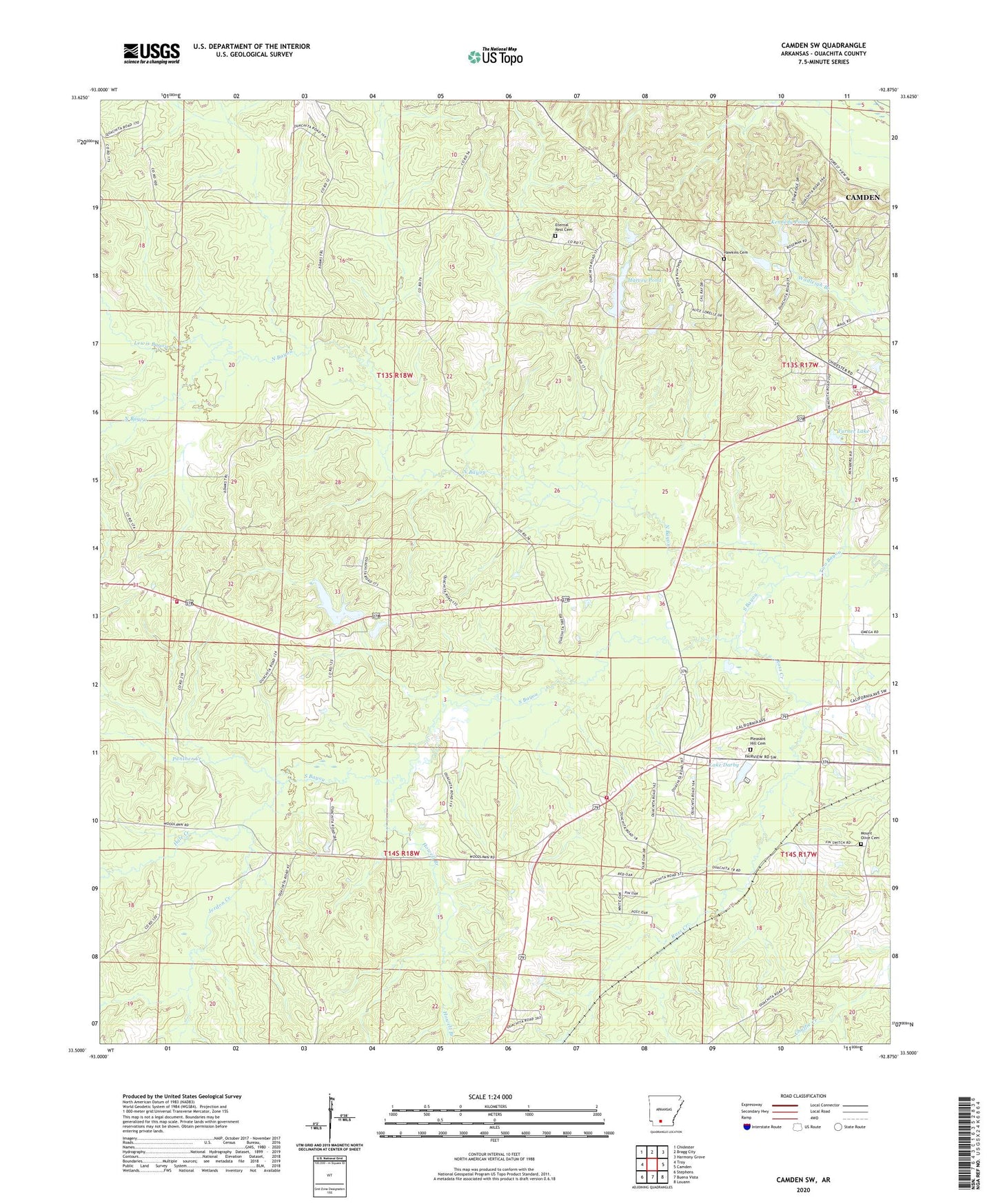
2024 topographic map quadrangle Camden SW in the state of Arkansas. Scale: 1:24000. Based on the newly updated USGS 7.5' US Topo map series, this map is in the following counties: Ouachita. The map contains contour data, water features, and other items you are used to seeing on USGS maps, but also has updated roads and other features. This is the next generation of topographic maps. Printed on high-quality waterproof paper with UV fade-resistant inks.
Quads adjacent to this one:
West: Troy
Northwest: Chidester
North: Bragg City
Northeast: Harmony Grove
East: Camden
Southeast: Louann
South: Buena Vista
Southwest: Stephens
This map covers the same area as the classic USGS quad with code o33092e8.
Contains the following named places: Arkansas Noname 85 Dam, Buena Vista Volunteer Fire Department Station 2, Darby Lake Dam, Eternal Rest Cemetery, Fellowship Church, Finnswitch, First Union Baptist Church, Greenings Lake, Greenings Lake Dam, Hale Creek, Harvey Pond, Harvey Pond Dam, Hawkins Cemetery, Howell Branch, Jerdon Creek, Kennedy Pond, Kennedy Pond Dam, Kingdom Hall, Lake Darby, Lewis Bayou, Lufra, Mount Olive Cemetery, Mount Olive Missionary Baptist Church, Mount Zion Church, North Bayou, Ouachita County, Panther Creek, Pleasant Ridge Assembly of God Church Cemetery, Pleasant Ridge Church, Ross Creek, Saint James Baptist Church, South Bayou, Sweet Home Baptist Church, Township of Bragg, Turner Lake, Two Bayou Church, Two Bayou Volunteer Fire Department, Two Bayou Volunteer Fire Department Substation