MyTopo
Luna Arkansas US Topo Map
Couldn't load pickup availability
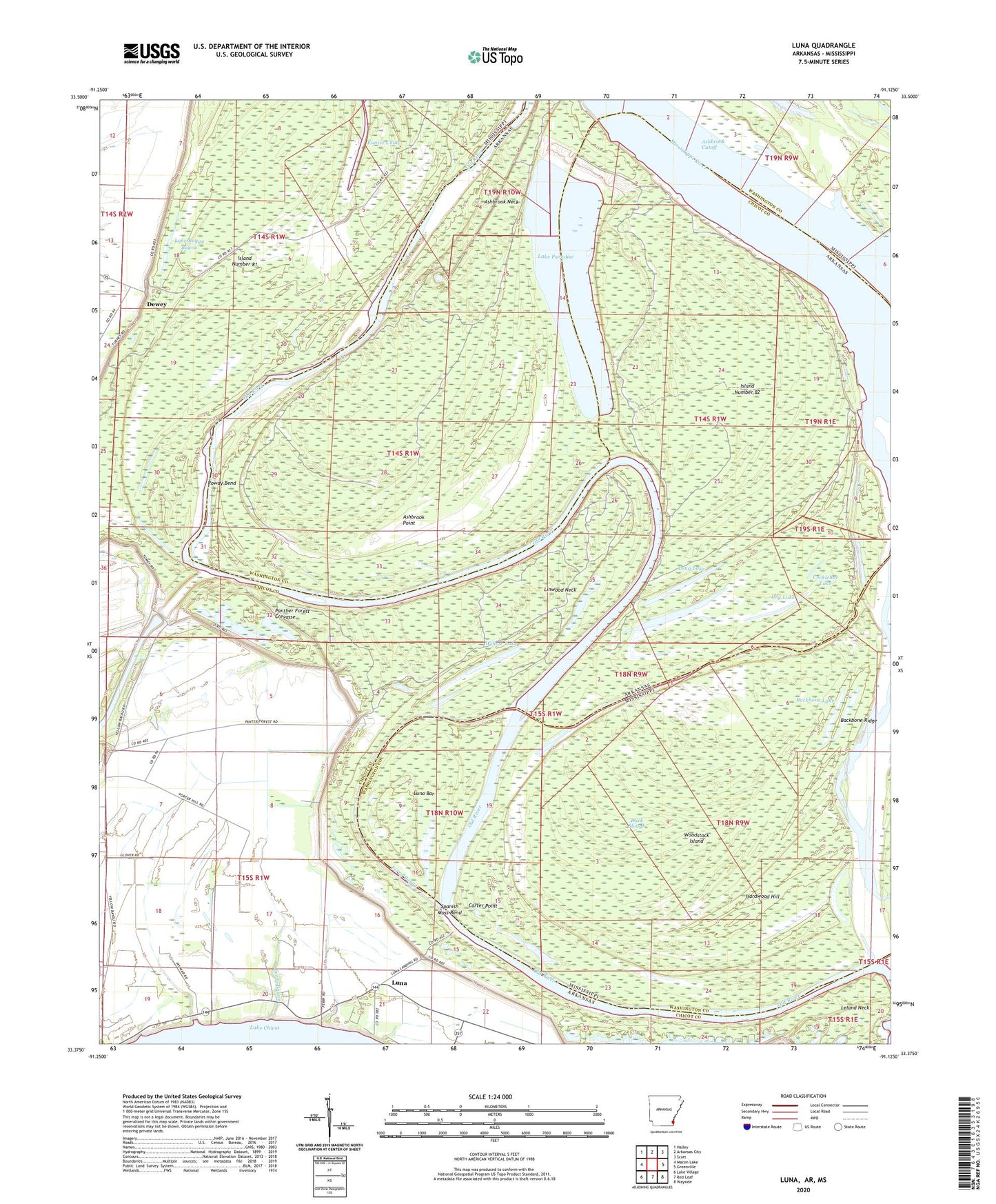
2024 topographic map quadrangle Luna in the states of Arkansas, Mississippi. Scale: 1:24000. Based on the newly updated USGS 7.5' US Topo map series, this map is in the following counties: Chicot, Washington. The map contains contour data, water features, and other items you are used to seeing on USGS maps, but also has updated roads and other features. This is the next generation of topographic maps. Printed on high-quality waterproof paper with UV fade-resistant inks.
Quads adjacent to this one:
West: Macon Lake
Northwest: Halley
North: Arkansas City
Northeast: Scott
East: Greenville
Southeast: Wayside
South: Red Leaf
Southwest: Lake Village
Contains the following named places: Ashbrook Cutoff, Ashbrook Neck, Ashbrook Point, Backbone Lake, Backbone Ridge, Blue Hole, Camp Lake, Carter Point, Carter Point Landing, Cocklebur Lake, Dewey, Dewey Landing, Dry Lake, Duck Slough, Eunice Chute, Ferry Bayou, Gaines Landing, Hardwood Hill, Island Number 81, Island Number 82, Lake Boggy Bayou, Lake Paradise, Leland Neck, Leland Neck Revetment, Linwood Landing, Linwood Neck, Little Island, Long Lake, Luna, Luna Bar, Luna Landing, Mud Lake, Old River, Panther Forest Crevasse, Panther Forest Landing, Panther Forest Revetment, Paradise Lake Dam, Point Comfort, Point Comfort Landing, Rossmere Church, Rowdy Bend, Rowdy Bend Towhead, Sevenmile Dike, Spanish Moss Bend, Spanish Moss Revetment, Vinson, Willow Lake, Woodstock Island