MyTopo
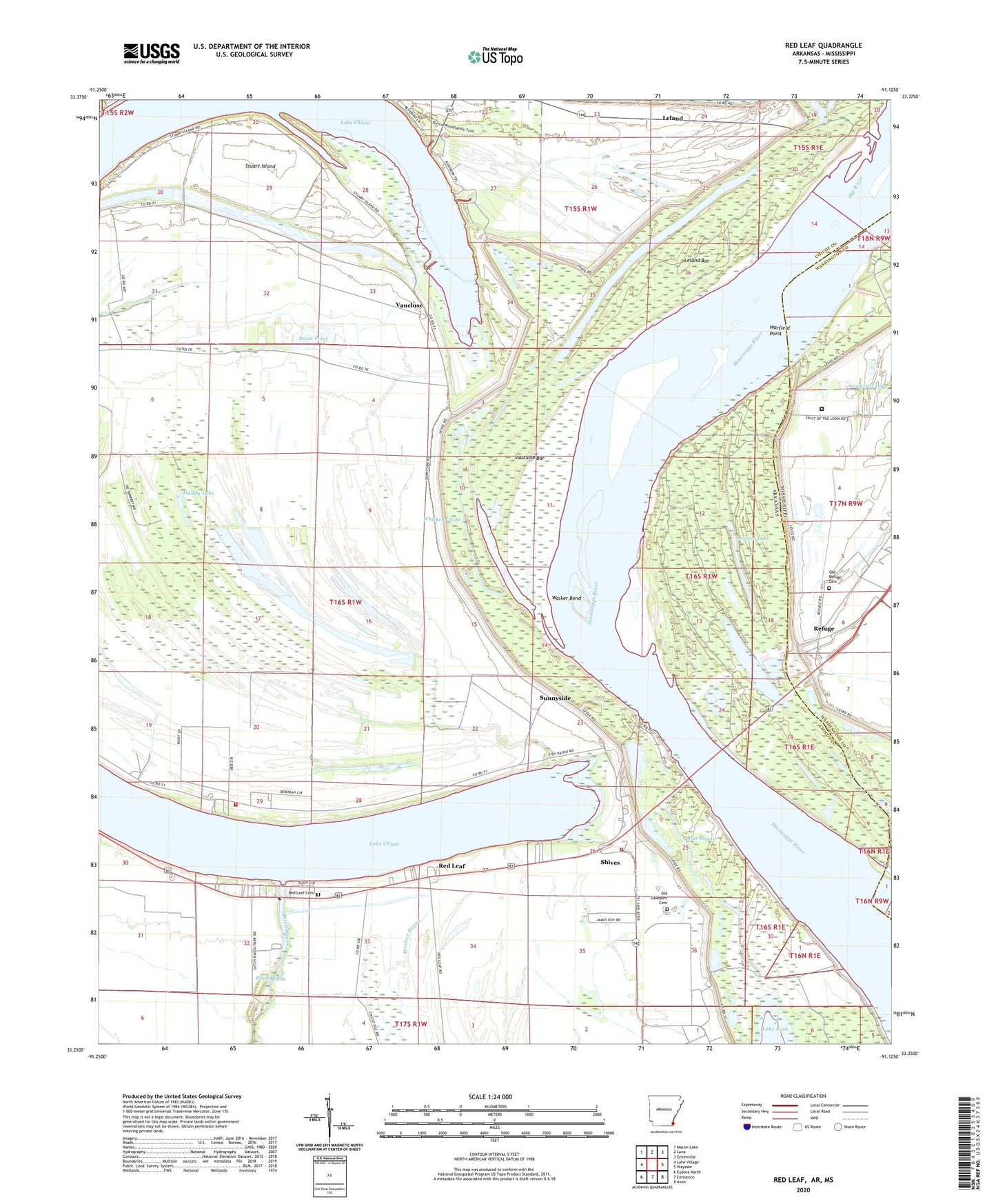
Red Leaf Arkansas US Topo Map
Couldn't load pickup availability
2024 topographic map quadrangle Red Leaf in the states of Arkansas, Mississippi. Scale: 1:24000. Based on the newly updated USGS 7.5' US Topo map series, this map is in the following counties: Chicot, Washington. The map contains contour data, water features, and other items you are used to seeing on USGS maps, but also has updated roads and other features. This is the next generation of topographic maps. Printed on high-quality waterproof paper with UV fade-resistant inks.
Quads adjacent to this one:
West: Lake Village
Northwest: Macon Lake
North: Luna
Northeast: Greenville
East: Wayside
Southeast: Avon
South: Eminence
Southwest: Eudora North
Contains the following named places: Beaver Lake, Blue Bayou, Cottonwood Chute, Ditch Bayou Station Dam, Fawnwood Volunteer Fire Department, Grassy Lake, Island Number 84, Jerusalem Church, KUUZ-FM (Lake Village), Lake Chicot, Lake Chicot State Park, Lakeport Church, Lakeport Volunteer Fire Department, Leland, Leland Bar, Leland Bar Dikes, Leland Chute, Mount Pleasant Church, Muddy Lake, Old Lakeport Cemetery, Old Refuge Cemetery, Red Leaf, Red Leaf Cemetery, Refuge, Refuge Landing, Shives, Stuart Island, Sunnyside, Sunnyside Landing, Sunnyside Revetment, Swan Pond, Township of Lake, Township of McConnell, Vacluse Landing, Vacluse Revetment, Vaucluse, Vaucluse Bar, Walker Bend, Warfield Point, Washington County Regional Correctional Facility, Whiskey Chute, Whiskey Chute Reservoir