MyTopo
Martindale Arkansas US Topo Map
Couldn't load pickup availability
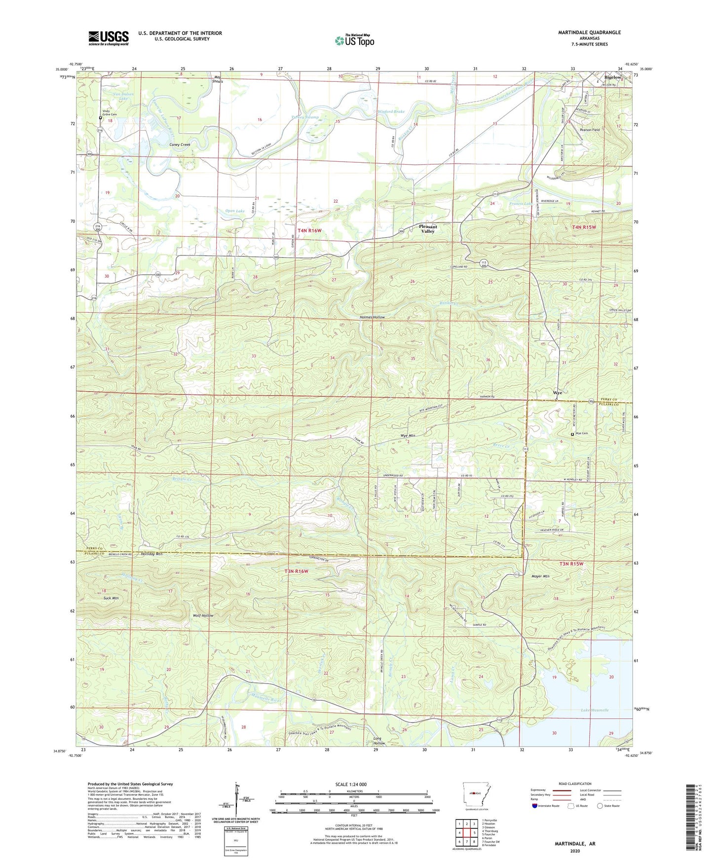
2024 topographic map quadrangle Martindale in the state of Arkansas. Scale: 1:24000. Based on the newly updated USGS 7.5' US Topo map series, this map is in the following counties: Perry, Pulaski. The map contains contour data, water features, and other items you are used to seeing on USGS maps, but also has updated roads and other features. This is the next generation of topographic maps. Printed on high-quality waterproof paper with UV fade-resistant inks.
Quads adjacent to this one:
West: Thornburg
Northwest: Perryville
North: Houston
Northeast: Gleason
East: Fourche
Southeast: Ferndale
South: Fourche SW
Southwest: Paron
This map covers the same area as the classic USGS quad with code o34092h6.
Contains the following named places: Bellevue, Bigelow High School, Caney Creek, Crossroads, Deerlick Creek, East End High School, Francis Lake, Francis Lake Dam, Graytown, Highland School, Holliday Creek, Holliday Mountain, Holmes Hollow, Lamb Creek, Long Hollow, Martindale, May Shoals, Mill Creek, Moyer Mountain, Oak Grove, Oak Grove Church, Oak Grove School, Open Lake, Orchard, Pearson Field, Pleasant Valley, Pleasant Valley School, Rankin, Rankin Creek, Rothy Creek, Sleepy Hollow Park, Suck Mountain, Town of Bigelow, Township of Kenney, Township of Maumelle, Township of Rankin, Turkey Swamp, Underwood Store, Van Dalsen Lake, Van Dalsen Lake Dam, Viney Grove Cemetery, Winford Brake, Wolf Hollow, Wye, Wye Cemetery, Wye Mountain, Wye United Methodist Church, Yount Creek, ZIP Code: 72016