MyTopo
Fourche SW Arkansas US Topo Map
Couldn't load pickup availability
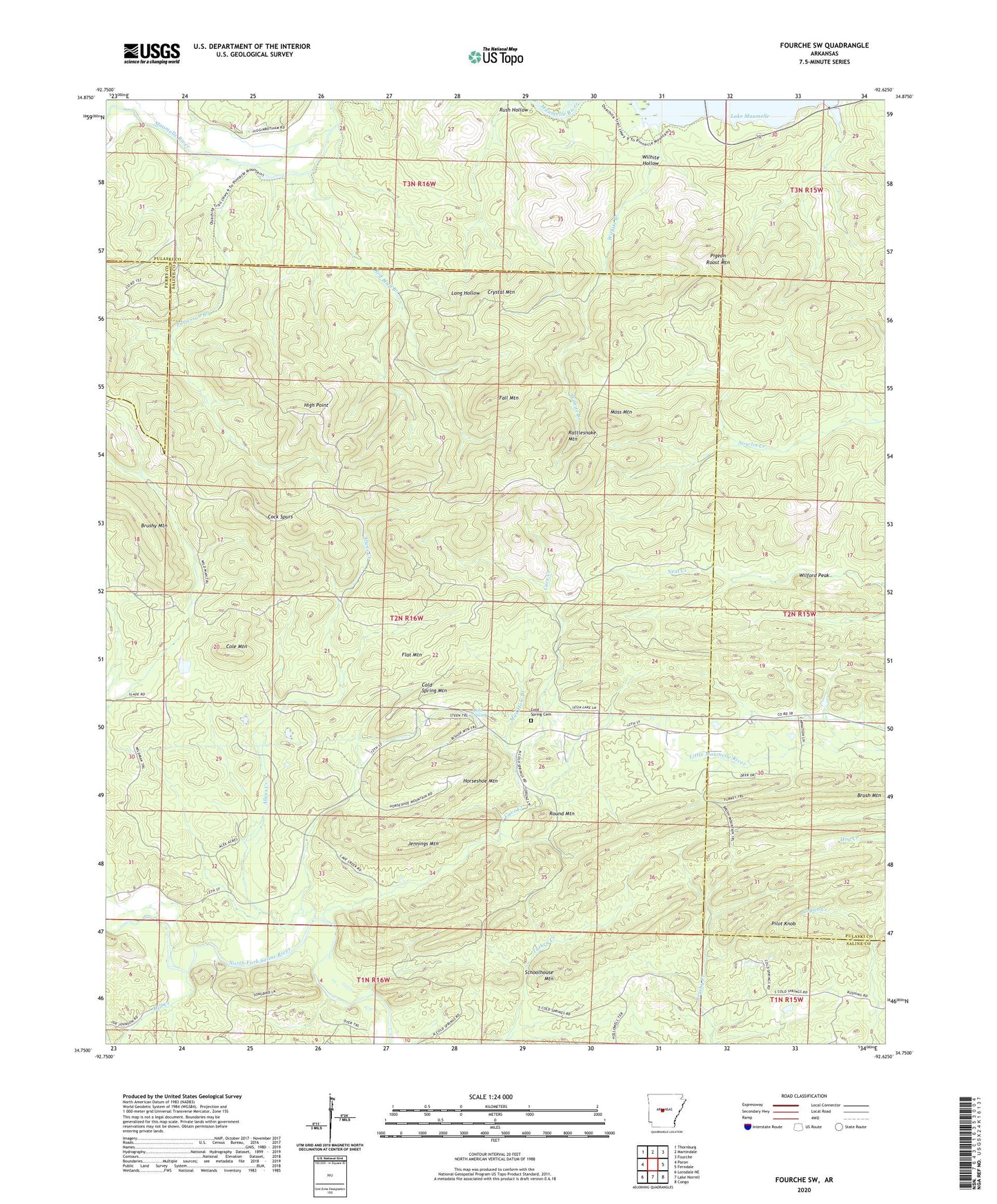
2024 topographic map quadrangle Fourche SW in the state of Arkansas. Scale: 1:24000. Based on the newly updated USGS 7.5' US Topo map series, this map is in the following counties: Saline, Pulaski, Perry. The map contains contour data, water features, and other items you are used to seeing on USGS maps, but also has updated roads and other features. This is the next generation of topographic maps. Printed on high-quality waterproof paper with UV fade-resistant inks.
Quads adjacent to this one:
West: Paron
Northwest: Thornburg
North: Martindale
Northeast: Fourche
East: Ferndale
Southeast: Congo
South: Lake Norrell
Southwest: Lonsdale NE
This map covers the same area as the classic USGS quad with code o34092g6.
Contains the following named places: Allens Creek, Bringle Creek, Brush Mountain, Cave Creek, Cock Spurs, Cold Spring, Cold Spring Cemetery, Cold Spring Mountain, Cold Springs, Cole Mountain, Crystal Mountain, Fall Mountain, Ferguson Ranch, Flat Mountain, High Point, Horseshoe Mountain, Jennings Mountain, Mill Creek, Moss Mountain, Mud Hole Branch, Patterson Branch, Pigeon Roost Mountain, Pilot Knob, Rattlesnake Mountain, Red Bluff Branch, Round Mountain, Rush Hollow, Schoolhouse Mountain, Smyrna Church, Vista Park, West Union School, Wilford Peak, Wilhite Branch, Wilhite Hollow