MyTopo
McCaskill Arkansas US Topo Map
Couldn't load pickup availability
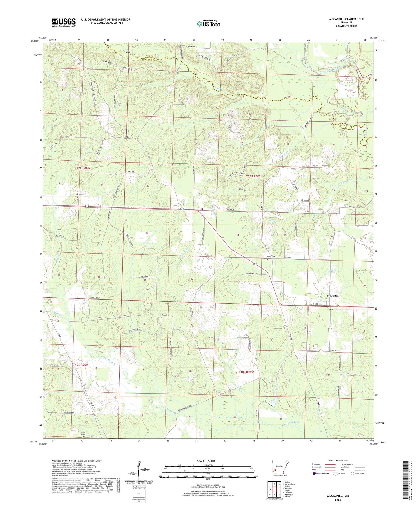
2024 topographic map quadrangle McCaskill in the state of Arkansas. Scale: 1:24000. Based on the newly updated USGS 7.5' US Topo map series, this map is in the following counties: Hempstead, Pike. The map contains contour data, water features, and other items you are used to seeing on USGS maps, but also has updated roads and other features. This is the next generation of topographic maps. Printed on high-quality waterproof paper with UV fade-resistant inks.
Quads adjacent to this one:
West: Nashville
Northwest: Nathan
North: Murfreesboro
Northeast: Delight
East: Pisgah
Southeast: Blevins
South: Washington
Southwest: Columbus
This map covers the same area as the classic USGS quad with code o33093h6.
Contains the following named places: Avery Chapel United Methodist Church, Belton, Blevins School Number 2, Brushy Creek, Bunker Hill School, C J Erwin Estate Lake Dam, Erwin Lake, Gaines Branch, Goff Chapel, Golf Chapel, Howard Creek, Lake Harris, Lake Harris Dam, McCaskill, McCaskill Post Office, McCaskill Volunteer Fire Department, Mount Pleasant Church, New Home Church, Pleasant Grove Church, Pond Run, Saint Peter Church, Stanley Lake Number One, Stanley Lake Number One Dam, Stanley Lake Number Two, Stanley Lake Number Two Dam, Town of McCaskill, Township of Redland, Westbrook, White Oak Church, Young Cemetery, ZIP Code: 71847