MyTopo
Pisgah Arkansas US Topo Map
Couldn't load pickup availability
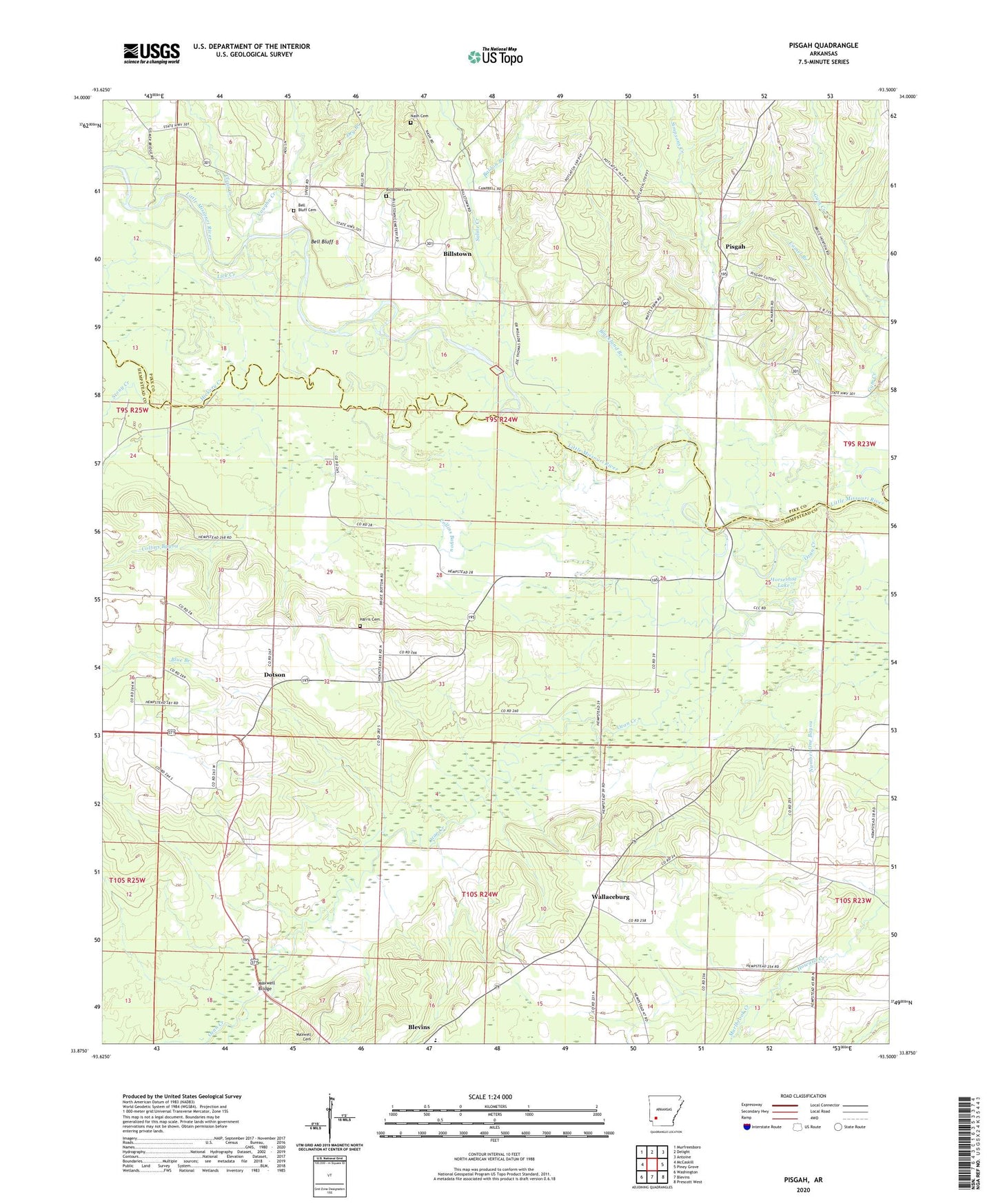
2024 topographic map quadrangle Pisgah in the state of Arkansas. Scale: 1:24000. Based on the newly updated USGS 7.5' US Topo map series, this map is in the following counties: Hempstead, Pike. The map contains contour data, water features, and other items you are used to seeing on USGS maps, but also has updated roads and other features. This is the next generation of topographic maps. Printed on high-quality waterproof paper with UV fade-resistant inks.
Quads adjacent to this one:
West: McCaskill
Northwest: Murfreesboro
North: Delight
Northeast: Antoine
East: Piney Grove
Southeast: Prescott West
South: Blevins
Southwest: Washington
This map covers the same area as the classic USGS quad with code o33093h5.
Contains the following named places: Baldon Branch, Ball Chapel, Bell Bluff, Bell Bluff Cemetery, Bills School, Billstown, Billstown Cemetery, Blackland Branch, Blevins Elementary School, Blue Branch, Bruce Memorial United Methodist Church, Camel Branch, Clear Creek, Collins Bayou, Dotson, Dotson Station, Dry Branch, Friendship United Methodist Church, Harris Cemetery, Hickory Creek, Horseshoe Lake, Kilgore, Lick Creek, Macedonia Church, Marlbrook Creek, Maxwell Bridge, Nash Cemetery, Ozan Creek, Pisgah, Pleasant Springs Baptist Church, Saline Creek, Simpsons Creek, Stony Creek, Township of Saline, Township of Wallaceburg, Vaughn Creek, Wallaceburg, Wallaceburg Bridge, ZIP Code: 71825