MyTopo
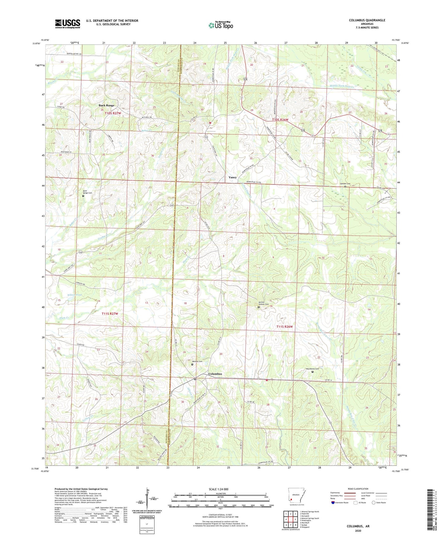
Columbus Arkansas US Topo Map
Couldn't load pickup availability
2024 topographic map quadrangle Columbus in the state of Arkansas. Scale: 1:24000. Based on the newly updated USGS 7.5' US Topo map series, this map is in the following counties: Hempstead, Howard. The map contains contour data, water features, and other items you are used to seeing on USGS maps, but also has updated roads and other features. This is the next generation of topographic maps. Printed on high-quality waterproof paper with UV fade-resistant inks.
Quads adjacent to this one:
West: Mineral Springs South
Northwest: Mineral Springs North
North: Nashville
Northeast: McCaskill
East: Washington
Southeast: Sheppard
South: McNab
Southwest: Red Bluff
This map covers the same area as the classic USGS quad with code o33093g7.
Contains the following named places: Buck Range, Buck Range Cemetery, Camp Spring Church, Caney Creek, Columbus, Columbus Fire Department, Columbus High School, Columbus Post Office, Corinth Church, Fountain Church, Gamble Cemetery, Grahm Creek, Liberty Church, Little Brushy Creek, Macedonia Cemetery, Macedonia Church, Mounds Cemetery, Saint Luke Church, Saint Paul Church, Sardis Church, Schooley, Section Sixteen Cemetery, Temple Church, Township of Buck Range, Walker School, Wilson Pond, Yancey Volunteer Fire Department, Yancy, ZIP Code: 71855