MyTopo
McCormick Arkansas US Topo Map
Couldn't load pickup availability
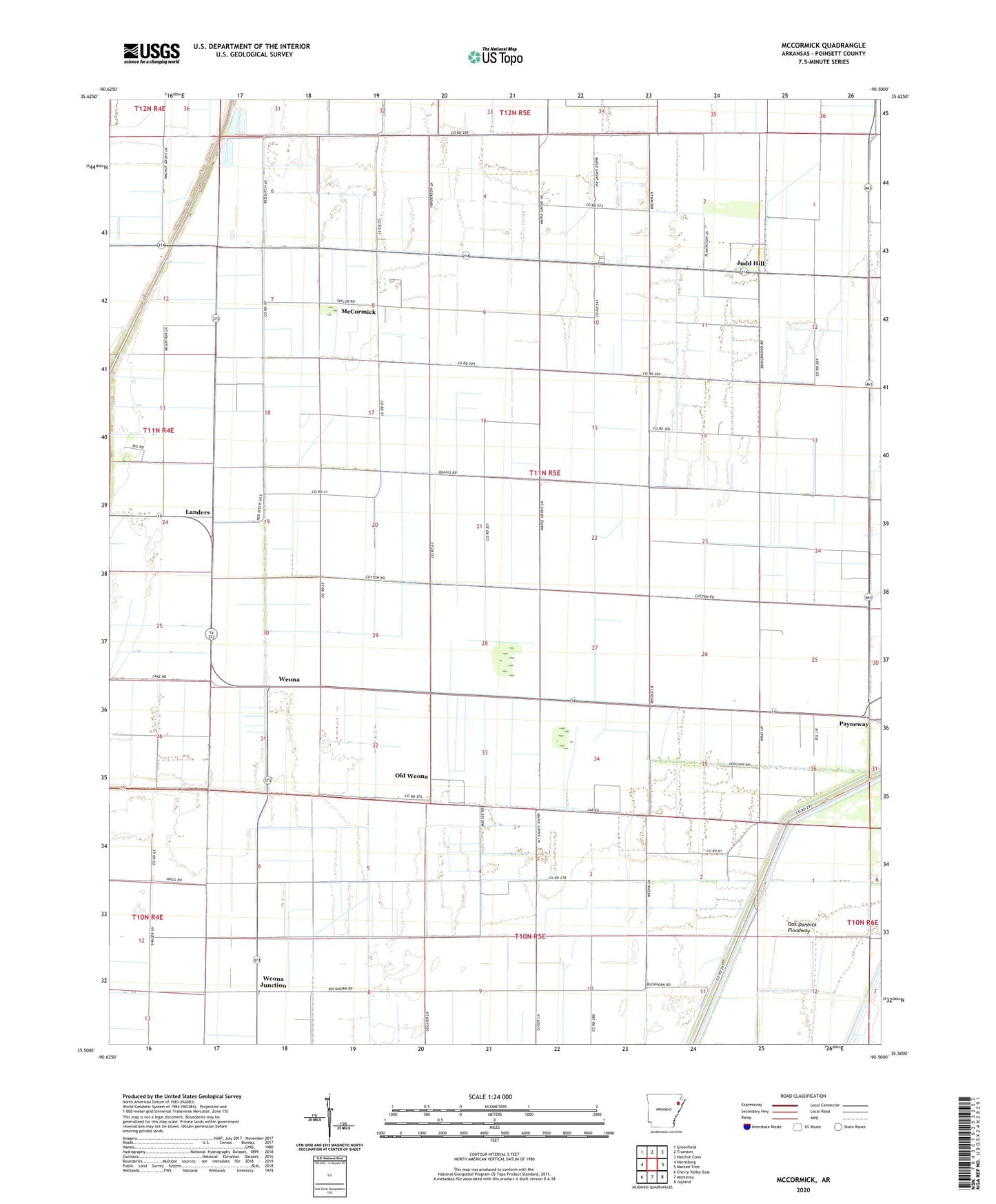
2024 topographic map quadrangle McCormick in the state of Arkansas. Scale: 1:24000. Based on the newly updated USGS 7.5' US Topo map series, this map is in the following counties: Poinsett. The map contains contour data, water features, and other items you are used to seeing on USGS maps, but also has updated roads and other features. This is the next generation of topographic maps. Printed on high-quality waterproof paper with UV fade-resistant inks.
Quads adjacent to this one:
West: Harrisburg
Northwest: Greenfield
North: Trumann
Northeast: Hatchie Coon
East: Marked Tree
Southeast: Joyland
South: Monterey
Southwest: Cherry Valley East
This map covers the same area as the classic USGS quad with code o35090e5.
Contains the following named places: Centerview Church, Chudy Grove Church, Ditch Number 10, Ditch Number 103, Ditch Number 11, Ditch Number 18, Ditch Number 19, Ditch Number 20, Ditch Number 21, Ditch Number 23, Ditch Number 24, Ditch Number 25, Ditch Number 26, Ditch Number 36, Ditch Number 38, Ditch Number 39, Ditch Number 77, Ditch Number 81, Engman, Glaze Church, Judd Hill, Judd Hill School, Landers, McCormick, McCormick Baptist Church, Mount Zion Church, Oak Donnick Floodway, Old Weona, Payneway, Payneway Census Designated Place, Perkins School, Promised Land Church, Red Bridge Church, South McCormick Church, Township of Lunsford, Weona, Weona Junction, ZIP Code: 72472