MyTopo
Hatchie Coon Arkansas US Topo Map
Couldn't load pickup availability
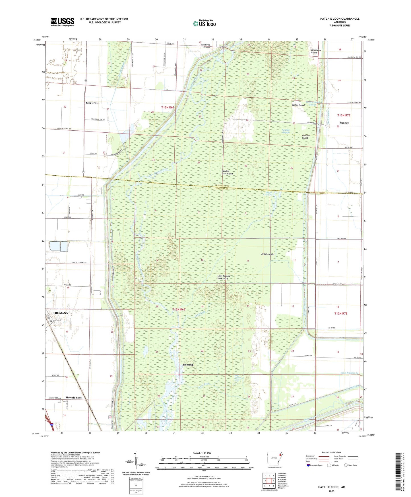
2024 topographic map quadrangle Hatchie Coon in the state of Arkansas. Scale: 1:24000. Based on the newly updated USGS 7.5' US Topo map series, this map is in the following counties: Poinsett, Craighead. The map contains contour data, water features, and other items you are used to seeing on USGS maps, but also has updated roads and other features. This is the next generation of topographic maps. Printed on high-quality waterproof paper with UV fade-resistant inks.
Quads adjacent to this one:
West: Trumann
Northwest: Needham
North: Lake City
Northeast: Caraway
East: Rivervale
Southeast: Lepanto
South: Marked Tree
Southwest: McCormick
This map covers the same area as the classic USGS quad with code o35090f4.
Contains the following named places: Bunney, Deep Landing, Ditch Number 1, Ditch Number 23, Ditch Number 31, Ditch Number 32, Ditch Number 33, Ditch Number 54, Ditch Number 55, Ditch Number 59, Ditch Number 60, Ditch Number 8, Donnick, Elk Grove School, Elm Grove, Elm Grove Church, Fairfield Christian Union Church, Freer Baptist Church, Freer School, Grapevine Island, Hatchie Coon, Hatchie Coon Hunting Lodge, Hatchie Coon Island, Hatchie Coon Lake, Lead Fork, Longwill, Middle Island, New Hope Church, Panther Island, Panther Slough, Pleasant Valley Baptist Church, Purcell Slough, Right Hand Chute Little River, Saint Francis Lake, Saint Francis Sunk Lands, Shaw School, Stevens Landing, Thorn School, Township of Taylor, Tulot Church, Turkey Island, Turkey Island Slough