MyTopo
Cherry Valley East Arkansas US Topo Map
Couldn't load pickup availability
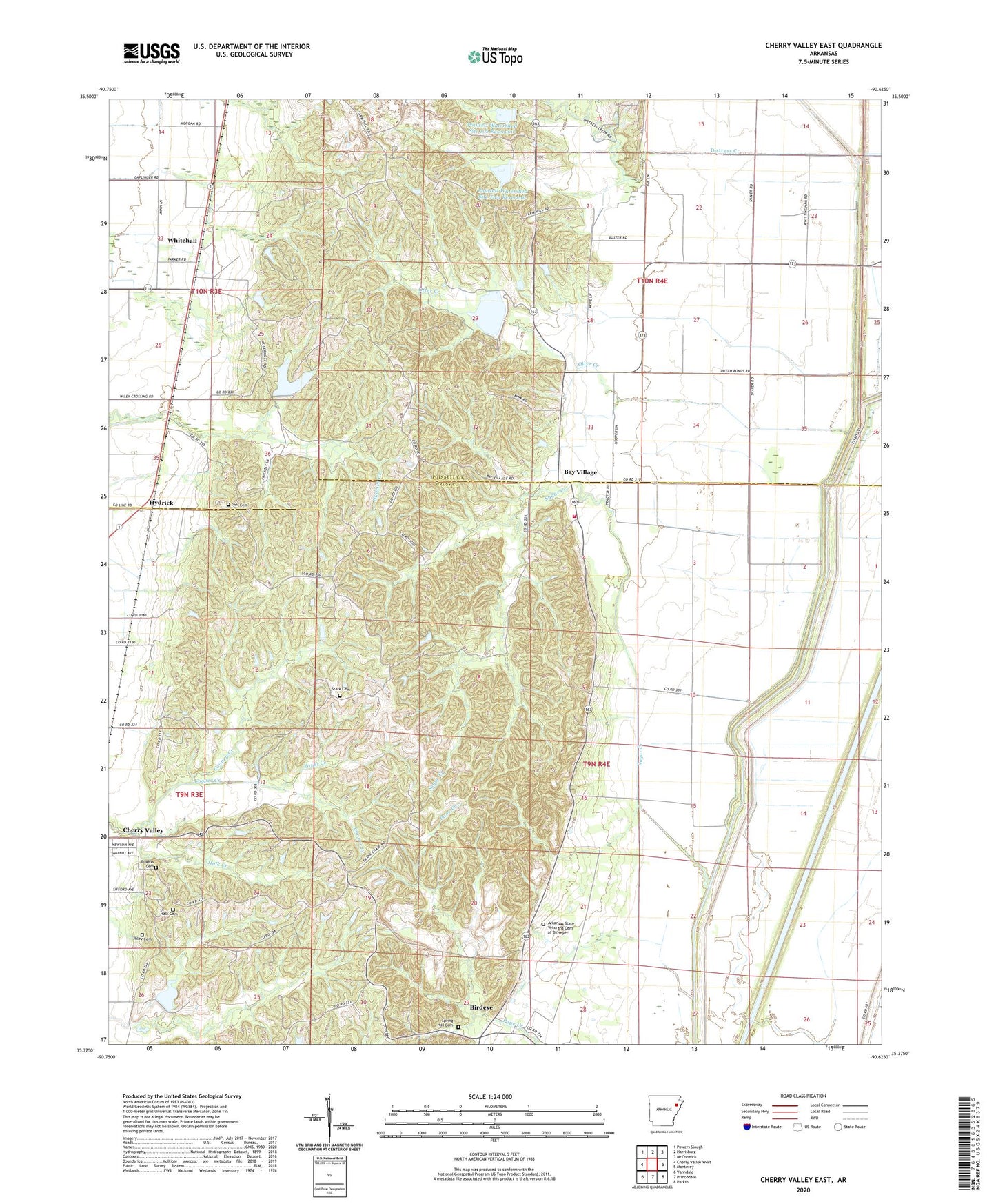
2024 topographic map quadrangle Cherry Valley East in the state of Arkansas. Scale: 1:24000. Based on the newly updated USGS 7.5' US Topo map series, this map is in the following counties: Cross, Poinsett. The map contains contour data, water features, and other items you are used to seeing on USGS maps, but also has updated roads and other features. This is the next generation of topographic maps. Printed on high-quality waterproof paper with UV fade-resistant inks.
Quads adjacent to this one:
West: Cherry Valley West
Northwest: Powers Slough
North: Harrisburg
Northeast: McCormick
East: Monterey
Southeast: Parkin
South: Princedale
Southwest: Vanndale
This map covers the same area as the classic USGS quad with code o35090d6.
Contains the following named places: Arkansas State Veterans Cemetery at Birdeye, Bay Village, Bay Village Volunteer Fire Department, Birdeye, Birdeye Post Office, Bowers Cemetery, Cherry Valley Creek, Coopey Creek, Distress Creek, Ditch Number 3, Ditch Number 4, Foust Creek, Halk Cemetery, Halk Creek, Hydrick, Labanon Church, Lebanon Baptist Church, Otter Creek, Pleasant Grove Church, Poinsett Watershed Site 1 Dam, Poinsett Watershed Site 101 Dam, Poinsett Watershed Site 101 Reservoir, Poinsett Watershed Site 102 Dam, Poinsett Watershed Site 102 Reservoir, Poinsett Watershed Site 2 Dam, Poinsett Watershed Site One Reservoir, Poinsett Watershed Site Two Reservoir, Riley Cemetery, Spring Hill Cemetery, Stark Cemetery, Straight Slough, Sugar Creek, Thomas Church, Thomas School, Township of Coldwater, Township of Scott, Tyer Cemetery, Valley View Baptist Church, Valley View School, Whitehall, Wiley Crossing, Wiley Crossing Church, Wiley Crossing School