MyTopo
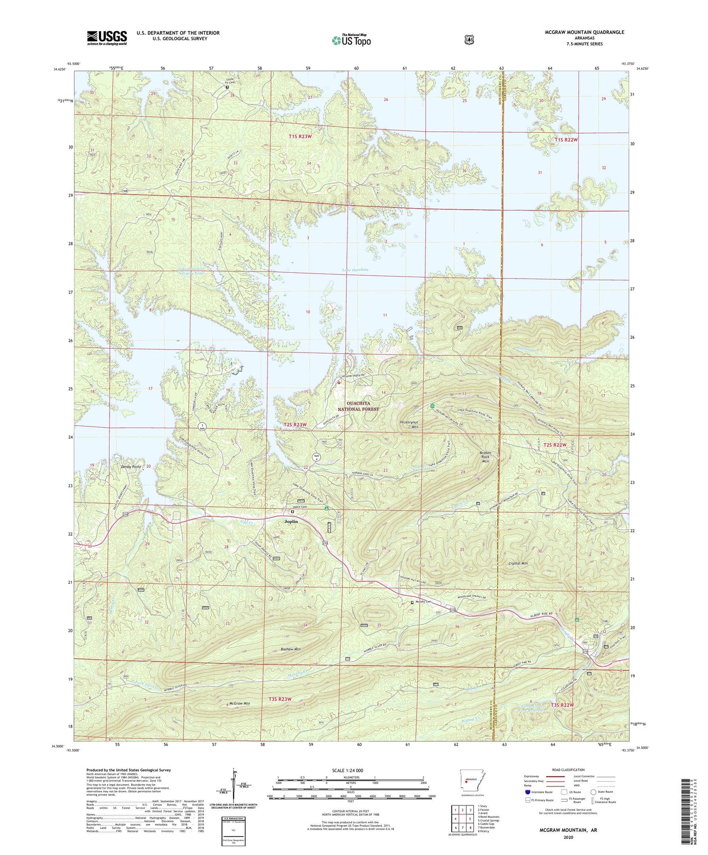
McGraw Mountain Arkansas US Topo Map
Couldn't load pickup availability
Also explore the McGraw Mountain Forest Service Topo of this same quad for updated USFS data
2024 topographic map quadrangle McGraw Mountain in the state of Arkansas. Scale: 1:24000. Based on the newly updated USGS 7.5' US Topo map series, this map is in the following counties: Montgomery, Garland. The map contains contour data, water features, and other items you are used to seeing on USGS maps, but also has updated roads and other features. This is the next generation of topographic maps. Printed on high-quality waterproof paper with UV fade-resistant inks.
Quads adjacent to this one:
West: Reed Mountain
Northwest: Story
North: Fannie
Northeast: Avant
East: Crystal Springs
Southeast: Pearcy
South: Bonnerdale
Southwest: Caddo Gap
This map covers the same area as the classic USGS quad with code o34093e4.
Contains the following named places: Arnold Creek, Bashaw Mountain, Big Fir Public Use Area, Broken Rock Mountain, Camp Clear Fork Reservoir, Camp Clearfork, Camp Clearfork Lake Dam, Caney Creek, Charlton Public Use Area, Crystal Mountain, Denby Creek, Denby Point, Denby Point Public Use Area, Fir, Gap Creek, Gap Creek Recreation Site, Harbor Chapel, Hickory Nut Mountain Campground, Hickorynut Lookout Tower, Hickorynut Mountain, Irons Creek, Joplin, Joplin Cemetery, Joplin Public Use Area, Joplin School, Joplin Volunteer Fire Station, Lake Ouachita Nursery Pond, Lake Ouachita Nursery Pond Dam, Lake Ouachita Vista Point of Interest, Little Fir Cemetery, Little Fir School, McGraw Mountain, Murphy Cemetery, Murphy Creek, North Fork Ouachita River, Pollard Creek, Red Branch, Tompkins Bend Public Use Area, Township of Fir