MyTopo
Bonnerdale Arkansas US Topo Map
Couldn't load pickup availability
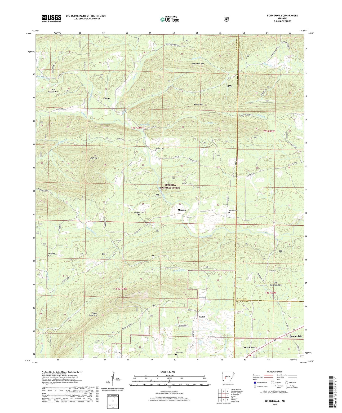
2024 topographic map quadrangle Bonnerdale in the state of Arkansas. Scale: 1:24000. Based on the newly updated USGS 7.5' US Topo map series, this map is in the following counties: Montgomery, Garland, Hot Spring. The map contains contour data, water features, and other items you are used to seeing on USGS maps, but also has updated roads and other features. This is the next generation of topographic maps. Printed on high-quality waterproof paper with UV fade-resistant inks.
Quads adjacent to this one:
West: Caddo Gap
Northwest: Reed Mountain
North: McGraw Mountain
Northeast: Crystal Springs
East: Pearcy
Southeast: Point Cedar
South: Amity
Southwest: Glenwood
This map covers the same area as the classic USGS quad with code o34093d4.
Contains the following named places: Adams Cemetery, Alamo, Alamo Missionary Baptist Church, Alamo School, Blue Creek, Bonnerdale, Bonnerdale Post Office, Bonnerdale Volunteer Fire Department, Caney Cemetery, Cold Water Creek, County Line Church, Cross Roads, Dry Fork, Dry Mazarn Creek, Grants Chapel United Methodist Church, Hickory Station, High Top, Horseshoe Mountain, Howerton Cemetery, Howton Cemetery, Imelda, Imelda School, Kinsey Mountain, Lucky, Lucky School, Mazarn, Oak Grove School, Old Bonnerdale, Peak, Peak Church, Pigeon Roost Mountain, Shady Grove School, Smith Creek, Tackett School, Tea Creek, Township of Alamo, Township of Mazarn, Wacaster Cemetery, Wake Creek, Waterfork Creek, Wyatt Spring