
MyTopo
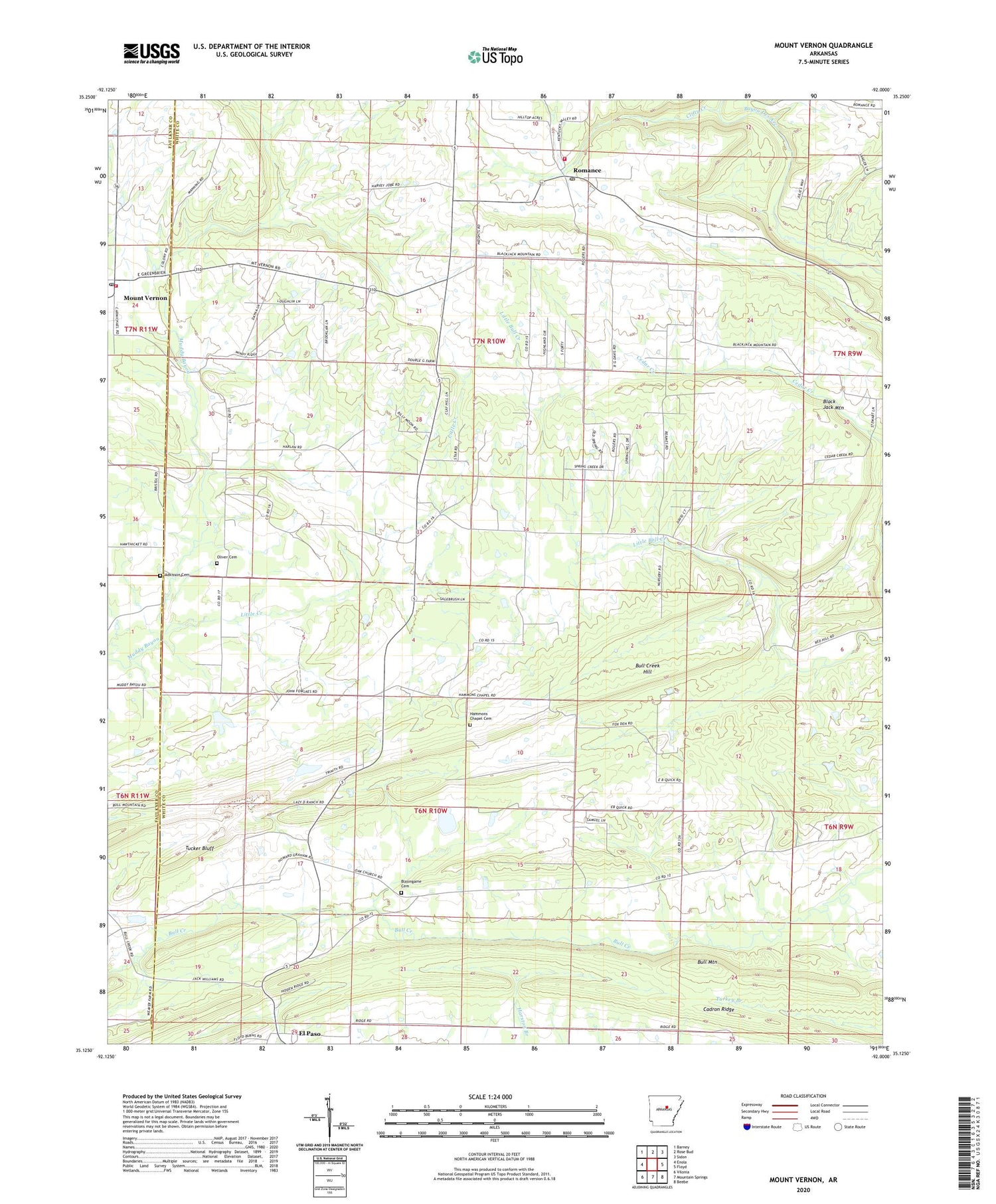
Mount Vernon Arkansas US Topo Map
Couldn't load pickup availability
2024 topographic map quadrangle Mount Vernon in the state of Arkansas. Scale: 1:24000. Based on the newly updated USGS 7.5' US Topo map series, this map is in the following counties: White, Faulkner. The map contains contour data, water features, and other items you are used to seeing on USGS maps, but also has updated roads and other features. This is the next generation of topographic maps. Printed on high-quality waterproof paper with UV fade-resistant inks.
Quads adjacent to this one:
West: Enola
Northwest: Barney
North: Rose Bud
Northeast: Sidon
East: Floyd
Southeast: Beebe
South: Mountain Springs
Southwest: Vilonia
This map covers the same area as the classic USGS quad with code o35092b1.
Contains the following named places: Adkisson Cemetery, Black Jack Mountain, Blasingame Cemetery, Bull Creek Hill, Bull Mountain, Clifty Creek, El Paso, Faith Missionary Baptist Church, First Baptist Church of El Paso, Floyd Volunteer Fire Department Station 2, Hammondsville, Hammons Chapel Cemetery, Little Creek, Mount Vernon, Mount Vernon Post Office, Mount Vernon Volunteer Fire Department, Oak Church of Christ, Oliver Cemetery, Powell Branch, Romance, Romance Post Office, Royal Hill Baptist Church, Smyrna Baptist Church, Town of Mount Vernon, Township of Cleveland, Township of Jefferson, Township of Marshall, Tucker Bluff, Union Hill Church, ZIP Codes: 72045, 72136


