MyTopo
Sidon Arkansas US Topo Map
Couldn't load pickup availability
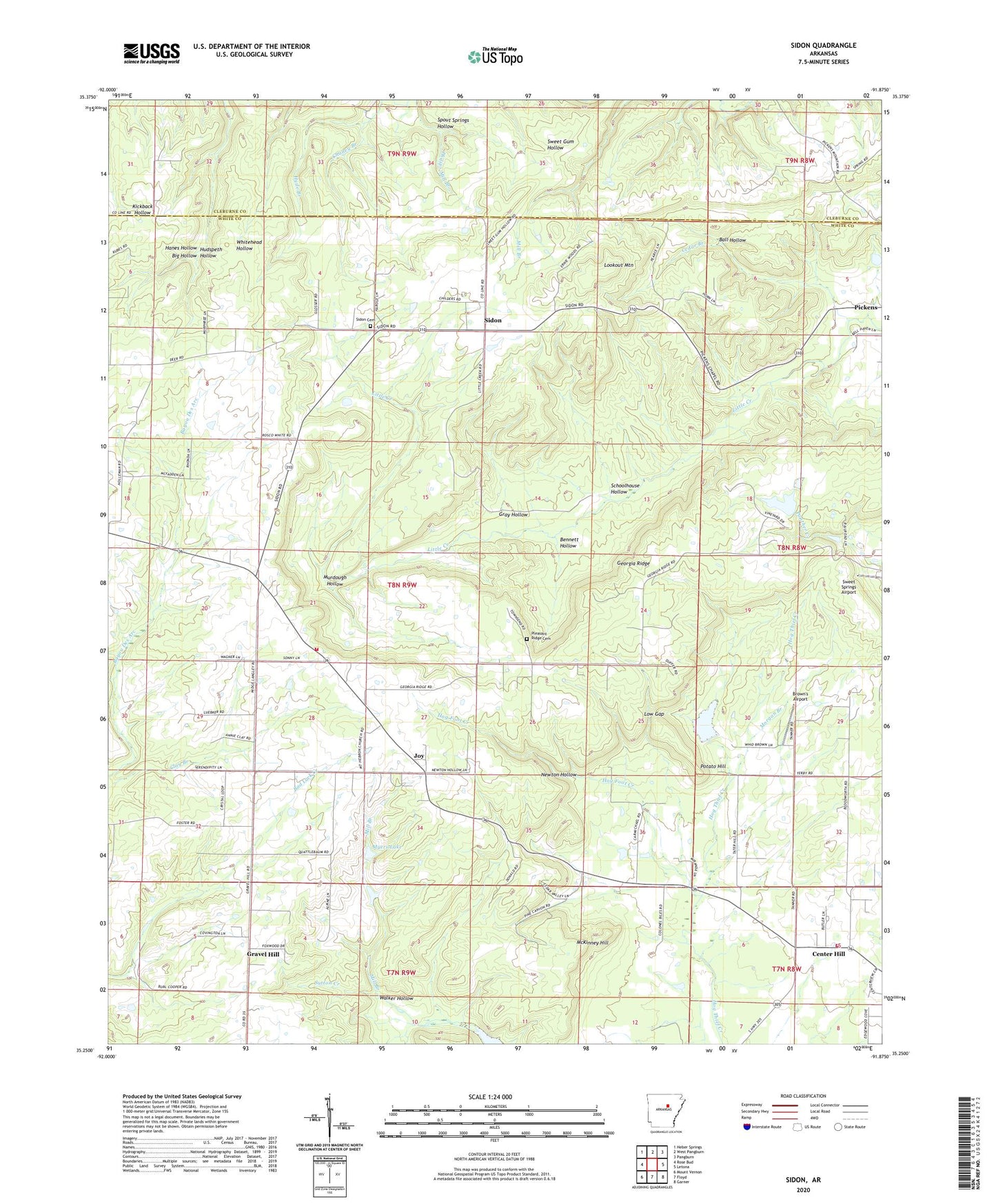
2024 topographic map quadrangle Sidon in the state of Arkansas. Scale: 1:24000. Based on the newly updated USGS 7.5' US Topo map series, this map is in the following counties: White, Cleburne. The map contains contour data, water features, and other items you are used to seeing on USGS maps, but also has updated roads and other features. This is the next generation of topographic maps. Printed on high-quality waterproof paper with UV fade-resistant inks.
Quads adjacent to this one:
West: Rose Bud
Northwest: Heber Springs
North: West Pangburn
Northeast: Pangburn
East: Letona
Southeast: Garner
South: Floyd
Southwest: Mount Vernon
This map covers the same area as the classic USGS quad with code o35091c8.
Contains the following named places: Ball Hollow, Bennett Hollow, Bethel Church, Brown's Airport, Cedar Branch, Center Hill, Center Hill Church, Center Hill Volunteer Fire Department, Georgia Ridge, Gravel Hill, Gray Hollow, Hanes Hollow, Hog Foot Creek, Hudspeth Hollow, Hyde Branch, Joy, Joy Volunteer Fire Department, Lookout Mountain, Low Gap, McKinney Hill, Mill Branch, Morgan Branch, Mount Hebron Baptist Church, Murdough Hollow, Myers Lake, Myers Lake Dam, Newton Hollow, Pleasant Ridge Cemetery, Potato Hill, Schoolhouse Hollow, Sidon, Sidon Baptist Church, Sidon Cemetery, Sidon Post Office, Spout Springs Hollow, Sweet Springs Airport, Sweet Springs Church, Township of Cadron, Township of Des Arc, Township of Joy, Walker Hollow