MyTopo
Floyd Arkansas US Topo Map
Couldn't load pickup availability
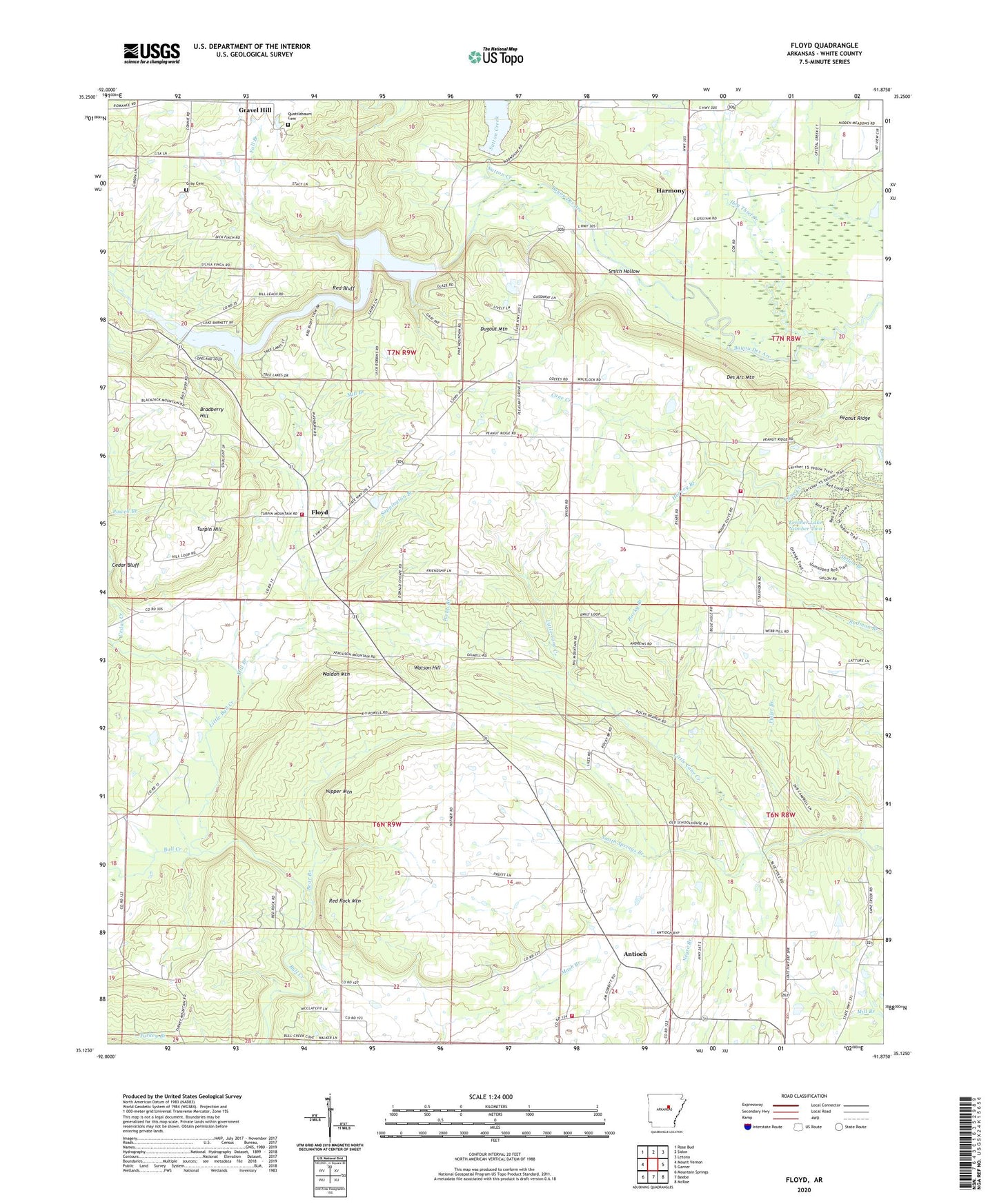
2024 topographic map quadrangle Floyd in the state of Arkansas. Scale: 1:24000. Based on the newly updated USGS 7.5' US Topo map series, this map is in the following counties: White. The map contains contour data, water features, and other items you are used to seeing on USGS maps, but also has updated roads and other features. This is the next generation of topographic maps. Printed on high-quality waterproof paper with UV fade-resistant inks.
Quads adjacent to this one:
West: Mount Vernon
Northwest: Rose Bud
North: Sidon
Northeast: Letona
East: Garner
Southeast: McRae
South: Beebe
Southwest: Mountain Springs
This map covers the same area as the classic USGS quad with code o35091b8.
Contains the following named places: Antioch, Antioch Baptist Church, Antioch Volunteer Fire Station, Bear Branch, Bradberry Hill, Brundige, Cedar Bluff, Cedar Creek, Des Arc Mountain, Dugout Mountain, Essex, Fall Branch, Floyd, Floyd Census Designated Place, Floyd Quarry, Floyd Volunteer Fire Department Station 1, Floyd Volunteer Fire Department Station 3, Fuller Branch, Gray Cemetery, Harmony, Harmony United Methodist Church, Harvey Branch, Hog Thief Creek, KPIK-FM (Beebe), Lercher Lake Number Two, Lercher Lake Number Two Dam, Little Bull Creek, Mill Branch, Mount Olive Church, Nipper Mountain, Pleasant Grove Church, Quattlebaum Cemetery, Red Bluff, Red Rock Mountain, Rocky Branch, Sappington Branch, Shiloh Church, Smith Hollow, Smith Springs Branch, Sunrise, Sutton Creek, Township of Antioch, Township of Coffey, Township of Gravel Hill, Turpin Hill, Waldon Mountain, Watson Hill, Webb Branch