MyTopo
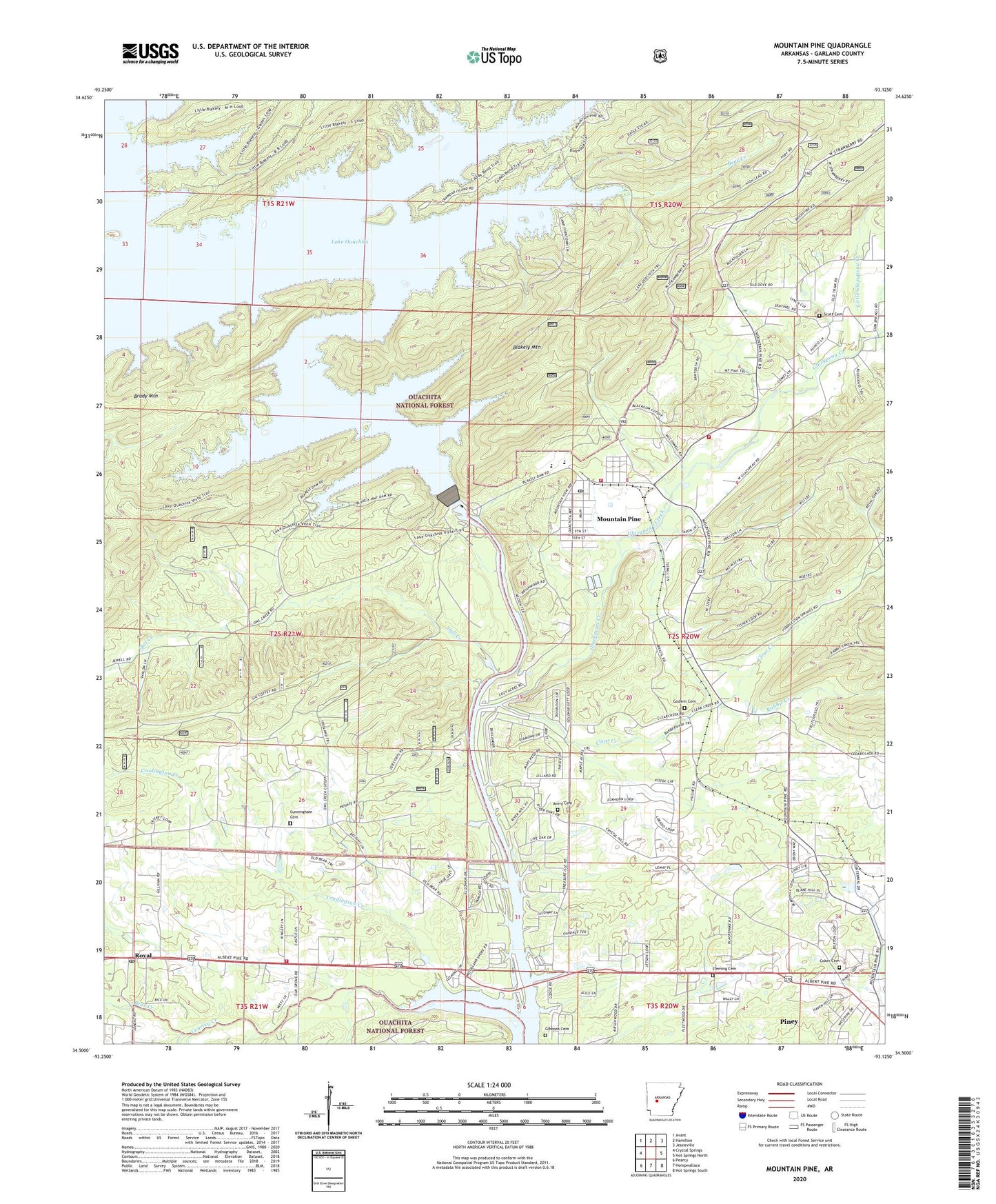
Mountain Pine Arkansas US Topo Map
Couldn't load pickup availability
Also explore the Mountain Pine Forest Service Topo of this same quad for updated USFS data
2024 topographic map quadrangle Mountain Pine in the state of Arkansas. Scale: 1:24000. Based on the newly updated USGS 7.5' US Topo map series, this map is in the following counties: Garland. The map contains contour data, water features, and other items you are used to seeing on USGS maps, but also has updated roads and other features. This is the next generation of topographic maps. Printed on high-quality waterproof paper with UV fade-resistant inks.
Quads adjacent to this one:
West: Crystal Springs
Northwest: Avant
North: Hamilton
Northeast: Jessieville
East: Hot Springs North
Southeast: Hot Springs South
South: Hempwallace
Southwest: Pearcy
This map covers the same area as the classic USGS quad with code o34093e2.
Contains the following named places: Avery Cemetery, Bear Creek, Blakely Mountain, Blakely Mountain Dam, Brady Mountain, Cearley Creek, Cedar Glades Baptist Church, City of Mountain Pine, Clear Creek, Coker Cemetery, Crudington Creek, Crystal Hill Church, Cunningham Cemetery, Fleming Cemetery, Garland County, Gibbons Cemetery, Glazypeau Creek, Godwin Cemetery, Gospel Mission, Greenwood Church, Gum Spring Church, Harveys Chapel Baptist Church, Hawes, Lake Ouachita State Park, Little Glazypeau Creek, Mill Creek, Mountain Pine, Mountain Pine Elementary School, Mountain Pine High School, Mountain Pine Police Department, Mountain Pine Post Office, Mountain Pine Volunteer Fire Department, New Home Church, New Salem Church, Ouachita Job Corps Conservation Center, Owl Creek, Piney, Piney Census Designated Place, Piney Fire Protection District Station 2, Piney Fire Protection District Station 4, Rabbit Creek, Royal, Royal Church, Royal Post Office, Scott Cemetery, Spillway Landing, Spillway Public Use Area, Spillway Recreation Site, Steep Shoals Creek, Three Sisters Landing, Township of Bain, Township of Hale, Township of Ouachita, ZIP Code: 71956