MyTopo
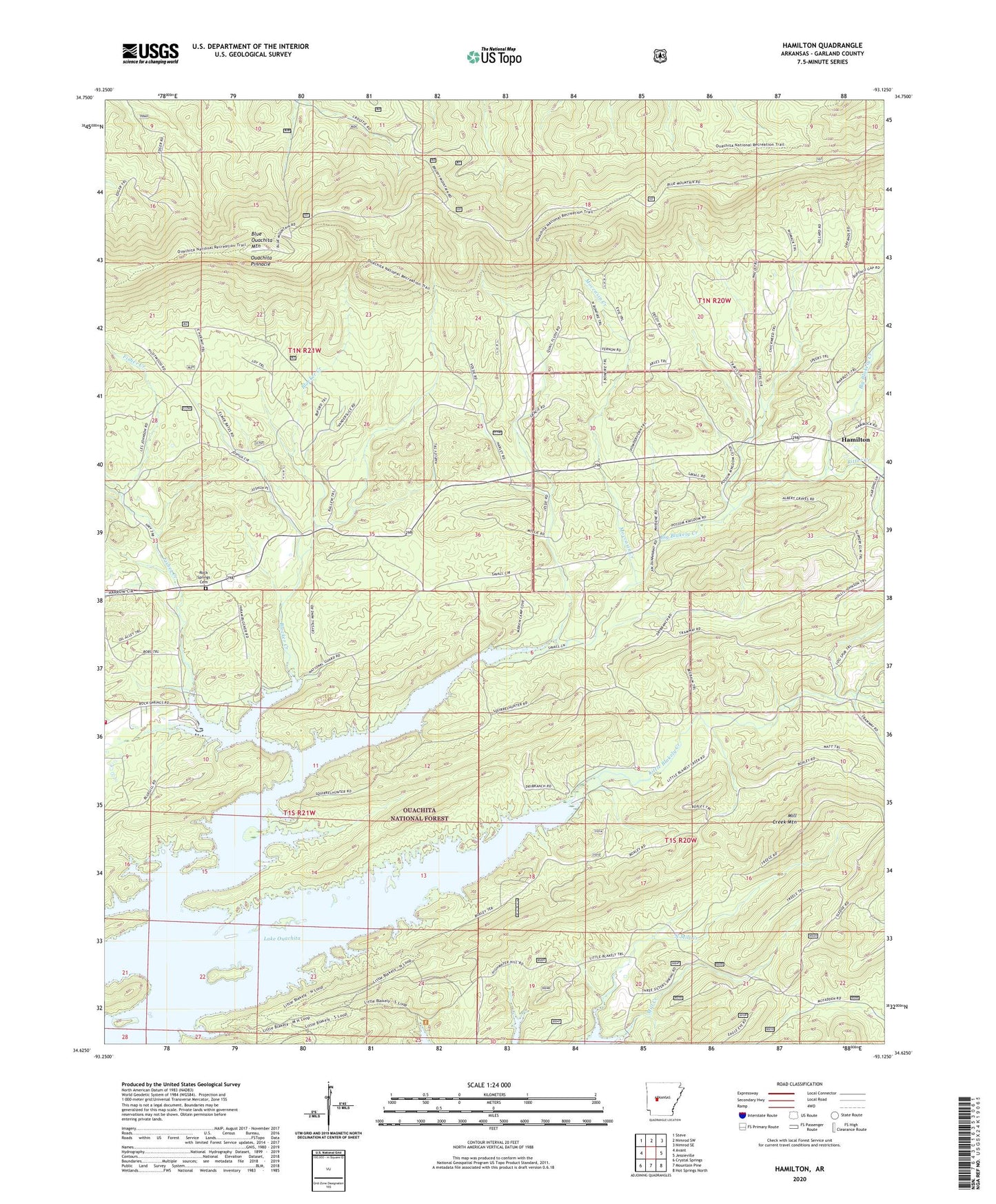
Hamilton Arkansas US Topo Map
Couldn't load pickup availability
Also explore the Hamilton Forest Service Topo of this same quad for updated USFS data
2024 topographic map quadrangle Hamilton in the state of Arkansas. Scale: 1:24000. Based on the newly updated USGS 7.5' US Topo map series, this map is in the following counties: Garland. The map contains contour data, water features, and other items you are used to seeing on USGS maps, but also has updated roads and other features. This is the next generation of topographic maps. Printed on high-quality waterproof paper with UV fade-resistant inks.
Quads adjacent to this one:
West: Avant
Northwest: Steve
North: Nimrod SW
Northeast: Nimrod SE
East: Jessieville
Southeast: Hot Springs North
South: Mountain Pine
Southwest: Crystal Springs
This map covers the same area as the classic USGS quad with code o34093f2.
Contains the following named places: Big Blakely Creek, Blocker Creek, Blue Ouachita Mountain, Fisher Creek, Hamilton, Jessieville Fire Department Station 2, Lena Landing Public Use Area, Little Blakely Creek, Mill Creek Mountain, Moccasin Creek, North Mill Creek, Ouachita Pinnacle, Ritter Creek, Rock Springs Cemetery, Rock Springs Church, Township of Montian, Walnut Grove Church, ZIP Code: 71949