MyTopo
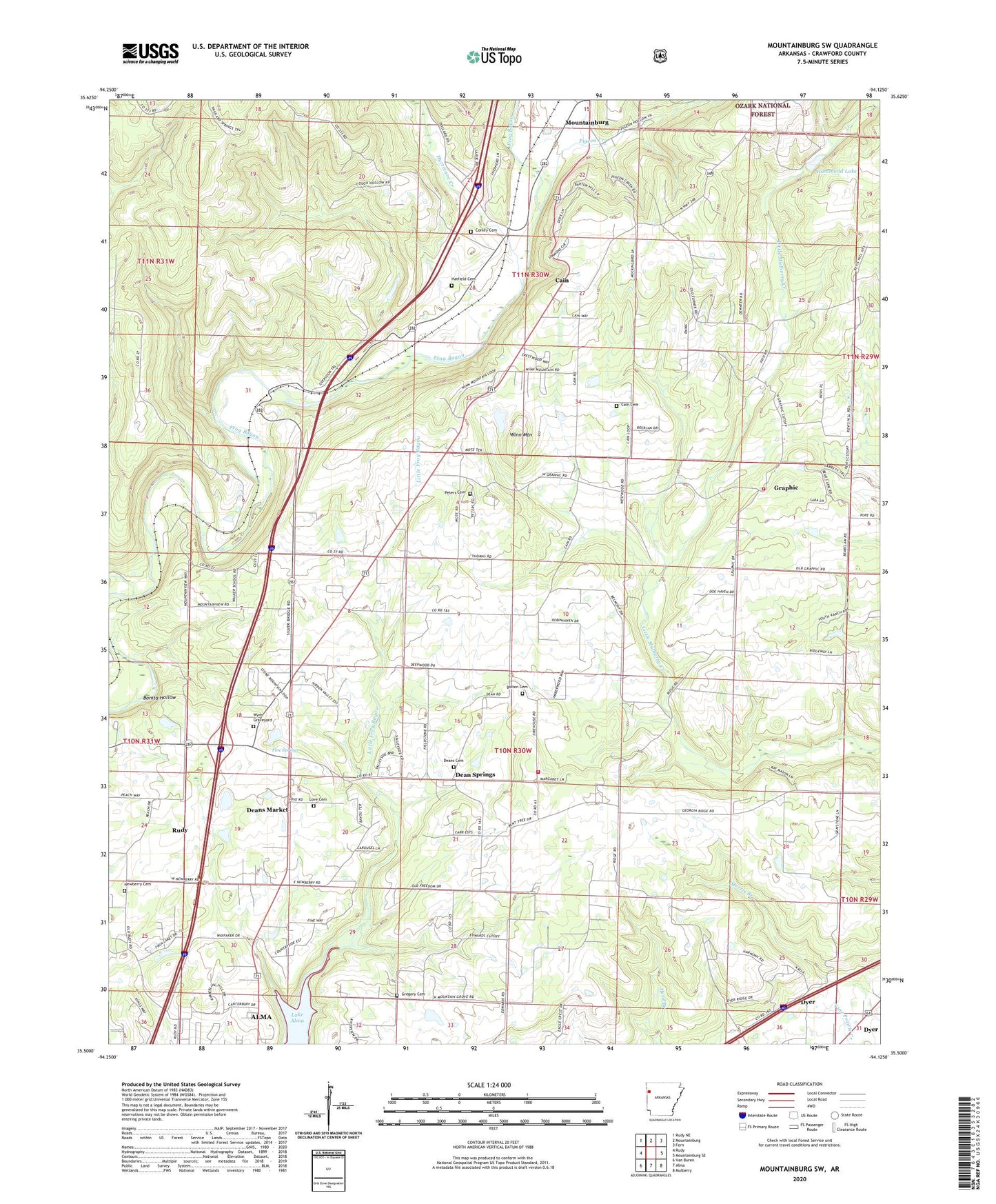
Mountainburg SW Arkansas US Topo Map
Couldn't load pickup availability
Also explore the Mountainburg SW Forest Service Topo of this same quad for updated USFS data
2024 topographic map quadrangle Mountainburg SW in the state of Arkansas. Scale: 1:24000. Based on the newly updated USGS 7.5' US Topo map series, this map is in the following counties: Crawford. The map contains contour data, water features, and other items you are used to seeing on USGS maps, but also has updated roads and other features. This is the next generation of topographic maps. Printed on high-quality waterproof paper with UV fade-resistant inks.
Quads adjacent to this one:
West: Rudy
Northwest: Rudy NE
North: Mountainburg
Northeast: Fern
East: Mountainburg SE
Southeast: Mulberry
South: Alma
Southwest: Van Buren
This map covers the same area as the classic USGS quad with code o35094e2.
Contains the following named places: Belmont, Bolton Cemetery, Bond Special - Dean Springs - Rudy District 1 Dean Springs Fire Station, Bonita Hollow, Cain, Cain Cemetery, Cain Church, Church of Christ, Conley Cemetery, Crawford County, Crawford County Rural Fire District 3 Graphic, Dean Springs, Deans Cemetery, Deans Market, Fine Springs, Fine Springs Baptist Church, Freedom Church, Graphic, Gregory Cemetery, Gregory Chapel, Hammond Lake, Hammond Lake Dam, Hatfield Cemetery, Highway 71 Church, Hurricane Creek, Lake Alma, Lancaster, Love Cemetery, Morris Lake, Morris Lake Dam, Mountain Grove Church, Mountain View Church, New Hope Church, Newberry Cemetery, Newberry Church, Peters Cemetery, Pigeon Creek, Revis Hill Assembly of God Church, Town of Rudy, Township of Dean Springs, Township of Lafayette, Township of Lancaster, Township of Mountain, Township of Mountainburg, Township of Rudy, Winn Mountain, Wynn Graveyard