MyTopo
Rudy Arkansas US Topo Map
Couldn't load pickup availability
Also explore the Rudy Forest Service Topo of this same quad for updated USFS data
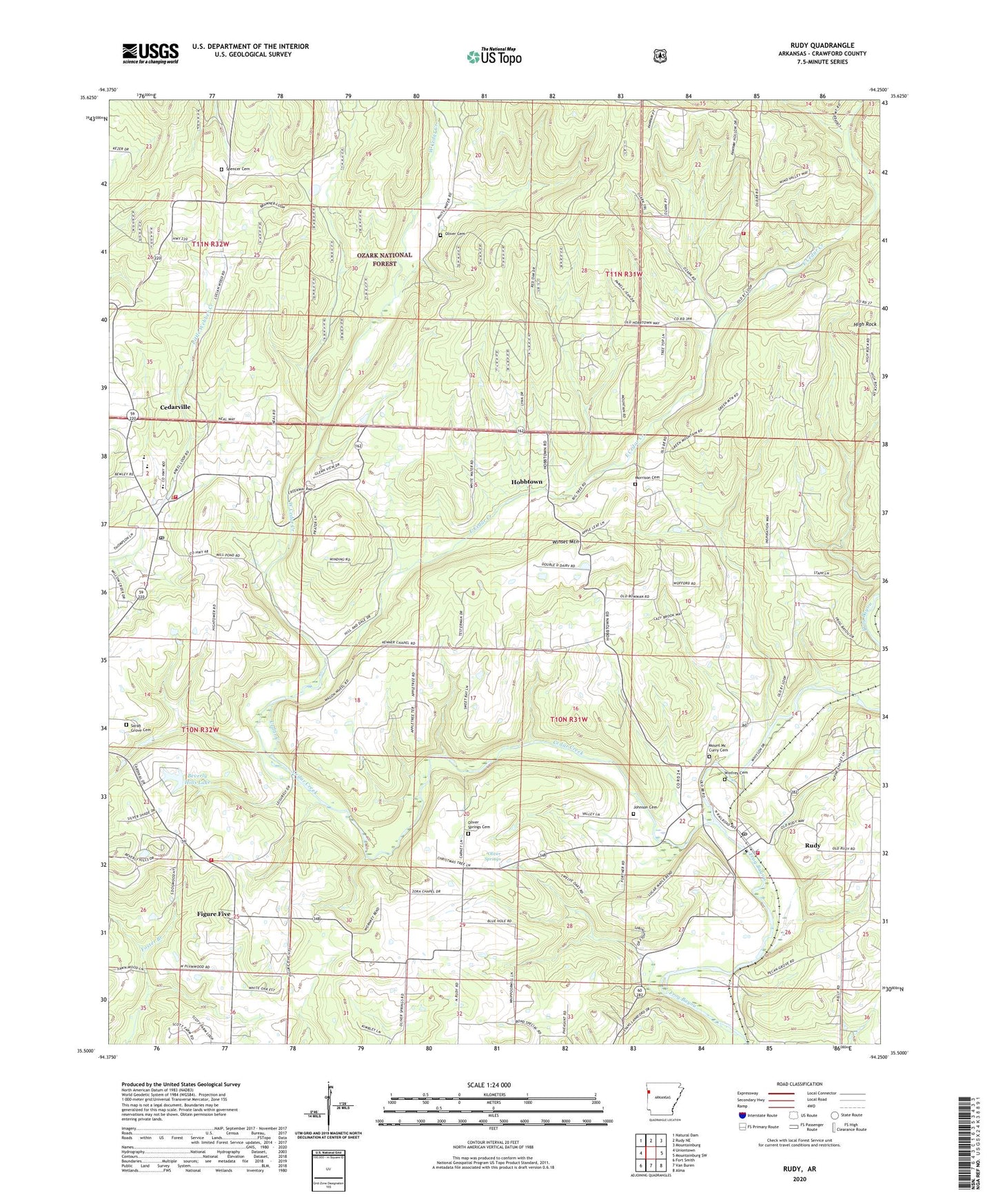
2024 topographic map quadrangle Rudy in the state of Arkansas. Scale: 1:24000. Based on the newly updated USGS 7.5' US Topo map series, this map is in the following counties: Crawford. The map contains contour data, water features, and other items you are used to seeing on USGS maps, but also has updated roads and other features. This is the next generation of topographic maps. Printed on high-quality waterproof paper with UV fade-resistant inks.
Quads adjacent to this one:
West: Uniontown
Northwest: Natural Dam
North: Rudy NE
Northeast: Mountainburg
East: Mountainburg SW
Southeast: Alma
South: Van Buren
Southwest: Fort Smith
This map covers the same area as the classic USGS quad with code o35094e3.
Contains the following named places: Ball, Beverly Hills Lake, Beverly Hills Lake Dam, Bond Special - Dean Springs - Rudy District 1 Rudy Fire Station, Butterfield District 5 Volunteer Fire Department Figure Five, Cedar Creek, Cedarville, Cedarville Baptist Church, Cedarville Elementary School, Cedarville Fire Department, Cedarville High School, Cedarville Middle School, Cedarville Post Office, City of Cedarville, East Cedar Creek, Eightyeight Church, Eightyone Church, Figure Five, High Rock, Hobbtown, Johnson Cemetery, Kenner Chapel, KFSM-TV (Fort Smith), Morrison Cemetery, Mount Mc Curry Cemetery, Oliver Cemetery, Oliver Springs, Oliver Springs Cemetery, Oliver Springs Church, Pentecostal Church, Rudy, Rudy Church, Rudy Gas Field, Rudy Post Office, Rudy School, Rural District 4 Station 88, Sarah Grove Cemetery, Spencer Cemetery, Township of Cedarville, Township of Oliver Springs, West Cedar Creek, Winfrey Cemetery, Winset Mountain, ZIP Code: 72952