MyTopo
Alma Arkansas US Topo Map
Couldn't load pickup availability
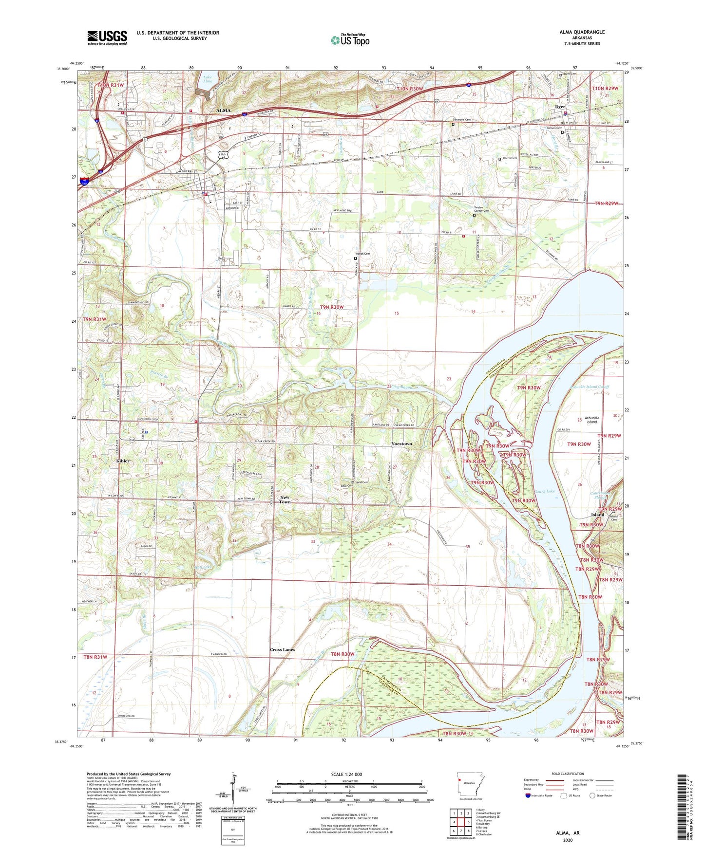
2024 topographic map quadrangle Alma in the state of Arkansas. Scale: 1:24000. Based on the newly updated USGS 7.5' US Topo map series, this map is in the following counties: Crawford, Sebastian. The map contains contour data, water features, and other items you are used to seeing on USGS maps, but also has updated roads and other features. This is the next generation of topographic maps. Printed on high-quality waterproof paper with UV fade-resistant inks.
Quads adjacent to this one:
West: Van Buren
Northwest: Rudy
North: Mountainburg SW
Northeast: Mountainburg SE
East: Mulberry
Southeast: Charleston
South: Lavaca
Southwest: Barling
This map covers the same area as the classic USGS quad with code o35094d2.
Contains the following named places: Alma, Alma Church, Alma Fire Department, Alma Fire Department Station 2, Alma Fire Department Station 3, Alma Fire Department Station 4, Alma Gas Field, Alma High School, Alma Intermediate School, Alma Middle School, Alma Police Department, Alma Post Office, Alma Primary School, Arbuckle Island, Arbuckle Island Cutoff, Beal Cemetery, Big Creek, Camp Ground Church, Campground Church, City of Alma, City of Dyer, City of Kibler, Clear Creek Public Use Area, Courthouse Slough, Crawford County District 7 Fire Station Number 2, Cross Lanes, Curry Branch, Dyer, Dyer Cemetery, Dyer Fire Station, Dyer Police Department, Dyer Post Office, Dyer School, First Baptist Church, Frog Bayou, Gospel Lighthouse Church, Hall Lake, Hall Lake Dam, Harmony Baptist Church, Harris Cemetery, Herd Branch, Island, Island Cemetery, Kibler, Kibler Baptist Church, Kibler Gas Field, Kibler Police Department, Lake Alma Dam, Little Frog Bayou, Maple Shade Church, Mays Branch, Nelson Cemetery, New Town, Onion Creek, Pleasant Home Church, Prairie Branch, Real Cemetery, Rural District 7 Kibler Fire Station 1, Saint Mathew Church, Simmons Cemetery, Solid Rock Tabernacle, Stepping Stone School, Tadpole Branch, Township of Alma, Township of Dyer, Township of Kibler, Township of Richland, Twelve Corner Cemetery, Woods Cemetery, Yoestown, ZIP Codes: 72921, 72935