MyTopo
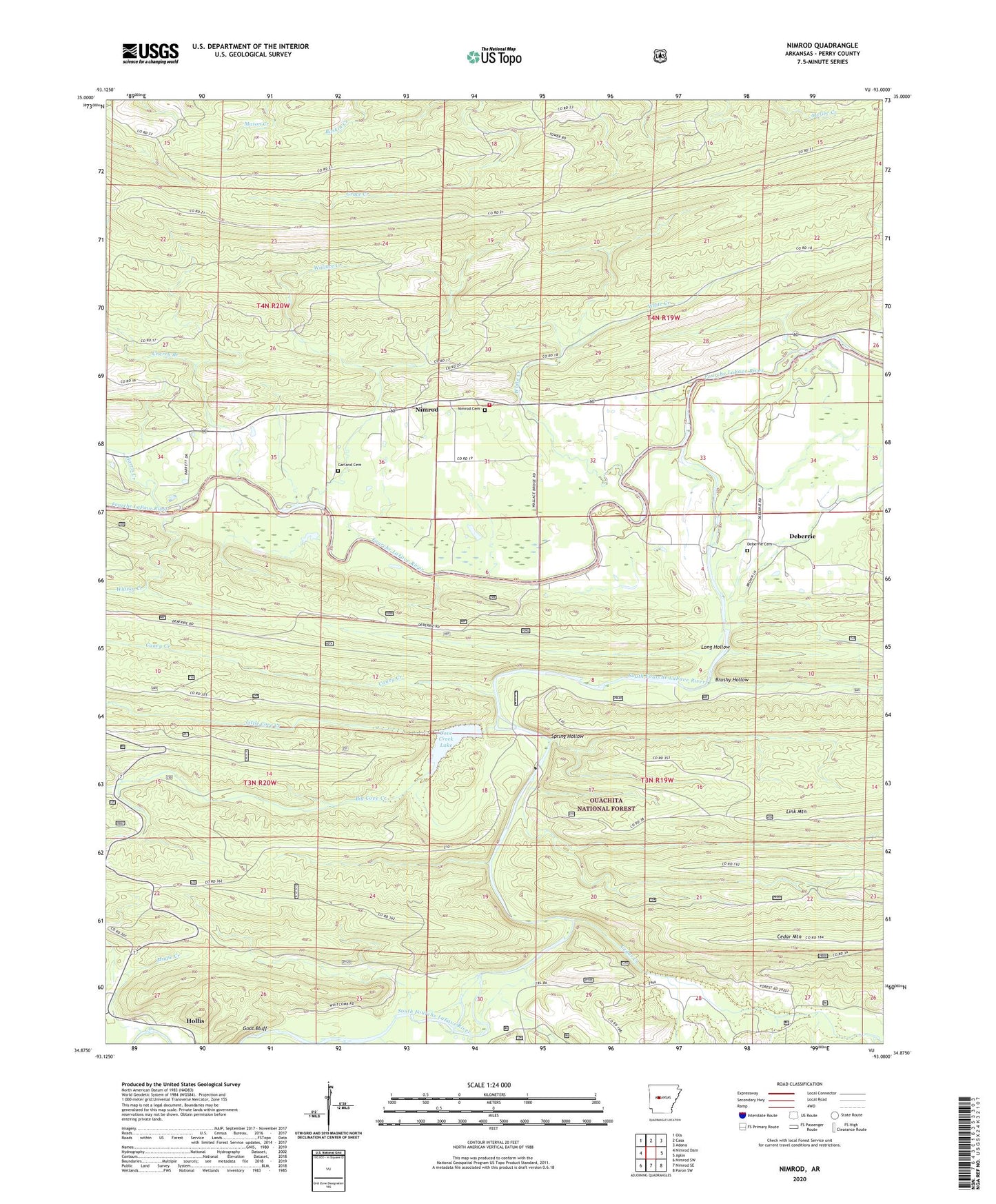
Nimrod Arkansas US Topo Map
Couldn't load pickup availability
Also explore the Nimrod Forest Service Topo of this same quad for updated USFS data
2024 topographic map quadrangle Nimrod in the state of Arkansas. Scale: 1:24000. Based on the newly updated USGS 7.5' US Topo map series, this map is in the following counties: Perry. The map contains contour data, water features, and other items you are used to seeing on USGS maps, but also has updated roads and other features. This is the next generation of topographic maps. Printed on high-quality waterproof paper with UV fade-resistant inks.
Quads adjacent to this one:
West: Nimrod Dam
Northwest: Ola
North: Casa
Northeast: Adona
East: Aplin
Southeast: Paron SW
South: Nimrod SE
Southwest: Nimrod SW
This map covers the same area as the classic USGS quad with code o34093h1.
Contains the following named places: Beene School, Big Cove Creek, Brushy Hollow, Caney Creek, Casa Mountain Lookout Tower, Cedar Creek, Cherry Branch, Cherry Ford, Cove Creek Lake, Deberrie, Deberrie Cemetery, Flynn Ford, Garland Cemetery, Gill Ford, Goat Bluff, Harris Creek, Little Cedar Creek, Little Cove Creek, Long Hollow, Magie Creek, Nimrod, Nimrod Baptist Church, Nimrod Cemetery, Nimrod Volunteer Fire Station, Rocky Crossing, Rocky Ford, South Fourche LaFave River, Spring Hollow, Township of New Tennessee, Township of Walnut Grove, Wallace Creek, Walnut Grove School, Whisky Creek, White Creek, Wright Branch