MyTopo
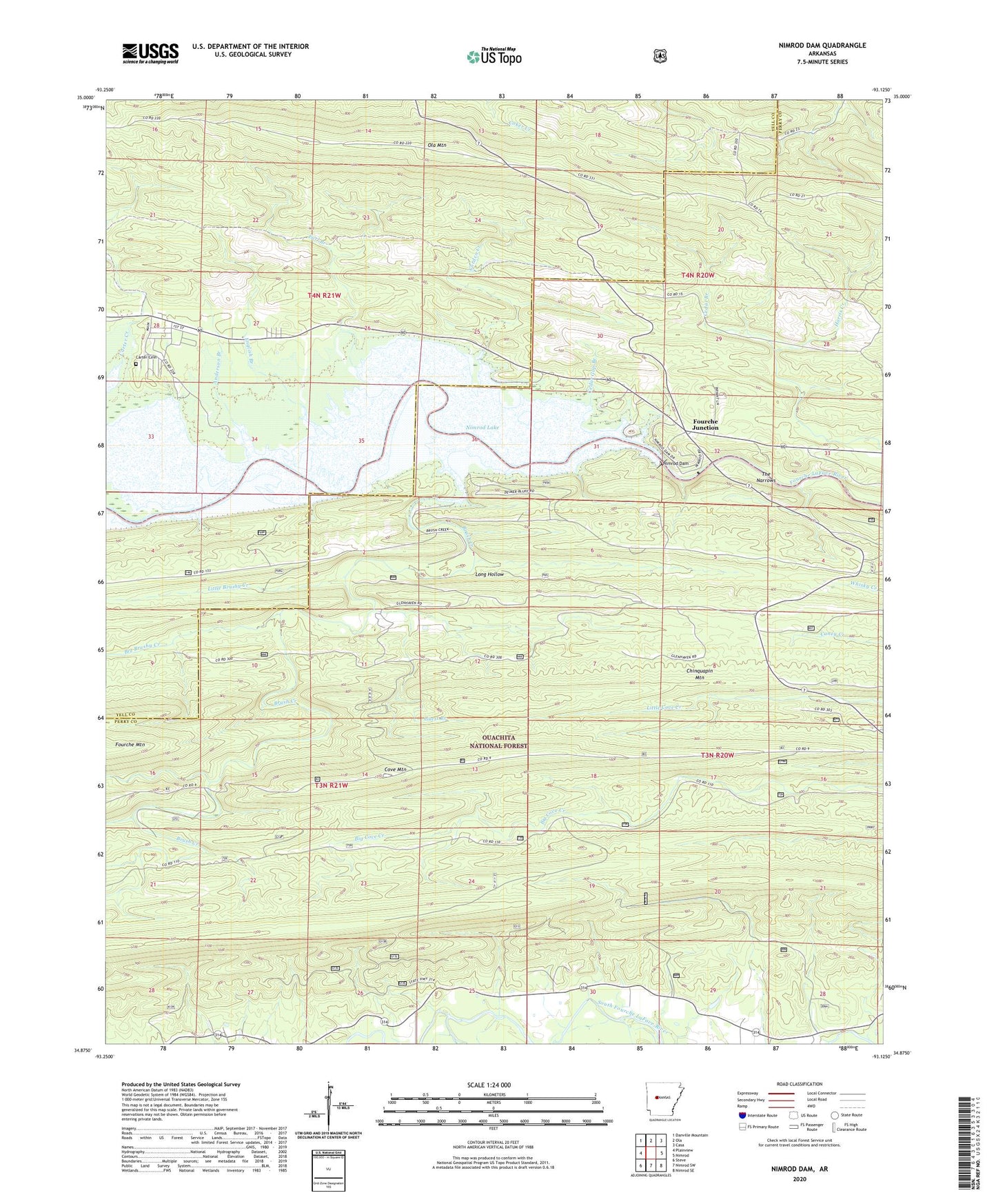
Nimrod Dam Arkansas US Topo Map
Couldn't load pickup availability
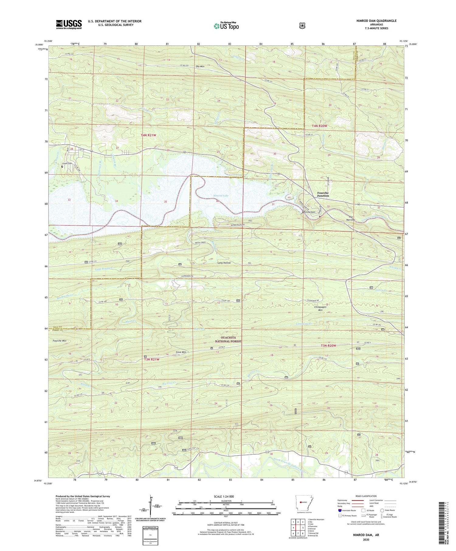
Also explore the Nimrod Dam Forest Service Topo of this same quad for updated USFS data
2024 topographic map quadrangle Nimrod Dam in the state of Arkansas. Scale: 1:24000. Based on the newly updated USGS 7.5' US Topo map series, this map is in the following counties: Perry, Yell. The map contains contour data, water features, and other items you are used to seeing on USGS maps, but also has updated roads and other features. This is the next generation of topographic maps. Printed on high-quality waterproof paper with UV fade-resistant inks.
Quads adjacent to this one:
West: Plainview
Northwest: Danville Mountain
North: Ola
Northeast: Casa
East: Nimrod
Southeast: Nimrod SE
South: Nimrod SW
Southwest: Steve
This map covers the same area as the classic USGS quad with code o34093h2.
Contains the following named places: Anderson Branch, Ark School, Bales Ford, Big Brushy Creek, Brush Creek, Carden Creek, Carden Point Public Use Area, Carter Cemetery, Carter Cove Public Use Area, Carter Creek, Carters Chapel, Cedar Branch, Cedar Gap Branch, Chinquapin Mountain, County Line Recreation Area, Cove Mountain, Dawson School, Dry Fork, Earl Branch, English Branch, Fourche Junction, Guest Branch, Little Brushy Creek, New Mount Everett Church, Nimrod Dam, Nimrod Lake, Nimrod State Game Management Area, Ola Mountain, Project Point Recreation Area, Quarry Cove Recreation Area, River Road Recreation Area, The Narrows, Township of Dawson, Township of Howell, Township of McCool, Valley Home Church, Westlake School