MyTopo
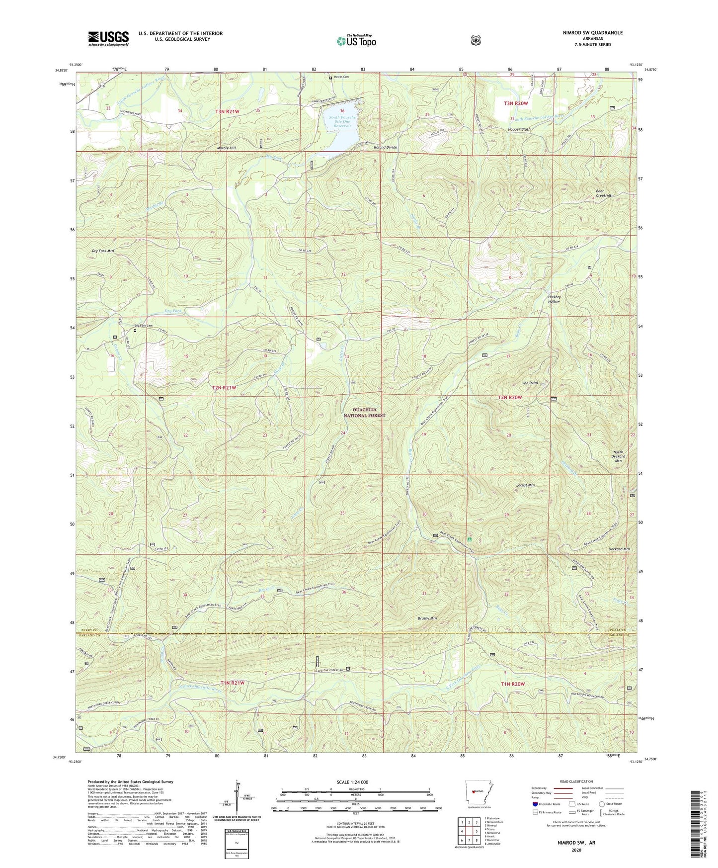
Nimrod SW Arkansas US Topo Map
Couldn't load pickup availability
Also explore the Nimrod SW Forest Service Topo of this same quad for updated USFS data
2024 topographic map quadrangle Nimrod SW in the state of Arkansas. Scale: 1:24000. Based on the newly updated USGS 7.5' US Topo map series, this map is in the following counties: Perry, Garland. The map contains contour data, water features, and other items you are used to seeing on USGS maps, but also has updated roads and other features. This is the next generation of topographic maps. Printed on high-quality waterproof paper with UV fade-resistant inks.
Quads adjacent to this one:
West: Steve
Northwest: Plainview
North: Nimrod Dam
Northeast: Nimrod
East: Nimrod SE
Southeast: Jessieville
South: Hamilton
Southwest: Avant
This map covers the same area as the classic USGS quad with code o34093g2.
Contains the following named places: Ava, Bear Creek Mountain, Blythe Branch, Brush Creek, Brushy Mountain, Caney Creek, Deckard Branch, Deckard Mountain, Dry Fork Cemetery, Dry Fork Mountain, Hawk School, Hawks Cemetery, Hickory Hollow, Hopper Bluff, Joe Point, Little Creek, Locust Mountain, Marble Branch, Marble Hill, North Deckard Mountain, Roland Divide, Shop Branch, South Fourche Site One Reservoir, South Fourche Watershed Site Number One Dam, Township of Dry Fork, Township of Tyler