MyTopo
Oden Arkansas US Topo Map
Couldn't load pickup availability
Also explore the Oden Forest Service Topo of this same quad for updated USFS data
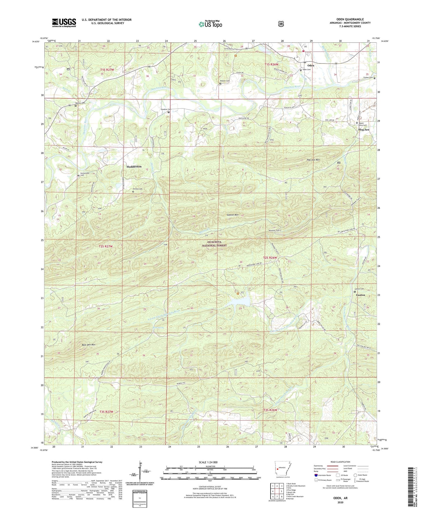
2024 topographic map quadrangle Oden in the state of Arkansas. Scale: 1:24000. Based on the newly updated USGS 7.5' US Topo map series, this map is in the following counties: Montgomery. The map contains contour data, water features, and other items you are used to seeing on USGS maps, but also has updated roads and other features. This is the next generation of topographic maps. Printed on high-quality waterproof paper with UV fade-resistant inks.
Quads adjacent to this one:
West: Pine Ridge
Northwest: Buck Knob
North: Brushy Creek Mountain
Northeast: Sims
East: Mount Ida
Southeast: Norman
South: Polk Creek Mountain
Southwest: Big Fork
This map covers the same area as the classic USGS quad with code o34093e7.
Contains the following named places: Arkansas Noname 186 Dam, Bear Den Mountain, Big Brushy Creek, Brewer Cemetery, Clear Creek, Crystal Hill School, Dry Fork, Forbes Cemetery, Gaston, Gaston Cemetery, Gaston Community Church, Gaston Lookout Tower, Gaston Mountain, Gaston School, Goodner Cemetery, Gortemiller Cemetery, Happy Hills Dairy, Hog Jaw, Hog Jaw Mountain, Huddleston, Independence School, Lick Branch, Macedonia Primitive Baptist Church, Mount Olive Baptist Church, Mount Olive Cemetery, Murphy School, North Fork Lake, North Fork South Fork Ouachita River, Ode Maddox Elementary School, Oden, Oden Cemetery, Oden First Baptist Church, Oden High School, Oden Post Office, Oden Ranger Station, Oden United Methodist Church, Oden Volunteer Fire Department Station 1, Oden Work Center, Polk Creek, Providence Church, Red Bird School, Redbird, Rock Creek, Rock Spring, Shirley Cemetery, Shirley Creek, Thorney Grove School, Town of Oden, Township of Gaston, Union Hill, Union Hill School, Wilhite Cemetery, ZIP Code: 71961