MyTopo
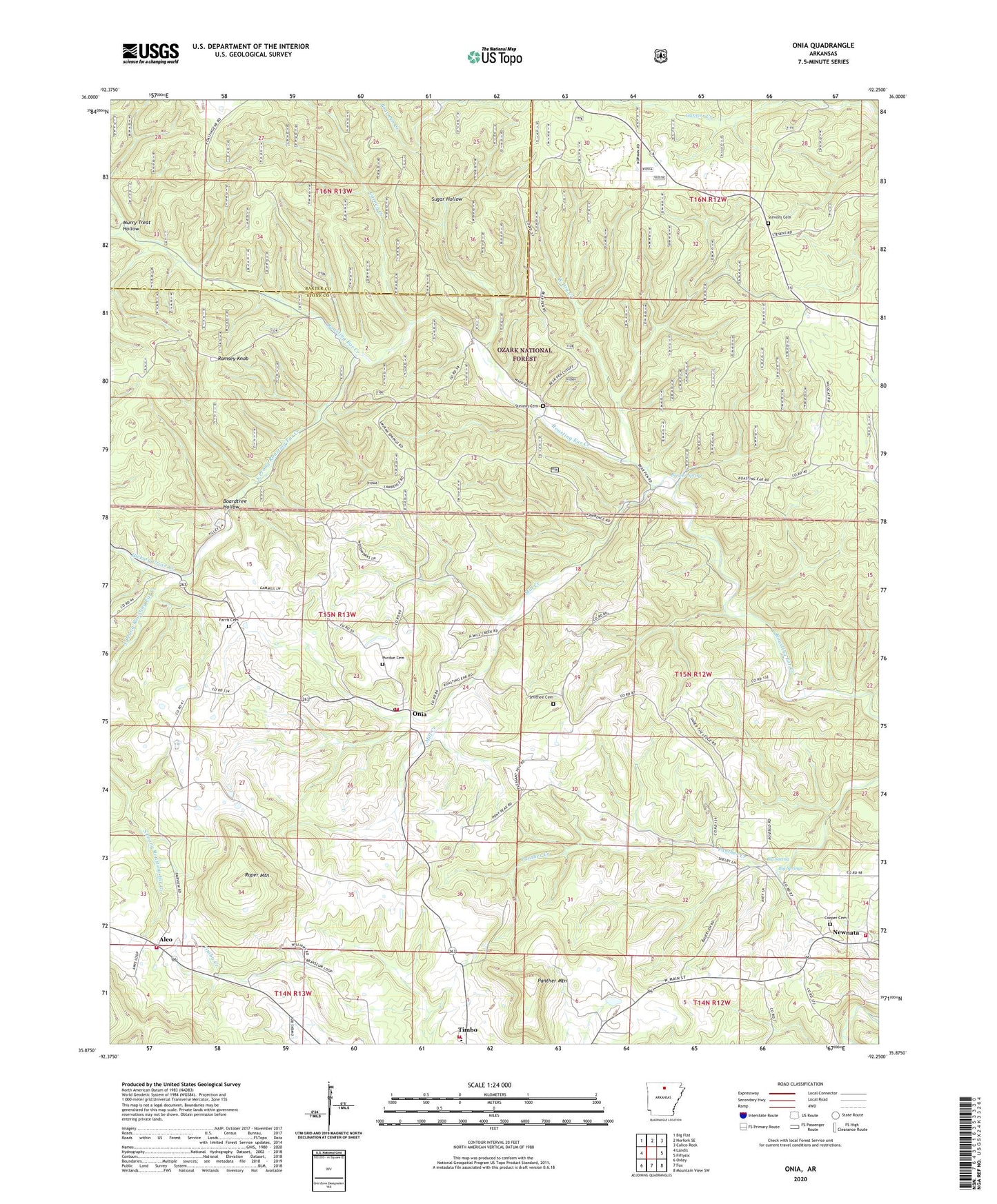
Onia Arkansas US Topo Map
Couldn't load pickup availability
Also explore the Onia Forest Service Topo of this same quad for updated USFS data
2024 topographic map quadrangle Onia in the state of Arkansas. Scale: 1:24000. Based on the newly updated USGS 7.5' US Topo map series, this map is in the following counties: Stone, Baxter. The map contains contour data, water features, and other items you are used to seeing on USGS maps, but also has updated roads and other features. This is the next generation of topographic maps. Printed on high-quality waterproof paper with UV fade-resistant inks.
Quads adjacent to this one:
West: Landis
Northwest: Big Flat
North: Norfork SE
Northeast: Calico Rock
East: Fiftysix
Southeast: Mountain View SW
South: Fox
Southwest: Oxley
This map covers the same area as the classic USGS quad with code o35092h3.
Contains the following named places: Alco, Alco Post Office, Bear Pen Creek, Bethany Church, Big Spring, Big Springs, Boardtree Hollow, Brewer Spring, Calvary Church, Carney Creek, Cooper Cemetery, Fairview Church, Farris Cemetery, Friendship Church, Hickory Grove Creek, Mill Creek, Murry Treat Hollow, Newnata, Newnata Post Office, Oga, Onia, Onia Post Office, Panther Mountain, Pleasant Hill, Purdue Cemetery, Ramsey Knob, Roasting Ear Church, Roasting Ear School, Roper Mountain, Smithee Cemetery, South Prong Roasting Ear Creek, Stevens Cemetery, Sugar Hollow, Timbo Fire and Rescue Newnata, Timbo Fire and Rescue Onia, Timbo Fire and Rescue Station 3, Timbo Fire and Rescue Station 5, Timbo High School, Township of Farris, Township of Roasting Ear, Township of Sylamore, West Dry Creek, ZIP Codes: 72663, 72680