MyTopo
Oxley Arkansas US Topo Map
Couldn't load pickup availability
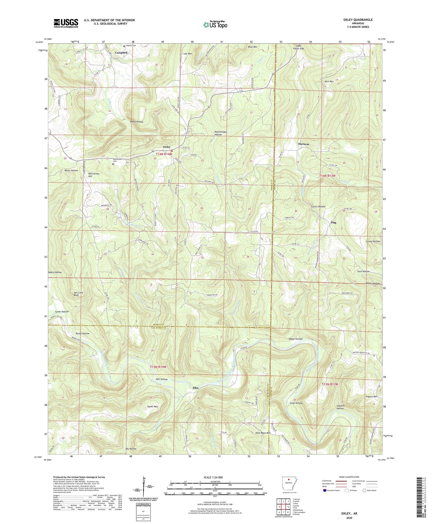
2024 topographic map quadrangle Oxley in the state of Arkansas. Scale: 1:24000. Based on the newly updated USGS 7.5' US Topo map series, this map is in the following counties: Searcy, Stone, Van Buren. The map contains contour data, water features, and other items you are used to seeing on USGS maps, but also has updated roads and other features. This is the next generation of topographic maps. Printed on high-quality waterproof paper with UV fade-resistant inks.
Quads adjacent to this one:
West: Leslie
Northwest: Harriet
North: Landis
Northeast: Onia
East: Fox
Southeast: Shirley
South: Old Lexington
Southwest: Botkinburg
This map covers the same area as the classic USGS quad with code o35092g4.
Contains the following named places: Adams Hollow, Alco Mountain, Angora Church, Angora Mountain, Avery Hollow, Big Hollow, Bradshaw Branch, Campbell, Cane Hollow, Curtis Hollow, Cyner Hollow, Elba, Flag, Flag Branch, Half Moon, Half Moon Church, Half Moon Creek, Half Moon Mountain, Harness, Hurricane Creek, Kuykendall Cemetery, Linn Creek, Lobe Patric Gap, Mabrey Cemetery, Marys Hollow, McCutchen Hill, Mill Branch, Mill Hollow, Oxley, Oxley Post Office, Oxley Volunteer Fire Department, Rattlesnake Hollow, Rocky Hollow, Salt Cave Bluff, Sawmill Hollow, Styles Mountain, Tom Moss Branch, Township of Campbell, Township of Flag, Township of Oxley, Wilson Creek