MyTopo
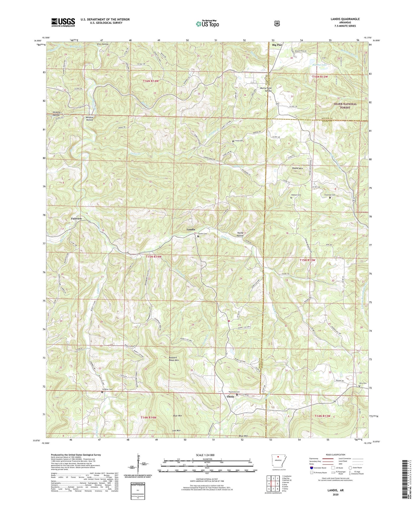
Landis Arkansas US Topo Map
Couldn't load pickup availability
Also explore the Landis Forest Service Topo of this same quad for updated USFS data
2024 topographic map quadrangle Landis in the state of Arkansas. Scale: 1:24000. Based on the newly updated USGS 7.5' US Topo map series, this map is in the following counties: Searcy, Stone, Baxter. The map contains contour data, water features, and other items you are used to seeing on USGS maps, but also has updated roads and other features. This is the next generation of topographic maps. Printed on high-quality waterproof paper with UV fade-resistant inks.
Quads adjacent to this one:
West: Harriet
Northwest: Cozahome
North: Big Flat
Northeast: Norfork SE
East: Onia
Southeast: Fox
South: Oxley
Southwest: Leslie
This map covers the same area as the classic USGS quad with code o35092h4.
Contains the following named places: Alco Cemetery, Bear Creek, Bethlehem Church, Big Flat Lake, Big Flat Lake Dam, Bluff Springs Church, Bluff Springs School, Bratton Creek, Buzzard Roost Mountain, Cedar Creek, Cellar Creek, Elm Hollow, Fairview, Freeman Cemetery, Hickory Hollow, Landis, Landis Cemetery, Landis Fire Station, Lee Mountain, Long Creek, May, North Cedar Creek, Passmore Cemetery, Round Mountain, Round Mountain Church, Scribner Cemetery, South Bratton Creek, Thola, Township of Clark, Township of Locust Grove, Township of Long Creek, Treat Cemetery, Turkey Creek, Wallace Cemetery, Wildcat Hollow, Young Hollow