MyTopo
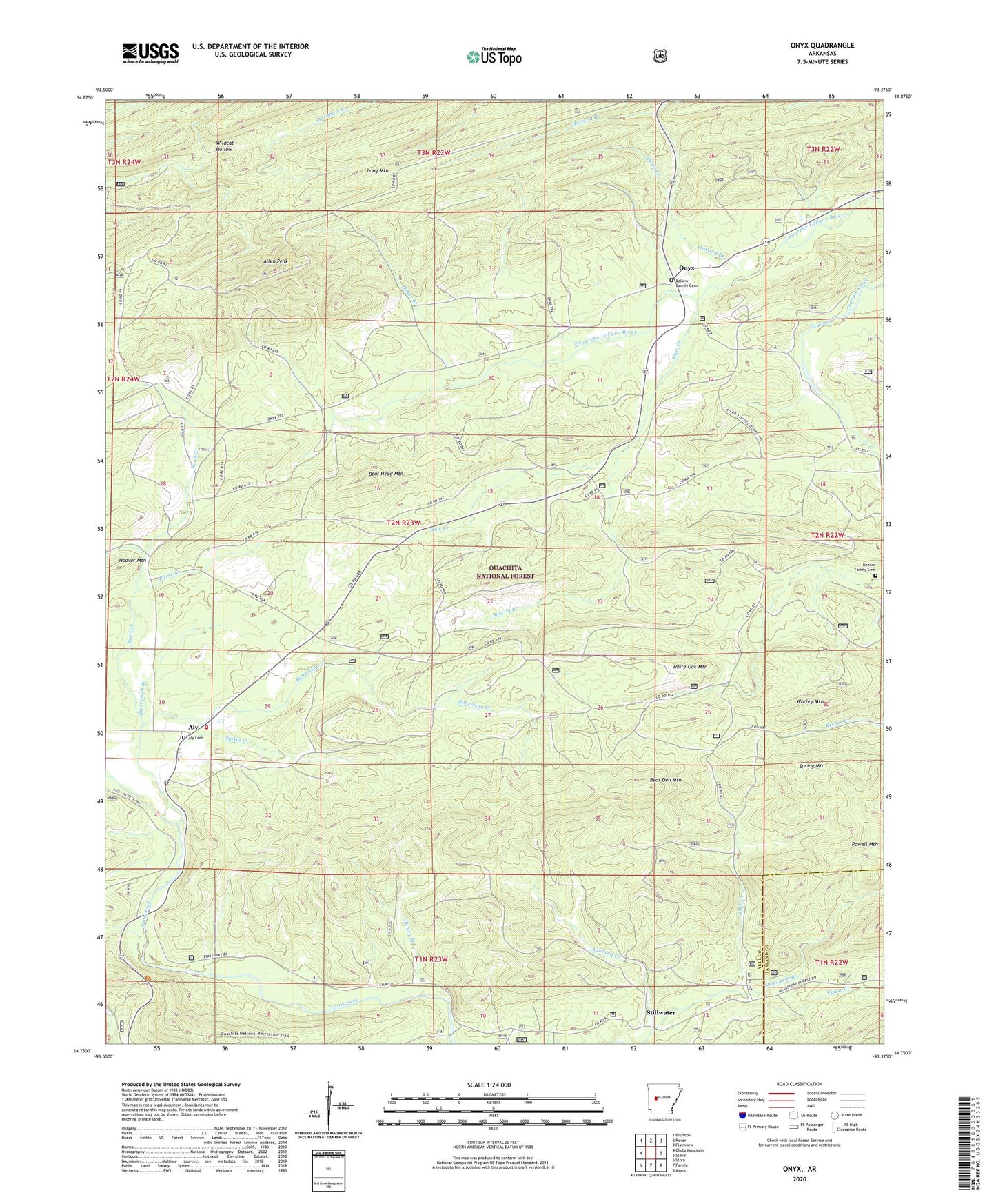
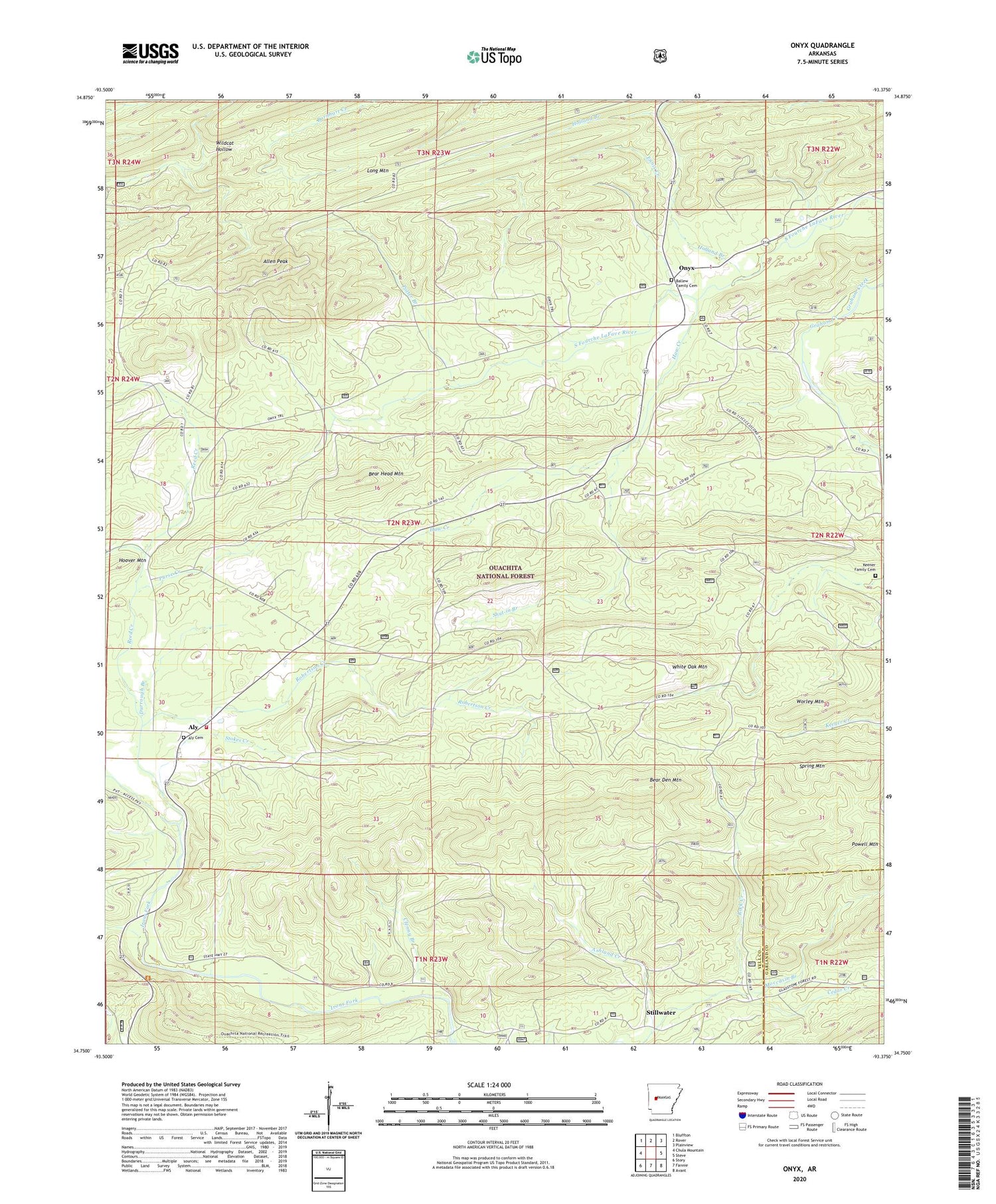
Onyx Arkansas US Topo Map
Couldn't load pickup availability
Also explore the Onyx Forest Service Topo of this same quad for updated USFS data
2024 topographic map quadrangle Onyx in the state of Arkansas. Scale: 1:24000. Based on the newly updated USGS 7.5' US Topo map series, this map is in the following counties: Yell, Garland. The map contains contour data, water features, and other items you are used to seeing on USGS maps, but also has updated roads and other features. This is the next generation of topographic maps. Printed on high-quality waterproof paper with UV fade-resistant inks.
Quads adjacent to this one:
West: Chula Mountain
Northwest: Bluffton
North: Rover
Northeast: Plainview
East: Steve
Southeast: Avant
South: Fannie
Southwest: Story
This map covers the same area as the classic USGS quad with code o34093g4.
Contains the following named places: Allen Peak, Aly, Aly - Chula Fire Station, Aly Cemetery, Aly Union Community Church, Ashland Creek, Ballew Family Cemetery, Bear Den Mountain, Bear Head Mountain, Cedar Creek, Clenny Branch, Concord School, Durrough Branch, Ennis Creek, Haw Creek, Holland Branch, Keener Family Cemetery, Long Mountain, Moccasin Branch, Negro Branch, Onyx, Potter Branch, Purse Creek, Reed Creek, Robertson Creek, Shut-in Branch, Spring Mountain, Stillwater, Stokes Creek, Sweet Home School, White Oak Mountain, Worley Mountain